
Welcome to the second in our series of walking trails written and researched by Discovering Britain. Let’s explore Sandwich.
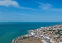
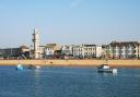
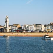
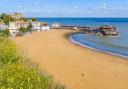
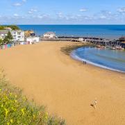
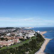
At two miles from the sea, the picturesque medieval town of Sandwich is a far cry from the neighbouring seaside towns of Margate or Ramsgate. But 500 years ago, Sandwich was once a thriving coastal town with a busy harbour.
This Discovering Britain walk is a chance to explore the changing geography and history of the town and find out how this once-prosperous port lost its sea.
Changing geography
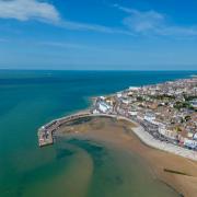
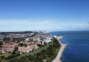
The original settlement was founded on a sandbank, east of today’s town, at the mouth of the Wantsum Channel – the body of water separating the Isle of Thanet from the rest of Kent.
Thanks to the direction of the prevailing winds, it became a natural shelter, a protected anchorage away from the tempestuous North Sea waves and weather. By the 11th century, Sandwich was England’s fourth-largest port.
But the same wind and tides that carried ships to Sandwich also carried sand and sediment along the coast. Over time, this process of deposition blocked the mouth of the Wantsum Channel, joining the Isle of Thanet to the mainland and reducing Sandwich’s access to the sea.
The Wantsum became a salt marsh, drained by medieval monks to create farmland.
By the end of the 16th century, Sandwich was no longer accessible by boat. The last recorded ship to use the Wantsum Channel delivered a set of bells from London to St Clement’s Church in 1672.
Walking the walls
Today, the town’s defences are concentrated on protecting Sandwich from flooding rather than foreign invasion, but this hasn’t always been the case.
Built during the Hundred Years War with France (1337-1453), this walk includes the chance to stroll a section of the old town walls. From their elevated position above the low ground, the town’s defenders could watch for enemies sailing in via the river.

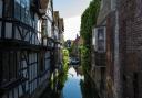
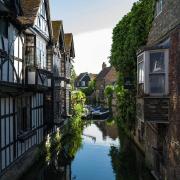
Do the Strand
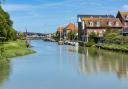
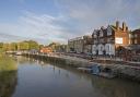
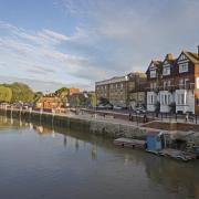
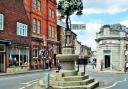
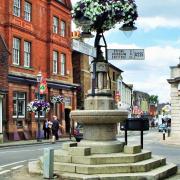
Thought to be the UK’s longest unbroken stretch of timber-framed buildings, a trip down Strand Street is a trip back in time. Hundreds of years ago these streets would have bustled with the noise of people, pack animals and barrels being trundled from the busy quayside, as Strand Street once overlooked the river Stour.
The clue is in the name: ‘strand’ being an old English word for ‘bank’ or ‘shore’. London’s Strand, shares the same place name origin, as it too historically ran along the bank of a river – the Thames.
Stranger on the shore
A stroll up Bowling Street brings you to a part of Sandwich with a decidedly Dutch flavour. The clues are again in the buildings and place names. Ornate brickwork, gable walls and house names like the Old Dutch House reveal the hidden stories of this part of East Kent; when 16th-century Dutch Protestants fled religious persecution, many came to live here.
Known locally as ‘the Strangers’, they were expert weavers and skilled at market gardening, growing new crops like celery in the sandy soils east of the town.

Information
Where: Sandwich
Why: Walk the old town walls, wander picturesque Saxon streets and explore a nature reserve.
Start and end: Sandwich town bridge, CT13 9EA, Grid ref: TR 33181 58291
OS map: Explorer 150 Canterbury and the Isle of Thanet
Length: 2 miles
Discover more at: www.discoveringbritain.org
The route
1) Start at Sandwich Town Bridge, Ramsgate Road
Stand on the bridge and look across the river to the car park area.
2) View from the bridge
Cross towards the Bell Hotel. Turn left then cross over the road. Follow the pavement beside the quayside buildings. Stop when you reach a stone archway next to a white building.
3) The Fisher Gate
Continue along The Quay. Cross over the road then turn left before the entrance to the Secret Garden. Head towards the river and stop by the beacon.
4) Millennium beacon
Head away from the river and cross the grassy area towards the stone wall. Turn left at the wall. Follow the path, keeping the wall and fence on your right. Continue until you reach a bench and noticeboard overlooking a ditch and tennis courts.
5) The Bulwark
Continue up to the road bridge. Turn right into Sandown Road and continue until you reach a churchyard on your left.
6) St Clement’s Church
Keeping the church on your left, follow the path to a set of metal gates. Follow the road ahead, then turn right into Fisher Street. Turn left into Upper Strand Street. At the end, turn right and then immediately left past the Admiral Owen pub. Continue on the left-hand side of Strand Street to stop outside the Sandwich Weavers building.
7) 15 Strand Street
Continue along Strand Street and cross Potter Street. When the road curves to the left, stop outside the large timber-framed building opposite the boatyard.
8) 39 Strand Street
Continue along Strand Street to the end of Harnet Street. Cross over then turn left to continue along Harnet Street. Turn right into Guildcount Lane. When you reach the end, turn left into Bowling Street. Look across the road at the large house with window shutters on the corner of Vicarage Lane.
9) 7 Bowling Street
Continue along Bowling Street. At the end carefully cross the road and turn right into Delf Street. Continue up to a small L-shaped area of water outside a grey house.
10) Horse Pond Sluice, Delf Street
Continue along Delf Street then turn right into Church Street, stopping outside St Mary’s Church.
11) St Mary’s Church
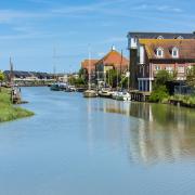
Pass the church, cross over Strand Street and head towards the car park. Stop by the wooden gate overlooking the river.
12) Riverbank opposite St Mary’s Church
Stay beside the River Stour and look along the river towards the bridge where the walk began
13) Riverbank by Gazen Salts car park
Head towards the buildings to the left of the car park. Go through the gates and follow the path through the trees until you reach the playing field.
14) Playing field Gazen Salts
Remain facing the playing fields and look at the complex of pale modern buildings on the horizon.
15) Playing field Gazen Salts
Continue along the path as it sweeps to the left. Pass the entrance gate of the Gazen Salts Nature Reserve on the right. Stop when you reach a concrete bunker on your left.
16) Second World War pillbox
Continue along the path until you reach a road. Cross the road and enter the lane to the left of Guestling Cottage. Pass the houses on the left and continue onto a raised path lined with trees. Pass through a pair of metal gate posts. Stop at one of the benches by the path
17) The Butts
Continue along the path passing a small bridge on the right and a supermarket car park on the left. At the end of the path, turn left. Follow Moat Sole as it sweeps round to the left. Stop almost immediately opposite a large stone building with a porch by the road.
18) St Thomas’ Hospital
Continue along Moat Sole and stop outside the Red Cow Inn
19) The Red Cow Inn
Continue along Moat Sole. At the car park on the right, turn into the road to the left. Continue a short distance and stop outside the pale building set back from the road.
20) United Reform Church
Feel free to enter the church if it is open, then leave the church and cross the road. Keep the Guildhall on your right and follow the pavement into a market square. Continue across the square and onto the right-hand side of New Street. Stop beside a small white house with a square plaque above the door.
21) 20 New Street
Cross over the road and continue along Austin’s Lane. When you are ready, bear left and go into the church grounds.
22) St Peter’s Church
With the church on your left, go through the gap in the wall onto St Peter’s Street. Turn right and head toward the white building on the right-hand side with a noticeboard on the wall.
Go into the narrow passage across the street called Holy Ghost Alley and walk through to the High Street. Turn left and continue a short distance to a dark building on the left-hand side named Pellicane House.
23) Pellicane House
Continue along the High Street. Stop beside The Admiral Owen pub and look at the arch ahead next to The Crispin Inn.
24) The Barbican
Cross over the end of the High Street towards the Bell Hotel. Then cross over the Quay and bear left towards the town bridge where you started the walk.
Find out more
Discovering Britain is a series of geographically themed walks and views, created by the Royal Geographical Society (with IBG), designed to tell the stories behind Britain’s diverse landscapes. With thanks to Raymond Molony FRGS for researching and writing the original walk, Dr Helen Clarke, Keith Wells, John Hennessey and the Sandwich Society. See also Sandwich town feature on pages 56 to 58. The full walk text and images can be read, listened to and downloaded for free at: www.discoveringbritain.org