
This Dorset walk takes in an ancient ecclesiastical route, a modern Holiday Park and views from the South West Coast Path

The Walk
1 From the car park, go through the track gate and continue to 'Spyway Barn' crossing. Take left 'Priest's Way'. Pass the reverse-right fork. At the bridleway-gate, there are fine views to Nine Barrow Down and Ballard Down left. Later, with the Isle of Wight ahead, ignore all side footpaths. Reaching a T-junction with left barns, go over the fence-corner footpath-stile and cross the field diagonally to the far corner footpath-stile. Over into the tracks' junction, rejoin the 'Priest's Way Swanage 1' track.
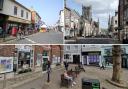
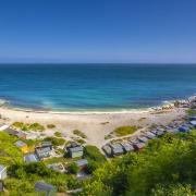
2 Continue past left barns and right South Barn farm. Through double bridleway-gates with 'Valley Road' footpath left, there are super views over Swanage. Through another two double-gates, continue along the fenced track and over a crossing into a grass track. Through the facing deep-hedge's path and through gates onto 'Priest's Way' junction, take right 'Townsend ½' signed footpath. Up the narrow path, bend left, now fence-enclosed. Through the end footpath kissing-gate, go through the hedge gap onto Swanage Coastal Park's drive with a back 'Footpath' arrow-stone.
3 The following instructions take you through the holiday park: Turn left for 16 yards down to the WC block. Turn right, unsigned. Continue past tent pitches to the far corner footpath-arrow post. Ignore it! Go through the facing hedge-gap onto Bay View Park's drive with a two-way footpath-post. Turn right. Up past right Number 79 and past left 78, bend left down to a junction with 'Daisy' right and 'Rose' with a footpath-post facing. Go left, down past 'Sunflower' and another 'Daisy' left. Turn right into 'Buttercup'. Meandering up to 49 right, go around the left bend. Go left down into 'Poppy' with another footpath-post. Now take the immediate right fork with 189 on the left corner. Pass right 192 and go down the grass bank's hand-railed steps. Cross 179a's drive into the hedged grass path.
4 Through the half-gate with a footpath-post, cross the lane to Townsend Nature Reserve kissing-gate. Follow the left fence/hedge path, then rising, cross a crossing, fork left and pass another footpath-post. Continue straight up into a shady path, past another footpath-post, down through wild-roses, more shade and steps and up to a kissing-gate and three-way footpath-arrows. Cross the lane into the opposite path through rough grass to the footpath-gate. Through, continue past 'The Old Barn' cottage and through 1½ footpath-gates into Rough Height lane, signed back 'Footpath'. Into Russell Avenue, go left to Bon Accord Road. Turn right, up and over, passing Swanage Water Works tower left.
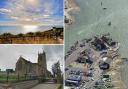
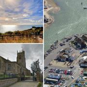
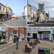
5 At Durlston Road, turn right down to the bottom left wood at 'Durlston' notice-board. Go through the left 'Durlston Castle' and 'Coast Path' half-gate. Keep to the level path. Then, at the 'Durlston Castle and Anvil Point' Coast Path stone, bend right up along the stone-walled 'Isle of Wight Road' track with the sea left. With Peveril Point, Old Harry Rocks and Bournemouth views, continue for ½ mile, passing right Solent Road and 'Learning Centre' path. Meeting the 'Timeline' path, turn right along walled St Catherine's Road narrow path. Across Durlston Castle drive, follow the left stone wall with car parks right. Continue into the unsigned lighthouse road. Before the facing 1½ gates beyond the dry-stone walling demonstration area, the right path leads to the Learning Centre and WCs.
6 Through the gates, continue down the road passing the nautical-mile time-trials measuring posts. We'll pass the other pair later. Meander down, passing the restored 'Purbeck Stone Quarr', the valley bridge and several right paths, to Anvil Point lighthouse. Just past the double-gates, go right down to the Coast Path stone. Take the wide 'Dancing Ledge 2' path, soon becoming fenced. Simply follow the Coast Path . The first wall's kissing-gate marks the end of Durlston Country Park and start of National Trust's Belle Vue. Through the next kissing-gate, you're nearly at the second nautical mile measuring posts. Later, negotiate a stile and following half-gate. Later still, through 1½ gates in another wall, cross a deep valley.
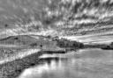
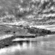
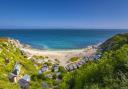
7 Finally, through another half-gate, see Dancing Ledge ahead. Descend to multiple stiles. Over these, explore Dancing Ledge and return here. Take the wide 'Spyway Barn Car Park' path up the steep hill. At the top, follow the arrowed-path to the wall's kissing-gate. Through, walk up through two hay-meadow fields to Spyway Barn farm's gate and kissing-gate. Go through the yard and the facing gate and kissing-gate. At the tracks' fork, take the diagonal grass path across the green to the Priest's Way crossing and follow the track back to the car park where you started.