With flooded valleys amid a panoramic landscape, Derbyshire Life explores this man-made lake district that offers some of Derbyshire’s most scenic walking routes
Distance: 5.5 miles
Parking: Fairholmes Visitor Centre S33 0AQ (pay and display)
Terrain: Five gates. Woodland paths and stony tracks with trip hazards. Steep slopes and paths close to deep water in reservoirs. Livestock grazing.
Refreshments: A kiosk at the Visitor Centre sells hot and cold snacks

Toilets: Fairholmes Visitor Centre
Map: O.S. Explorer OL1 - Dark Peak
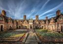
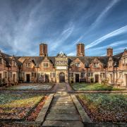
Walk Highlight: The twin towers of Derwent Dam
Description: Escape to the hills, starting with a flying visit to the famous Derwent Dam and an amble along the reservoir road heading north before ascending through regimented trees in a woodland plantation to Lockerbrook Heights where you are rewarded with far-reaching views. After a wander over elevated pasture, the route descends Hagg Side to finish with a stroll along the shoreline path of Ladybower.
1. Start your walk at Fairholmes Visitor Centre, well known for its flocks of visitors both by car and winged. For an ornithological display, spend a few moments watching the assortment of bird feeders or observe the resident ducks patrolling the car park on 'scrounge duty'.
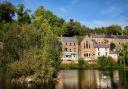
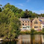
2. Follow the path from the side of the kiosk down to Derwent dam wall. Derwent and Howden dams were completed in 1916 after 14 years of hard toil. A temporary community of navvy workers and their families lived nearby at the purpose-built village of Birchinlee, known affectionately as Tin Town. Stone for the dams was quarried at Bolehill near Grindleford, and a railway line was specifically laid to transport it north up the valley, branching off the main line near Hope.
The River Derwent is Derbyshire's main river. It bisects the county and takes in water from several other rivers on its southward course. After a journey of almost 60 miles the river merges with the Trent on a final progression to the North Sea. For almost 25 miles of its course, the Derwent is flanked to the east by a series of dramatic Edges, remnants of the last ice age and glacial melt.
3. Walk up a path to the road by the west tower (on the left of the dam wall) which contains the Dams & Dambusters Museum (open most Sundays and Bank Holidays). The museum pays tribute to 617 Squadron (The Dambusters) which for six weeks prior to the attacks on the great dams of Germany used this dam for practice bombing runs by the Lancaster bomber pilots. The City of Lincoln is the only remaining airworthy Lancaster bomber in Britain and has made several flypasts down the valley which have attracted thousands of sightseers.
By the roadside beyond is the memorial to a sheepdog named Tip who stayed by the body of her dead master, Joseph Tagg, on the Howden Moors from 12th December 1953 to 27th March 1954. At the age of 86 the farmer had set off in atrocious wintry conditions to the high moors above Ronksley Farm (now demolished) where he lived. His remains weren't found until 15 weeks later. Amazingly Tip was still alive. She was brought down from the moors and carefully nursed back to health. She died on 16th February 1955 and the courageous vigil earned her a bronze medal for bravery. After Tip's death subscriptions came from far and wide to pay for the erection of the memorial.
4. Walk for almost a mile beside the road, with Derwent reservoir to your right, passing Gores Farm which dates from the 18th century and is one of only a handful of remote homesteads in the valley that survived the flooding.
5. After a bend heading for an inlet leading down from Ouzelden Clough, and with a glimpse of Howden dam wall just visible in the distance, go through a gate on your left and follow the fingerpost for 'public bridleway' leading up through Gores Plantation. Watch out for bikes speeding down the rough and hollowed away track on this well-used walking, cycling and horse riding route.
6. Follow the track as it eventually levels out, at times walking on a carpet of fragrant pine needles. Continue past dense, dark plantations where dappled sunlight casts bands of light and shadow through the trees. You might hear the distinctive sound of woodpeckers, one of several species that thrive in the Upper Derwent Valley. At a fingerpost continue ahead following the 'Snake Road' direction instructions.
7. Pass Lockerbrook Farm. This outdoor activity and environmental study centre has been operating for 50 years. It is owned and run by the Woodcraft Folk, a registered charity and an international movement for children and young people. Continue ahead on the driveway to a junction of paths with signpost.
8. Turn left and follow the bridlepath for Crook Hill going around the corner on your left and then across pastureland known as Open Hagg with woodland and a wall to your left. From here there are fantastic far-reaching views over Blackden Moor towards Kinder Scout and across the Woodlands Valley to Win Hill and the Great Ridge leading from Lose Hill to Mam Tor.
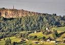
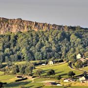
9. Continue for almost half a mile beside the wood to a combination of gates and stile where a green footpath sign indicates 'The Old Pack Road to Glossop'. Walk down past the sign on a woodland track between spruce and pine to meet the road in the valley below at the side of Bridge End car park. As you descend look across to the far horizon and see The Wheel Stones rock formation on Derwent Edge. Away to the left of this is the famous Salt Cellar, a landmark regularly photographed and used to promote the Peak District National Park.
10. Cross over the road and make your way down one of several short routes to access the shoreline path, turning left to return to Fairholmes.