
In International Map Year Kent Life is recording the changing seasons over the course of a year with a picture and different map at the centre of the county each month.
Maps are a time traveller’s guide to the world. They allow navigation in both time and space. Try it. Scour your local charity and second-hand bookshops for old Ordnance Survey (OS) and other map series that cover your local patch or parish, and see if this is not true.
The extract explored this month is but a short step back in time to the 1950s, but even over that time period major changes are evident. The heart of Kent, on the 1:25,000 ‘Provisional edition’, sits at the corner of four different map sheets (TQ84, 85, 94 and 95), and the extract is a merger of these. The ‘Provisional edition’ or ‘First Series’ was the Survey’s first civilian series at this scale; forerunner of the familiar OS Explorer and earlier Pathfinder series.
What will less familiar to some readers is the style of this map. The colours and the emphasis used to symbolise features in the landscape are very different from the more modern series. The most prominent features on this map are the roads, rivers, water features and the ‘contours.’ Apart from major roads and motorways, these are all much less obvious on the Explorer of the same area. Woodlands and public rights of way are far less conspicuous on the older series; indicative of the changing role of OS maps for the public.
What this map allows us to trace (very difficult on the newer series) is an important but almost insignificant set of features in the landscape, which are nonetheless the sources of two of Kent’s famous rivers, or in one case its tributary, the Great Stour and the River Len, which joins the Medway to the west. As R. H. Goodsall notes in his book, The Kentish Stour, that river had a less-than auspicious beginning close to Lenham’s Tanyard Farm: “…we made our way to the wire-netted enclosure where the chickens roamed… amid fragments of Kent rag and an assortment of old tins, a trickle of water issued suddenly from the dry bank. Here indeed was the birth of a river.”
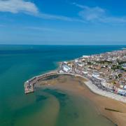
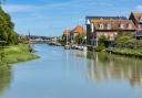
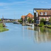
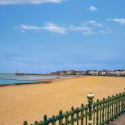
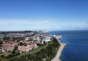
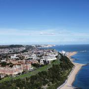
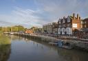
It is difficult to imagine he was describing the origin of the Great Stour, the lazy trout stream of the valley between Wye and Canterbury that runs through Godmersham Park of Jane Austen fame. Or the same river that becomes the tidal navigation once used to transport Caen stone to the port of Fordwich, the stone used to build Canterbury Cathedral. The Len, less renowned, also has a claim to fame providing the moat water for Leeds Castle.
Lenham, the settlement closest to the heart of Kent, occupies the watershed of the two rivers; it sits on a ridge of land, indicated by the 400 foot contour (c.120m), running from the village to the northern corner of nearby Chilston Park.
The Great Stour is actually born of several adjacent springs along the edge of the Downs, where water is forced to the surface at the point the permeable chalk meets the impervious Gault Clay. Lenham is one of a series of spring line settlements that run beneath the North Downs, including Hollingbourne and Brook, both of which include water features in their name.
But what of historic change? The most obvious is that the Great Stour now flows buried beneath the M20 and the high-speed rail line, features that dominate the modern map and that separate Lenham from Chilston Park. Part of the park itself has been severed by the motorway, and includes a distinctive circular water feature, an old ice pond, that supplied the nearby ice house. This can be clearly seen on the 1950s map; both this and later maps show evidence of the water mills that dotted the Stour and Len from their highest reaches. Ponds form a distinctive feature of the two southern sheets (TQ84/94), being a characteristic Weald clya landscape feature.
One advantage of the ‘First Series’ is that field boundaries are marked at this scale (unlike the smaller scale 1:50,000), and can be compared with contemporary maps and aerial photos.
The most obvious change is the field enlargement associated with post-war mechanisation and agricultural intensification, plus the loss of orchards and hop gardens. The former often resulted in the wholesale removal of hedgerows and small field-corner copses, with a consequent cost to biodiversity and landscape aesthetic.
Pinpointing the centre
“Imagine cutting out a map of Kent and trying to balance it on a pin. When it is perfectly balanced, you would have found the county’s centre of gravity.
The centre is found at TQ 902 514 on the OS map, just to the south east of Lenham, and on the Stour Valley Walk. This is based on the map of Kent with Medway. Another option could be to calculate the centre Kent based on its population (which pulls the centre of gravity towards Medway), and results in a centre at TQ 868 596, close to Bicknor (south of Sittingbourne).”
Prof. Peter Vujakovic, Canterbury Christ Church //
Find out more
2015-16 is International Map Year
http://mapyear.org/about-international-map-year
With thanks to …
Peter Vujakovic, Professor of Geography, Canterbury Christ Church University
John Hills, Research Fellow and Geographic Information Systems expert in the School of Human and Life Sciences
w