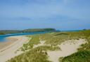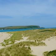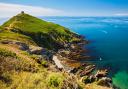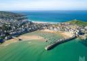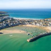

Take a long stroll across the South West Coast Path from from the breathtaking serpentine cove at Kynance, heading out over the National Nature Reserve at Lizard Downs to the ancient farmstead at Predannack Wollas
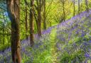
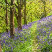
There's something about taking a long walk that clears the head and the South West Coast path has plenty of routes perfect for making plans. This is circular route from the breathtaking serpentine cove at Kynance, heading out over the National Nature Reserve at Lizard Downs to the ancient farmstead at Predannack Wollas. The landscape changes with the bedrock, and you travel from flat grasslands full of bright flowers into a stony area where the stream has carved a deep ravine in the soft rock at 'Soapy Cove'.
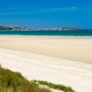
Above Kynance the rocky outcrops are crusted with yellow and grey lichen and the turquoise water below is fringed with white surf.
BOOTS ON, LET'S GO
1. From the entrance to the National Trust car park at Kynance Cove, head through the long field to the right (north), to take the path out of the far right (north eastern) corner. Turn left on the gravel track, descending gently into the valley before climbing out again. Just after the track turns left towards Kynance Cove, take the path on the right and walk to the T-junction with another track.
2. Turn right on the track to follow the bridleway to the top of Lizard Downs, travelling northeast to where it approaches the fields on your left and the road on your right.
3.Leave the bridleway to take another on your left which goes through the gap in the hedge by the corner of the last field and then sets off ahead.
4. After passing Die's Pool turn left to follow the path around the perimeter of the airfield, turning right to stay on the path between the airfield on your right and the fields on your left. Towards the end of the airfield the bridleway doglegs to the right and back again while a small footpath cuts between the fields to join it at the far side. Carry straight on ahead along the track towards Predannack Wollas. Two of the three farms at Predannack Wollas are owned by the National Trust. They are still farmed using the traditional system of sharing out the local land fairly, meaning that their fields are intermingled. This medieval system was inherited from prehistoric times, when Bronze Age settlers divided the best arable land, close to home, so that each family had an equal share.
5. Shortly before you reach Predannack Wollas a path heads off to the left, towards the coast. Turn left on this path, forking left when it splits, joining the South West Coast Path above Parc Bean ('Little Field') Cove and Ogo Dour ('Water Cave') Cove.
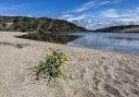
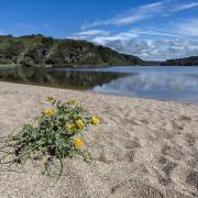
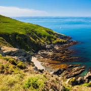
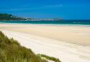
6. On the Coast Path turn left, towards Kynance Cove, Caerthillian and Lizard Point. The mild climate and the exposed southerly location provide an ideal habitat for wildflowers. The path is bright with pink thrift, yellow kidney vetch, the fried-egg flowers of low-growing ox-eye daisy, the pyramid heads of delicate green-winged orchid, and the tiny blue and pink stars of spring and autumn squills.
7. The coast path heads out around Vellan Head, while the bridleway forking off to the left at the start of the headland takes a shortcut across it. The two paths rejoin after a couple of hundred metres. There are caves in the cliffs above the tiny sandy beach - Ogo Pons (Bridge Cave) and Pigeon Ogo. Listen out for the eerie echoes of the pigeons cooing in the cave and you will understand the origin of the Cornish legends of ghosts in caves.
8. Cross the stream at the bottom of the valley at Gew-graze and climb steeply to the cliff-top again. Carry on along the Coast Path towards Kynance Cove, ahead. You will sometimes see Merlin and Sea King helicopters circling overhead along here. Predannack Airfield, built during the Second World War to help defend the important dockyards and ports at Falmouth, is now a satellite station of RNAS Culdrose, at Helston.
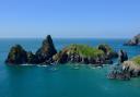
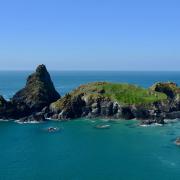
9. At Kynance Cliff the path travels around some rocky outcrops crusted with yellow and green lichens and then drops steeply downhill to the cove. The trio of islands below you as you descend are aptly named Gull Rock (the one covered in seabirds' nest in summer), Asparagus Island (where wild asparagus grown) and The Bishop (whose pointed mitre is visible between the other two). Like the other rocks in the cove, these are serpentine and resemble highly polished carvings more often found in buildings, furniture and galleries.
10. Cross the beach at Kynance Cove to take the footpath back up to the car park.
Details:
Start/parking: Kynance Cove car park - TR12 7PJ
Terrain: Moderate - Some short stretches of very steep ascent and descent, and the path is stony in places and wet elsewhere.
Length: 6.4 miles (10.3 km)