

Legend has it that long ago, there lived a giant by the name of Bolster in the parish of St Agnes. Discover more on this walk with the South West Coast Path Association

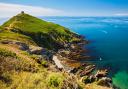
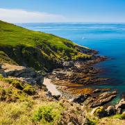
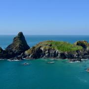
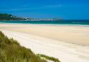
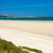
This section of the South West Coast Path is one in which Cornwall’s mining heritage in the landscape is paramount. There is plenty of evidence of former mining activity, including somewhat stark areas of spoil and sometimes slightly sad building relics, but also grand, imposing engine houses and chimneys. In some locations the larger-scale level of activity is difficult to imagine now. Nevertheless, the scale and grandeur of the cliffs, the beaches and the surf illustrate that nature always re-asserts itself.
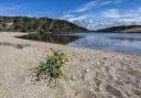
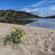
A lot of this walk is through areas of open heathland offering a feast of colour and aroma throughout most of the year. In autumn the ling and bell heather form purple carpets beneath the black pods of the gorse cracking open in the sun. With spring comes thorn bushes bedecked with tumbling white scented blossom and sharp green leaf buds, while beneath them bluebells and primroses are a riot of colour in the fresh bracken unfurling between them. But it’s not just mining history and wildlife to look out for on this walk.
Stand on the top of St Agnes Beacon looking eastwards and if you turn just a little to the right you’ll spot the remains of a massive earthen bank in the fields below you around Bolster Farm. It is believed that the bank dates from around the fifth or sixth century, when the Romans had left Britain and waves of Anglo-Saxons were pushing Celtic overlords further south into Cornwall. In places, the bank is as high as ten feet above its ditch and once enclosed the whole of this district by extending as far as Chapel Porth at one end and Trevaunance Cove at the other. There are theories that suggest the name comes from its likeness to a boat; ‘both lester’ (shortened to ‘bolster’) is Cornish for ‘boat-shaped hump’ - but the locals know better!
According to the legend, celebrated every spring in the St Agnes Bolster Pageant, Bolster was a wicked giant who ate children and passed his time building a large bank and throwing rocks. The angry tyrant forced his unfortunate wife to carry these rocks to the top of the beacon for him and she became old and stooped before her time, causing him to go off in search of a better wife. He fell in love with young Agnes, who often sang as she worked in the fields, and demanded that she marry him. She agreed to do so on one condition, that he prove his love for her by filling a small hole in the rock above Chapel Porth with his blood. Giant Bolster willingly accepted the challenge and felt that he could fill many such holes and be none the weaker for the loss of blood. Unbeknownst to him though, the hole was a bottomless cave that led straight out sea. As he tried to fill the hole, his blood flowed endlessly out to sea. Finally, exhausted from blood loss he collapsed, fell over the cliffs and died. All along the coast, the sea ran red for days and even now the cliffs around Chapel Porth retain the crimson stain from the giant’s lost lifeblood.
The villagers hailed Agnes as a heroine as she had freed them from the giant’s tyranny and saved the lives of their children. To celebrate, they lit a bonfire on top of the beacon and held a party that went on for weeks. In time, they even re-named the village after the now canonized St Agnes, which today attracts visitors from all over the world.
For more detailed information on this walk please visit southwestcoastpath.org.uk/st-agnes
Fee-fi-fo-fum…Boots on? Let’s go
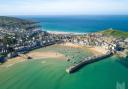
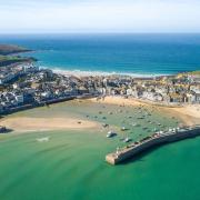
1 From Trevaunance Cove car park TR5 0RU bear left on the road towards the Watch House, climbing with it past the Watch House and on around the headland to carry on above the cliffs.
2 Carry on alongside a few fields at Newdowns Head before heading across open heathland to St Agnes Head. Follow as it turns left around the headland and walk about half a mile, to where a number of paths converge and a track heads inland to a parking area.
3 Make your way to the car park. Leave the coast path as it continues to the right. Take the footpath heading across the open ground. Carry on to the left of the hedge ahead and bear left to follow the path to the lane. Turn right here, to come out on the road at the foot of St Agnes Beacon (Beacon Drive).
4 Walk a few metres to the left and cross the road to head towards the beacon, bearing left almost immediately to contour around the bottom of the hill; or if you detour to the top of the beacon for the far-reaching panoramic views over coast and countryside return to this spot and turn right to follow this path around the foot of the hill.
5 The path drops to the left, passing on the right-hand side of the houses. Cross the road and carry on along the footpath as it heads towards the top right-hand corner of this field, carrying on ahead through the next, and then follows the left-hand hedge to pick up the lane beyond. Carry on ahead when another lane joins from the left.
6 The lane bears right and comes out on a road. Cross the road and carry on ahead along the footpath to the main road beyond.
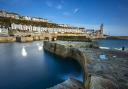
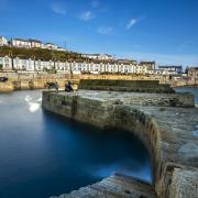
7 Turn left on the main road, following it around to the right past the church, turning left just afterwards onto Stippy-Stappy Lane. Bear left towards the bottom, turning left onto Quay Road to return to Trevaunance Cove Car Park.
Walk information provided courtesy of the South West Coast Path Association. For more information please visit: www.southwestcoastpath.org.uk