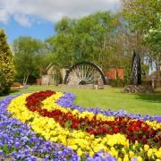
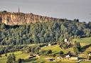
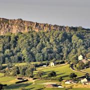
The second highest plateau in the Peak District is home to stunning scenery, wild weather, wreckage from a tragic aeroplane crash and a world-famous path – as well as being on the frontline of the battle against pollution. Peter Naldrett visits the peaty summit of Bleaklow

Heading up to the highest point of the Snake Pass, we park our car at the side of the road and step out at a popular spot to begin Derbyshire walks, with Kinder Scout to the south and Bleaklow to the north.
It was fairly warm when we set off, but the air up here is chilly and there’s a misty threat of some rain being blown in on a fresh wind. It’s often the way up here on Bleaklow, where the microclimate can swing from good to bad in seconds.
Boots on and coat zipped up, we set off on a well-maintained path installed by volunteers many years ago to stop feet like mine causing erosion on this delicate moorland landscape.
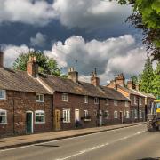
Though not as popular as the neighbouring Kinder Scout – largely because it doesn’t have the equivalent of Edale at its base – Bleaklow is nevertheless one of the big names in Peak District hill walking.

The king of our long-distance footpaths – the Pennine Way – leaves behind the A57 and winds a snaky way over the peaty mass of Bleaklow towards Crowden, bringing an end to the first section of the mighty walking route that runs for 268 miles from Edale to Kirk Yetholm.
Those setting off on the two-week Pennine Way challenge from Edale will find the trek over Kinder and Bleaklow a challenging start on day one; those heading down from Scotland will be invigorated by the landscape as their final destination looms.
The Pennine Way is surrounded by Access Land, meaning you are free to explore places off the beaten track at your leisure. So we left the Pennine Way to visit the triangulation pillar sitting on the plateau’s highest point; the views from up here are stunning.
But the glory of the surroundings is sadly matched by tragedy as you get closer to the trig point and come across the remaining wreckage of a 1948 aircraft, alarmingly well-preserved and cleaned by the wind and rain.

It was in the November of that year when the United States Air Force plane crashed on the way to Burtonwood, near Warrington, on a journey from Scampton in Lincolnshire.
All 13 members of the crew on the photographic reconnaissance aircraft were killed and are today honoured by the memorial that stands at the site, surrounded by poppies.
It’s a thought-provoking sight that highlights the dangers once faced by planes over these mist-shrouded hills before satellite technology provided assistance to pilots.
Back on the path, I realise how much the landscape of Bleaklow has changed over recent years due to the huge programme of environmental renewal.
Years of damage from industrial pollution took its toll on the moorland environment; walkers a couple of decades ago were used to it being a desolate place, with exposed peat stretching into the distance and erosion creating large gullies akin to a lunar landscape.
The problem was caused by 200 years of industrial pollution as the factories of Manchester belched chemicals into the sky and created acid rain that caused much harm to the peat landscape.
In some cases, the land took on the same pH levels as lemon juice, making it inhospitable for plants. The lack of vegetation, in turn, made erosion much more of a problem as rain washed away the exposed peat and caused water discolouration and flooding.
Another concern was the impact on climate change. Peat is a natural store of carbon and when it is eroded it leads to carbon dioxide being released into the atmosphere. The need for action was obvious, and thankfully Moors for the Future took on the task admirably.
Keen walker Neil Holt is one of the people strolling with us and acknowledges the change that’s taken place, saying: ‘The last time I was on Bleaklow was the day Princess Diana died in 1997. I can recall it being much more desolate and barren back then. Being back here now shows me just how much the moorland has been restored by the conservation efforts.’
The contrast of then and now is, indeed, startling. The fortunes of Bleaklow have been transformed.
It’s easy to take for granted the caterpillars, birds and butterflies we see on our walk, but it has not always been this way up on Bleaklow. Before a programme of conservation led by Moors for the Future started, a stroll across this peaty moorland revealed a substantially different landscape.
A phenomenal amount of environmental work has been carried out on the 26km² site between the Snake Pass and Longdendale, an area including the 633m high Bleaklow summit and its surrounding peaty landscape.
The bulk of the programme was centred on kickstarting revegetation on Bleaklow, with 11,000 bags of heather cuttings being flown in and spread over the area. Add to the mix some 22 tonnes of grass and heather seed, 150,000 moorland plants and 30,000 bog-loving plug plants and you start to get a picture of how big the scale was.
Gullies were blocked by almost 4,000 small-scale dams in a bid to stop erosion and 52km of geotextiles were laid in an attempt to stablise the peat and get plants thriving again.
Chris Dean is head of programme delivery at Moors for the Future Partnership. He told me: ‘After centuries of damage and degradation to the precious landscapes of the Peak District and South Pennines, we’re proud that the hard work of the Partnership in restoring our moorland is reaping visible results in areas like Bleaklow, where the change from blackened bare peat to green, vegetated landscape is there for all to see.’
The future for this much-loved Peak District hill is no longer bleak.