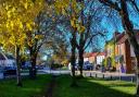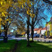

Take a long or short March meander with the Norfolk Ramblers

Directions
1. From the car park take the path ahead; with your back to the road follow the path to the seats from where there are excellent views. The old barn is down on the left - carry straight on to the bottom of the hill. Bearing slightly right follow the path to the steps; these will take you up onto the old railway line, part of the Paston Way.
Turn right, follow the track passing under the bridge; this is Knapton Cutting. At the end take the steps up to the car park. At the road go straight over, taking the path between two fences. At the end of the fence take the path off to the right across two fields, then through the gap in the hedge. Turn left, follow to a junction of tracks with Paston Way; at the finger post turn left, follow the path over the old railway bridge. Follow to a gap then take the cross-field path. Follow the track to the road, turn left - this is Knapton Church.
2. After visiting the church return the same way, back over the bridge to the finger post. Go straight on, crossing two fields, to come onto the road where you turn right.
3. If doing the short walk go straight on. After 30 metres, at a bend in the road, take the track straight ahead and go to section 4. For the main walk turn left to the corner; taking the footpath behind the hedge follow to the marker post. Turn left, following the path to a marker post. At a gap in the hedge go diagonally across the corner of the field to the field edge. Turn right, follow to the track, turn left, follow the track to the church - the lych gate entrance is straight on to the left. After visiting the church turn left out of the gate, then right at the end of the fence. Go straight on to the gap; going straight on behind the building to the drive, follow to the road. Turn right at the road. Follow the road; going straight on at the crossroads by the pond follow the road to the end. Take the track straight on to a T-junction of paths; turn left.
4. This is where the short walk re-joins the main one. Carry straight on until you come to a track coming in from the left. At Barchams Farmhouse turn right onto the road and carry straight on. Follow the road, going straight on at the crossroads. At the finger post opposite a track coming from the right, turn left. Taking the cross field path to a marker post, go straight on to the finger post, turn right then left on the far side of the hedge. This avoids a small cross field section. Follow the field edge to the road. Turn left then right on the B1150; after a short distance there is a finger post. Turn right, following the old North Walsham and Dilham Canal on your left. After 500 metres turn right across the ditch; this brings you back to Pigneys Wood. Follow the path straight on; this will bring you behind Stone Cottage back to the car park.
Points of interest
(A) St Peter & St Pauls church Knapton
The key feature of this 14th century church is the double hammer beam roof, said to be one of the best examples in the country. The church has a very interesting booklet for sale about its history.
(B) Edingthorpe All Saints Church
A round tower church with a thatched roof, the church has some partial wall paintings.
(C) The Paston Way
This 22-mile walk takes in 14 churches. The trail ambles down quiet lanes, through picturesque towns and villages, across vast fields, disused railway lines and quiet grazing pastures with views of the North Sea.
The trail is managed by Norfolk Trails - more information can be found at norfolk.gov.uk/pastonway
Compass points
Start: The Pigneys Wood car park
Grid reference: TG 2967 3206
Nearest post code: NR28 0SH
Main walk: 7 miles, 11km
Short walk: 5.5 miles, 8.5km