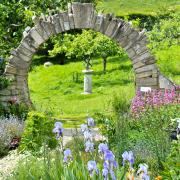

Explore Puddletown, which features as the fictional Weatherbury in Thomas Hardy’s novel Far From the Madding Crowd
This rewarding winter walk begins with a tour of Puddletown and its historic houses, before setting off into the lanes, fields, woods and heath south of the village.
Located on the River Piddle, Puddletown inspired the settlement of Weatherbury, in Thomas Hardy’s 1874 novel Far From the Madding Crowd, where the book's heroine, Bathsheba Everdene, had her farm.

The Walk
1. On leaving the church gate, the fine red-brick house to your right is the west wing of Dawnay House, built for Dr Henry Dawnay, vicar of Puddletown 1722 to 1754. In the corner is the drive to Ilsington House, brick-built in 1680 but rendered about 1835, it was once owned by Robert Walpole, son of the Prime Minister. The estate was sold to John Brymer in 1861 and remained the family home for 100 years. Between 1864 and 1870, Brymer built several ranges of cottages, the reading room and the present first school for the village before the 1870 Education Act made education compulsory.
Turn left towards The Square passing the right range of thatched cottages built about 1772. The far-end cottage had the first-floor bay with the Venetian window added in the early-19th century together with the ground-floor shop window. Walk through The Square to Mill Street.
Thatched Tudor Cottage opposite was built with flint and stone in 1573, as revealed by the ‘R.B.1573’ date-stone above the left window. Cross into Styles Lane and walk past the left ‘SGB 1911’ stone cottage. Between other houses, continue into the left-corner signed footpath enclosed along a cob wall. When the cob wall ends at a footpath-arrow, enter the estate but fork instantly left at right ‘Kissing Gate Cottage’ onto the fenced gravel path. Through the end half-gate cross Pottery Cottage’s drive to Blandford Road. A stroll to the right leads to The Blue Vinny pub, but turn left and walk up to the traffic lights.

2. Turn left into High Street passing the ‘Puddletown’ signpost. On the right, the white house with the flat door-hood and false window above was the old Post Office. The next right cottages are the oldest in the street, dating from the 18th century. The set-back thatched cottage is Ashton Cottage, the next thatched white painted brick cottage is ‘Pirstone Cottage’. Its more colourful attached neighbour ‘Cobblers’ has original iron-framed casement windows upstairs. Then we pass the first of several ranges of cottages built by John Brymer of Ilsington House, all bearing monogrammed date plaques. Four stone cottages right are dated 1870.
The former Prince of Wales Inn opposite stands on the site of an earlier 16th-century building. The older building burned down in 1930 and its replacement was more recently converted into apartments. Five right brick Brymer cottages with shop-fronts either end are dated 1868, and eight stone cottages opposite are 1864. Then, on left Mill Street corner begins a group of Brymer’s buildings including the 1864 School and 1870 Reading Room.
3. At this junction, turn right into Coombe Road and walk up the hill with houses either side. Over the hill, with a right hedge, join New Street. Pass St Mary’s School entrance with White Hill opposite. Continue up the sunken road under trees and over the top to a right signed-footpath. Take the left fork bridleway-signed track. Instantly, take the bridleway-arrowed 1½ gates into an undulating field and follow the left fence down past a farmhouse and other buildings.
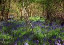
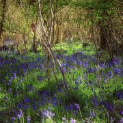
From the ‘valley’ there is no fence but continue up, with fine views, to the facing bridleway half-gate. Through into the woods, follow the path with left fence all the way through the mixed pine and deciduous wood passing The Kennels house left. Through the end bridleway-signed 1½ gates, cross the track to the opposite bridleway half-gate. Into the field, follow the bridleway arrows direction half-right aiming for Puddletown Forest’s taller pines.

4. Reaching the bridleway half-gate, go through and follow the path through scattered brambles and gorse with Puddletown Forest pines right all the way down the field and up to the bridleway-gate onto heathland. Keep following the path up along right Puddletown Forest, not the race-track, up to Castle Hill with superb views ahead and left. Pass the bridleway signpost and continue past the fence-corner bridleway-arrow into the enclosed path, descending with expansive fields left. Then, bending
right at bridleway-arrows onto the path inside Puddletown Forest’s edge, continue down for ¼ mile to a three-way bridleway-arrow post. Turn left and left again at another bridleway-post. Along the right fence, join Lower Heath Cottage’s drive/track and continue to the gate with a left bridleway-signpost. Out onto the road at another bridleway-signpost, turn left for an easy mile long stroll.
5. Pass right Ilsington Dairy Farm barns and sheds, continue down the road to right Ilsington Farmhouse drive. The house is 19th century but incorporates an older building whose smaller bricks were used in the eight chimneys. Opposite the drive,
the hedge-gate is a bridleway-gate (arrow currently smashed). Go through and veer slightly right to follow the tree avenue’s green track up the long field, then continue through scattered oaks to the facing fence’s bridleway-gate. Through, follow the
right wood’s edge green track down the field and round right to the corner bridleway half-gate. Through, follow the enclosed path with right field, rising slowly to a bridleway-post and right gate where the fence ends.
6. Keep straight on past the left pond and over the top. Start descending the sunken track under trees, past opposing gates and a left track. Keep meandering down, then hedged and rising past a tumbledown barn right and between opposing double-gates. Rising now, pass an old ruined brick barn right and go through the cantilever/half-gate into the rising sunken track, Rod Hill Lane. Over the top, descend past left houses and right Puddletown Surgery to the Athelhampton Road, signed back ‘Bridleway Open to All Traffic’. Cross into The Green and follow it round past right The Stables and Old Vicarage drives and past Dawnay House back to where you started.

COMPASS POINTS
Distance: 3½ miles/5.5 km
Time: 2½ hours
Exertion: Not strenuous. No stiles. Several slow ascents
Start: St Mary’s Church, The Square, Puddletown (Grid Ref: SY758943)
Map: OS Landranger Sheet 194
Public Transport: Damory Coaches 187
Dogs: Always pick up after your dog, abide by The Countryside Code
Refreshments: The Blue Vinny, Blandford Road for real ales and varied menu