
In our fifth visit to the centre of our county in International Map Year, we look at the origins of the place names in this region.
And see you, after rain, the trace
Of mound and ditch and wall?
O that was a Legion’s camping-place,
When Caesar sailed from Gaul.
- From Puck’s Song, Rudyard Kipling
Rudyard Kipling’s famous poem celebrates different events in British history and the traces they have left on the landscape. The Romans, Saxons, Vikings and Normans have all left their mark and helped to create the unique tapestry which we see before us in the landscape today.
There are clues to the past in ditches, mounds and tracks. The pattern of streets and villages, the shape of the fields, the distribution of woodlands and the boundaries between different areas are all significant. So too are place names.
Kipling understood in a deeply meaningful way how places have been shaped by history and he opens our eyes to a wonderful story which we can all enjoy and celebrate.
This month’s map extract shows just one small area in the heart of Kent. It portrays a landscape that has been shaped over thousands of years by different groups of people according to their needs. At the top (north) of the map are the chalk hills which make up the North Downs.
Moving down the page towards the south the land drops away sharply in the scarp above Lenham to a lowland area of heavy but fertile clay. Further south again another band of rock appears. This is the Greensand belt which has furnished the stone for many local churches and is the region’s best natural building material.
The geology is reflected in the place names. Flintbarn, for example, provides a clue to the chalk strata. Stone Hill, Stonebridge Hill and Sandway all indicate the greensand belt. The railway, A20 and ancient Pilgrim’s Way run diagonally along across the map following the clay vale and the line of the scarp.
So does the little stream which rises just to the east of Lenham called the Stour, which probably simply means ‘river’ or ‘water’ in the language of the Celts who once used to live in this area.
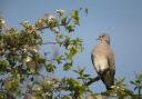
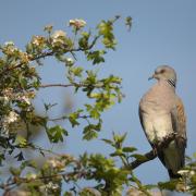
A closer look at the map reveals that several names focus on plants and creatures. Cuckoo Wood, Swallow Hill, Swan Street and Lark Hill are all to do with birds. Warren Street suggests rabbits and Foxen Farm hints at the animals which depended on them; Brockton Farm may well be linked to badgers.
Oaken Pole Wood tells us not only about the trees but also about the traditional activities associated with this once thickly wooded area. It also contains scattered deposits of ironstone which yielded the raw material for Roman and medieval industry. Small furnaces and glass works were once scattered across the forests.
Places with ‘hurst’ as part of their name suggest a link with this industrial heritage. ‘Hurst’ means ‘a wood from which timber was taken’ and large quantities of timber would have been needed to create charcoal. In the map extract, you can find Hurst Wood just south of Swan Street.
The suffixes and prefixes in many Kentish names reveal fascinating historical links. Names containing ‘den’, ‘ton’ or ‘ham’ all probably date back to Anglo-Saxon times. ‘Den’ indicates a wooded pasture which would have been used for grazing pigs, ‘ton’ an enclosure and ‘ham’ translates as a homestead or village. Lenham appears in early historical records as ‘Leanaham’. Leana was a man’s name, so ‘Leanaham’ must have originally meant Leana’s village.
Names can tell us a lot about the landscape and its cultural and historical heritage, but they can also mislead. It’s easy to jump to conclusions and historians recognise there may be multiple interpretations. However, most names provides a clue to the past and learning about their origins can enrich your understanding of your area.
Kipling knew how the dimpled tracks, the ancient mills, red oxen and ‘stilly woods of oak’ formed a unique tapestry that everyone could see and read. Next time you open a map, spare a thought for what the place names might mean. You never know what you’ll find out.
Dr Stephen Scoffham is author/consultant for Collins school atlases and a Visiting Reader in Sustainability and Education at Canterbury Christ Church University.
w