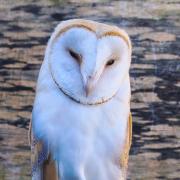

Hills in Suffolk are rare... Maggie Aggiss climbs one near the coast, that's full of mystery and intrigue.
In the filming of The Dig - a dramatisation of Basil Brown's history-making excavations at Sutton Hoo - Butley Ferry, which crosses Butley River to enable walkers to get to Orford, played the role of the long defunct Slaughden Ferry. I wonder if the cast and crew realised that they were at the base of a hill which holds on to its own intriguing history?
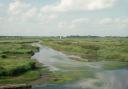
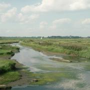
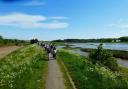
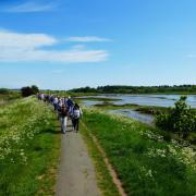
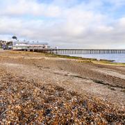
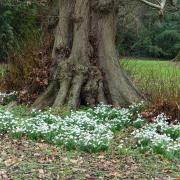
Burrow Hill, also known as Butley or Boyton Burrow, grabbed my attention when I was studying the map for a place to explore. The grassy, oval shaped hill is eerily peaceful. Described by locals as a ‘lost world’, the whole area feels as though it has changed little since medieval times. Horses graze on the west side, and the east side faces the river where just a few boats are moored.


Standing on the brow of the hill I am offered a panoramic view across Butley and Chillesford to the north, Boyton and Capel St Andrew to the west, and Gedgrave to the east, with Orford Ness and the Cold War pagodas in the far distance. Cargo ships appear towards the horizon to the south, down river, as the Butley ferry pilot stands on the jetty below waiting for passengers.
It's all very serene. But beneath the surface of this high haven lie hundreds of skeletons, and there is more than one theory as to why. Although the Burrow is now part of the mainland, hundreds of years ago it was an island among the mudflats. The sea walls were yet to be built, and the spit which now extends from Orford Ness meant that the village of Boyton was linked to the sea.
The precise date is unknown, but at one stage the hill was connected to the mainland on the Butley side by a 450m earthwork causeway called The Thrift. Today, this causeway, a route from Butley to the Burrow and down to the ferry, is also part of the mainland and continues as a footpath, which is also my chosen route to the Burrow on the steepest northern side.
In the Victorian era, the Burrow began to be excavated for sand and gravel to make local roads, and in 1966 Roman coins, glass and small metal objects were unearthed. Every so often bones would be turned up, but a belt and braces approach to extracting necessary materials meant that these remains were left where they were found.

Between the late 1970s and early 1980s seasons of ‘rescue excavations’ were carried out by the Butley Excavation Group. Their findings in terms of human remains were astonishing, described as “A chaotic jumble of human remains disturbed by later insertions and rodent activity”. More than 200 skeletons were recorded, many described as ‘plough damaged’, all were west-east orientated, suggesting that they could be Christian burials, although sometimes pagans also buried their dead in this way.
None of the skeletons were accompanied by ‘grave goods’ and, apart from two infant graves, all the skeletons were adult, mainly male. Some burials were in coffins - some with hinges - others had been lain on planks or biers. There were even coffins which were thought to have been re-cycled log boats. Carbon-dating carried out on one burial estimated it at around 780 AD.

The limit of the grave area was found on the south side of the Burrow, where several ditch systems indicated that there may have been a settlement of sorts, and an unusually high quantity of metal work was found, which according to studies, indicates ‘high status occupation’. Domestic items were found specifically in that area - Ipswich type pottery, glass, strap ends and buckles, spoons, fragments of bronze, writing implements, debris and a number of coins dating from the mid 700s.
With adult males predominating the scene there has been no firm conclusion as to what was going on here, or quite how many phases of occupation there were over time. As I stand on the opposite side of the Butley river at Gedgrave and look across to the Burrow, it isn’t hard to imagine how and why early settlers would have been attracted to the hill when it was an island. It would have appeared safe, with enough space to live and farm.
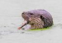
My trusty 1785 map names the area as ‘Butley Eye’, which suggests it would have been an ideal look-out for spotting would be invaders. The marshes would have provided an abundance of wild fowl, and the river would have provided a constant supply fish and molluscs, particularly oysters. Fossil molluscs found by enthusiasts line the side of the lane leading down to the ferry, and oysters are still grown in this part of the river.
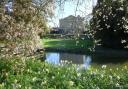
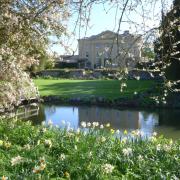
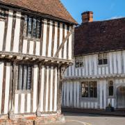
The Augustinian monks of Butley Priory, founded in 1171, traversed The Thrift causeway to the island, using it as a sort of stepping stone to Gedgrave and, ultimately, Orford. The Burrow’s time as an island gradually came to an end. By the 1500s the priory monks had drained the marshes and built river walls. They also moved the ferry, which was originally further along the river, to its present site for their own convenience.

As the Burrow burials were predominantly male, it would make perfect sense that there had once been an earlier monastery here. In mid Anglo-Saxon times the church had trading interests along the riverbanks. Did we have iron-mongering monks here? It's a possible explanation for all that unearthed metal work.
Currently, there is no firm conclusion that the skeletal damage was caused by the plough. Was there a mass slaughter here, or even a mighty battle? Viking raiding parties hit East Anglia and Kent in the mid 840s. Many men in Suffolk were slain, and although Ipswich would have been a major target, coastal and riverside Christian sites, particularly those that were trading and holding valuable goods, would have been vulnerable, poorly defended, and easily taken by surprise. Research has revealed that Burrow Hill was abandoned at this point. It is possible that the Vikings brought communal living on Burrow Hill to an end.
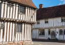
There's more on the theme of unusual burials and disturbed inhumations in this area at a crossroads on Hausen Street, Butley, where the solitary remains of a desperate prior lay. In 1509, having got the priory into debt, Prior Robert Brommer hanged himself at a house in Ipswich. Robert was initially given a formal Christian burial at Butley church. But according to the customs and beliefs about suicide at the time - and by order of the bishop - his body was exhumed a year later and moved from the western part of the graveyard to an area by the north door, a spot then referred to as the ‘devil’s portion’.
If that wasn’t troubling enough, Robert’s body was exhumed again and buried by lay hands as an ‘unhallowed’ corpse. This is the earliest recorded roadside burial in Suffolk, possibly East Anglia. The disturbances of Robert's corpse have led to alleged sightings of his equally disturbed ghostly spirit, which has been said to haunt a room at the priory gatehouse. The figure of a monk is also said to appear at the crossroads in autumn, at the break of dawn – the time of day and year when Robert Brommer was moved to his final resting place.