Steve Davison heads to the North Hampshire Downs for a peaceful walk with some lovely views and a pub
The North Wessex Downs, England’s third largest area of outstanding natural beauty, covers one of the most continuous tracks of chalk downland in England; and offers some great areas to walk. The predominant feature is the underlying chalk that is formed from the remains of billions of minute sea creatures – known as coccoliths – that over time have been compacted and raised above sea level by the gradual movement of landmasses drifting across the earth’s surface. Now, millions of years later, we have a landscape of sinuous valleys and ridges with a patchwork mosaic of open grassland and deciduous woods, such as those to be found in the North Hampshire Downs.
For this month’s peaceful walk we head to the hamlet of Upton that lies hidden amongst these chalk downs to the north of Andover.
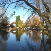
Home to several picturesque flint-walled cottages and a pub – The Crown Inn, Upton was mentioned in the Domesday Book, when it was held by Edith, Queen of Edward the Confessor before passing to William the Conqueror on her death in 1075. Running through the hamlet is the River Swift. This winterbourne (a stream that usually only flows after heavy winter rain) rises from a spring hereabouts and flows along the valley before disappearing back into the chalk and then re-emerging further along the valley as the Bourne Rivulet, a tributary of the River Test.
From Upton we head south-westwards along tracks, steadily rising up Rushmore Down. This area has a long history stretching back to the Iron Age as there are earthworks near Tangley Clumps and a hill fort – Bevisbury – at Hampshire Gate; a few hundred years later the Roman road to Venta Bulgarum (Winchester) ran over these downs.
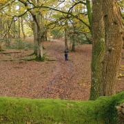
After passing over Cow Down we head north with a very steep, wooded descent into Well Bottom; here we are right on the border between Hampshire on the right and Wiltshire on the left. Just before joining Conholt Lane we pass a small pond known at Knyghtes Mere, some have suggested that knights may have watered their horses here on their way to the Crusades, or is that just wishful folklore?
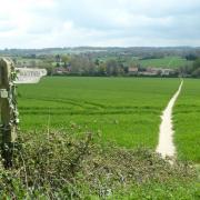
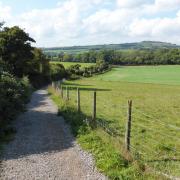
The final part of the walk then heads east along tracks back to Upton offering some great views over the lovely Hampshire countryside.
***
INFORMATION
• Distance: 5 miles (7.9km)
• Time: 2.5 hours without stops
• Terrain: Hilly route with one very steep descent, tracks and paths which can be very muddy, no stiles, some gates and sections of country road
• Start/Finish: Small lay-by 500m west of Upton on the road for Vernham Dean (SU354551); 2 miles north-west from the A343 at Hurstbourne Tarrant
• Map: OS Explorer 131
• Refreshments: The Crown Inn (01264 736638) at Upton
***
DIRECTIONS
1 (SU354551) – From the small lay-by head east along the road towards Upton. Just after passing The Crown Inn turn right at the junction signposted to Wildhern and Andover. Follow the road uphill and at the top of the rise – where the road curves left – turn right along a track. Follow the track as it swings left at Little Bourne Farm to reach a cross-junction of tracks. Keep ahead (left is private leading to Rushmore Farm) heading uphill. When the track heads into a field, keep ahead along the narrower route still climbing. The route starts to level out with views through the trees on the right. Keep ahead at the signpost.
2 (SU342540) – Later swing left and head southwards for 500m, soon with a plantation on the right. Keep to the route as it swings right and soon joins a tarmac lane. Keep ahead along the tree-shaded lane for 350m to a slight left-hand bend. Turn right here following a signposted path alongside a hedge with young trees on the right. Keep ahead into the trees to a path junction (marker post) and go straight on to enter an open grass field. Turn left alongside the trees for 50m and then turn right.
3 (SU333542) – Ignore a crossing track and descend the very steep wooded slope – take great care to avoid any slips – especially when it’s muddy. Leave the trees and bear slightly right across the field at Well Bottom before gently rising towards the trees opposite. At the marker post bear right, then left up through the trees (muddy track) and then continue with an open field on the right and trees to the left. At the field corner turn right still following the left-hand boundary. Dogleg left into another open grass field and follow the right-hand margin; over to the left is Lower Conholt Farm. At the field corner turn left (boundary on the right) and soon join a track.
4 (SU335550) – Turn right along the track to reach Conholt Lane beside Knyghtes Mere (pond). Turn right down the lane for 150m to a gate on the right. Bear right through the gateway and follow the track gently downhill following the trees and then curving right. At the field corner, where the track splits, keep ahead into a long field and follow the trees on your left hand side. Then continue straight on with the trees now on the right and descend through the woodland. Leave the trees behind and follow the track straight on down through the field and admire the lovely views ahead. At the bottom, go through a small gate in the hedge to arrive back at the lay-by.
***
READ ON
• Top tips and best places for stargazing in Hampshire - The skies above our county are littered with constellations – you may even spot a planet if you know where to look! But if you don’t know Polaris from Uranus, fear not, Jenny Shipway, Head of Winchester’s Planetarium is here to point us in the right direction.
• The history of Romsey’s King John’s House - Ever wondered about the history surrounding Romsey’s King John’s House? Claire Pitcher pays a visit to this little known treasure to find out more.


