
Check out our round-up of some of Somerset’s long-distance paths.
What constitutes a long-distance path? The answer to that depends on who you’re asking, as what each of us regards as long distance inevitably varies. Personally, I feel that anything I’m not able to walk in one day, while still allowing myself time to enjoy it, probably ticks the long-distance box, although the British Long Distance Walkers Association clearly defines it as a route of 20 miles or more.
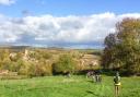
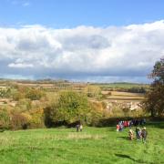
There is something pleasingly primal about reaching a distant destination on foot; a connection with our ancestors for whom walking or travelling on horseback was the only way, a daily necessity, rather than the leisure activity it is now.
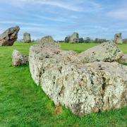
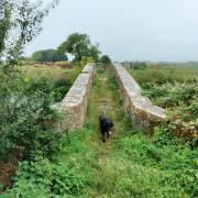
In Somerset, our network of paths is often rooted in social and economic history, such as the old droves of the Somerset Levels which have been tramped for centuries and forge an even stronger link with our heritage. These old ways existed long before the relatively modern-day designation of long-distance footpath or national trail was ever thought of.
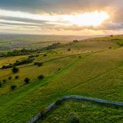
Our county has a good variety of long walks: some are within Somerset, others hop briefly over county boundaries and some form part of a much longer national trail. Often, you will find long-distance paths running concurrently with one another for a stretch.
So perhaps, as 2022 gets underway, this selection will whet your walking appetite and you will resolve to become a ‘long-distancer’ and get at least one of them under your boots. Whichever walk you choose it will promise beautiful scenery, the chance of abundant wildlife, glimpses of history and a great sense of satisfaction when you reach journey’s end.
1. The Monarch’s Way

The Monarch's Way is a fabulous and well-loved national trail of over 600 miles, commemorating the flight of Charles ll after the Battle of Worcester, when England was a republic. About 90 miles of the path is in Somerset: from Bristol to Montacute, where it leaves the county before re-entering it again near Hardington Mandeville, then running to Wincanton and thence, eventually to the Sussex coast and escape.
The route can also be regarded as a commemoration of Trevor Antill (1937-2010), who had the inspired idea in the first place. After Trevor died, his walking boots were carried in relay along the whole length of this very long-distance path by Members and Minders of the Monarch’s Way Association.
There are too many OS maps to list but the Monarch’s Way website is excellent. (W: monarchsway.50megs.com)
2. The Coleridge Way
The Coleridge Way stretches for 51 miles, starting at Nether Stowey and extending into Devon, to finish at Lynmouth. It celebrates the region’s connection with poet Samuel Taylor Coleridge who lived in the area at the end of the 18th century, some of his most poetically productive (and, possibly, opium-enhanced) years.
OS Explorer Maps to cover the route are: 9 Exmoor, and 140 Quantock Hills & Bridgwater. ‘Strip’ maps are also available from the Long Distance Walkers’ Association
3. The Colliers’ Way
The Colliers' Way shares its 18.5 miles with cyclists (Part of Sustrans Route 24) – so walkers will need to keep an eye open. It starts just outside Bath, from the Dundas Aqueduct, which carries the Kennet & Avon Canal over the River Avon, and runs to historic Frome, a town with more listed buildings than any other in Somerset. On the way it passes through Radstock, whose museum tells the story of Somerset Coalfields in the Victorian era (hence, Colliers’ Way).
OS Explorer Maps are: 142 Shepton Mallet and Mendip Hills East, with a little bit on 155 Bristol & Bath. (W: sustrans.org.uk)
4. The Liberty Trail
The Libery Trail is 28 miles long and celebrates the Somerset men of the 17th century who marched in support of Monmouth during the Rebellion. It starts at Ham Hill Country Park and ends across the border at Lyme Regis, in Dorset. OS Explorer Maps are: 116 Lyme Regis & Bridport, and 129 Yeovil & Sherborne.
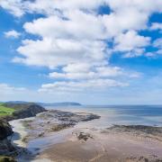
5. The South West Coast Path

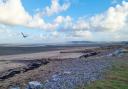
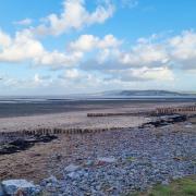
The South West Coast Path (SWCP) One of the South West’s best assets (imho!), no round-up would be complete without it, although less than 17 miles of it is in Somerset. At fractionally over 630 miles in total, this is the UK’s longest national trail and many people ‘collect’ sections of the path over years. From Minehead, the path travels to the county boundary with Devon and offers the option of a northerly route or southerly route.
One map covers this section of the path: OS Explorer OL9 Exmoor
The SWCP now links with the England Coast Path, a new and VERY long-distance route that goes all round the coast of England, a staggering, in every sense, 2,975 miles. It is hoped that it will be fully open in 2021.
At the time of writing 58 miles of the Somerset section, between Minehead and Brean Down, had been opened.
6. The Leland Trail
The Leland Trail is another route of around 28 miles, this time commemorating the 16th century academic John Leland, who worked as Henry Vlll’s chaplain and librarian and was tasked with surveying all the antiquarian records, manuscripts and relics contained in the cathedrals, colleges and religious houses of England. Although his precise route through Somerset is uncertain, the records he left behind have enabled this path to be established. It runs from Penselwood, on the Somerset-Wiltshire border, to Ham Hill Country Park.
OS Explorer Maps are: 142 Shepton Mallet & Mendip Hills East, and 129 Yeovil & Sherborne
7. The Limestone Link
The Limestone Link is a 36-mile route which starts at Shipham and hops over the county boundary with Gloucestershire to finish at Cold Aston. It links the limestone region of the Mendips to that of the Cotswolds, and uses as its logo an ammonite, whose attractive spiral fossils may be found in limestone.
OS Explorer Maps that cover the route are: 141 Cheddar Gorge and Mendip Hills West, 142 Shepton Mallet and Mendip Hills East, and 155 Bristol & Bath.
8. The East & West Deane Ways
The East and West Deane Ways each cover more than 40 miles in circular routes traversing countryside outside Taunton. The former extends from the east of Taunton towards Sedgemoor, the latter from west of Taunton towards the Quantocks, and almost to Exmoor. The East Deane Way is covered by a series of helpful leaflets and details of both routes are shown online. OS Explorer Maps are: 9 Exmoor, 128 Taunton & Blackdown Hills, and 140 Quantock Hills & Bridgwater. (W: ldwa.org.uk)
The Mendip Way explores Somerset’s beautiful range of limestone hills and is divided into The West Mendip Way The East Mendip Way. The whole route covers a fabulously varied (and hilly) 50 miles, from the coast near Western-super-Mare all the way to Frome.
OS Explorer Maps covering the route are numbers: 153 Weston-super-Mare & Bleadon Hill, 141 Cheddar Gorge and Mendip Hills West, 142 Shepton Mallet and Mendip Hills East.
9. The Macmillan Way
The Macmillan Way is the brainchild of Peter and Janet Titchmarsh who created a long-distance path to support the Macmillan Cancer Support charity. The Macmillan Way network of footpaths has resulted in hundreds of thousands of pounds being raised. The main 290-mile route runs from Lincolnshire to Dorset and has two sections in Somerset plus a ‘link’ between Langport and Evershot, in Dorset, which joins the Macmillan Way West with the main Macmillan Way.
The main route enters the county from Wiltshire and leaves it for Dorset after traversing the Corton Ridge near Corton Denham. The Macmillan Way West runs from Castle Cary to Exmoor, ending after 102 miles at Barnstaple in Devon. It covers too many OS maps to list but its dedicated website is excellent.
10. The Castles and Coast Way

The Castles and Coast Way is ideal if you’re looking for a short, circular ‘long’-distance path. Its 13 miles link Nether Stowey and Stogursey Castles and incorporate a stretch along the Somerset coast.
Map: OS Explorer 140 Quantock Hills & Bridgwater.
Simone Stanbrook-Byrne is the author of ‘A Dozen Dramatic Walks in Somerset’ and other West Country guides. simonestanbrookbyrne(at)gmail.com