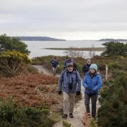

On this fascinating urban walk Edward Griffiths reveals the legacy left by two philanthropic sisters who established Talbot Village to help support the local community

In Victorian times, Bournemouth started to expand rapidly, covering native heath, ancient tracks, scattered clay pits and brick kilns, including builder Mark Loader’s brickworks which produced the white brick used as decorative bands on many 1890s red-brick Winton houses. In this intriguing urban setting, we find precious remnants of ancient heath at Talbot Heath and Winton Pleasure Grounds, and visit Talbot Village, built by philanthropic sisters Georgina and Marianne Talbot.
The Walk
1 Leave through the cantilever towards the open field. Turn left up the Tarmac path which follows the original Slades Lane from Talbot Village. Pass a left fork. At the five-ways junction, keep straight on to bollards and through woodland to the ‘Talbot Village Trust’ cantilever. Through, double-back right onto the drive. The Talbot sisters, Georgina and Marianne, were wealthy philanthropists who left London’s Grosvenor Square for Bournemouth shortly before 1850. They rented moorland to provide agricultural work for some of the area’s unemployed peasants, and in 1850 they built Talbot Village with six farms and 16 cottages for a self-supporting community. Slades Farm was one of the last survivors - the farmhouse on Columbia Road was demolished in 1977. Today, anyone can stroll along the paths and enjoy the woodland.
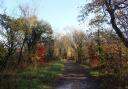
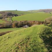
2 Pass the right car park and St Mark’s Primary School. Over a crossing, the drive bends left to St Mark’s Church, finished in 1870, the year Georgina died. Marianne died in London in 1885. Both sisters are buried here. Keeping left, go past the war memorial into Wallisdown Road. Turn right. Cross on the crossing. In 100 yards, go through the gap into Bournemouth University’s playing field. Cross diagonally to the far corner into Talbot Drive. Continue, beyond Talbot Combined School, to the road’s end. Take the left ‘Bridleway 33 East Avenue’ path into Talbot Heath Nature Reserve, a survivor of ancient heath, dominated by gorse, heather and silver birch, which once spread from Christchurch to Dorchester.

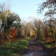
3 Descending through trees, pass a right path and follow the higher path. Then through gorse, pass another right path. Descend back into trees, ignoring a left and a right path. Continue, soon meeting a left fence and passing an electricity pylon. Past a left stile, go through facing 1½ gates. Keep following the left fence, then continue into open heath with gorse and birch. Reaching a T-junction, go left and start rising, over tree roots, to a fork. Go left to a steel-stile. Over, follow the fence across the field. Over the corner steel-stile, turn left along the fenced path into Alyth Road. Turn right into Dulsie Road to East Avenue.
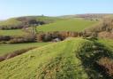
4 Turn left and walk the full length, crossing Glenferness Avenue early on. This whole area of Talbot Woods was originally Malmesbury Plantation, planted with pine trees soon after the 1802 Enclosure Act. The Talbot sisters named Winton in memory of their Scottish ancestors, the Earls of Winton, and named many of the roads in Talbot Woods after Scottish towns. The Scottish influence continued after their deaths when the Earl of Leven and Melville from Glenferness in Nairn inherited much of Talbot Woods and developed south and west Winton. Reaching Wimborne Road roundabout, cross using the right-side refuge. Continue along Wimborne Road which turned right at the roundabout. After left Stirling Road, entering ‘Winton’, turn right at St Luke’s Church, dedicated in 1898, into St Luke’s Road.
5 Walk the full length, crossing Stokewood Road junction on the way. Reaching Heron Court Road, named after the Earl of Malmesbury’s mansion near Bournemouth Airport, turn left. At the traffic lights, cross Alma Road, originally an ancient track over Shorthorn Common, and pass Winton Methodist Church. Turn right into Fitzharris Avenue. In 200 yards, cross into Winton Recreation Ground, a remnant of the Shorthorn and Claypit Commons which formerly supported clay pits and brickworks, laid out by the Council in 1906. Past the Bowls Club, the tennis courts and the cricket pavilion, descend into Maxwell Road. Turn left. Cross at Heron Court Road zebra crossing and continue. Cross Somerley Road and pass St Luke’s Primary School.

6 At the T-junction, turn right into Bingham Road, Shorthorn Common’s western edge, and swing left into Wycliffe Road. Keep straight on to Wimborne Road. Turn right. Continue past right Talbot Inn and left Winton Library. Reaching St John the Baptist Church on the corner, turn left into Victoria Park Road. Keep straight on, with old pines back in evidence. After Namu Road and around a right curve, turn left into Eldon Road. At the end, below Boundary Road pedestrian bridge, turn right to the pedestrian crossing. Over, go into Gorsecliff Road and continue to Ensbury Avenue T-junction. Turn left. Continue round to Slades Farm Open Space where you started.
Distance: 5 miles/8 km
Time: 3½ hours
Start: Slades Farm Open Space car park, off Ensbury Avenue, off Columbia Road, Ensbury Park, Bournemouth
Grid Ref: SZ075944
Exertion: Easy to moderate
Map: OS Landranger Sheet 195
Public Transport: Morebus 32; Yellow Bus 25, 36
Dog friendliness: On leads at all times during this urban walk
Refreshments: Winton has myriad cafés, restaurants and inns