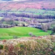
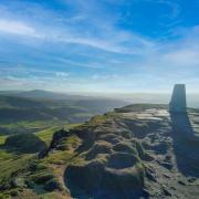
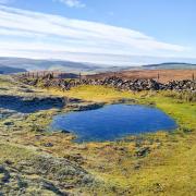
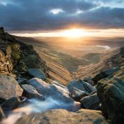
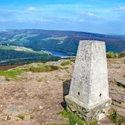
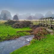
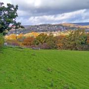
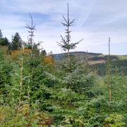
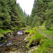
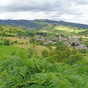
Head for high ground and enjoy far-reaching views towards dramatic heather-clad moors

Route
1. Begin by walking around the centre of Low Bradfield, a small village with a strong heart and community spirit. By the side of the bridge where Roche End Brook unites with Dale Dike, is an information plaque detailing the tragic night of 11th March 1864 when Dale Dike dam collapsed causing the Sheffield Flood. A small child was the only fatality from Low Bradfield but many buildings here were damaged or swept away.
The dam wall had recently been completed and the reservoir was being allowed to fill. However, extremely heavy rainfall caused this to occur too quickly. Strong winds blew the water into turbulent tidal waves that whipped up and lashed against the newly constructed dam. Late in the day a horizontal crack appeared which by nightfall had worsened. Just before midnight the dam was breached and some 700 million gallons of water poured down the Loxley Valley through Low Bradfield, Loxley, Malin Bridge and on to Sheffield. Water containing wreckage thundered down the valley like a battering ram. In the space of half an hour 244 people were drowned, 700 farm animals perished, 4,511 houses flooded, 39 of which were totally destroyed, 600 buildings were washed away, 15 bridges disappeared and 20,000 people were left homeless.

2. Walk around the sports field, heading up Smithy Bridge Road and then Wood Fall Lane towards the Post Office and General Store. Head along The Sands at the top of the sports field and then to the rear of the Village Hall. Notice along the way an interesting water fountain memorial to Mary Ann Smith which is inscribed ‘God’s gift to man’.
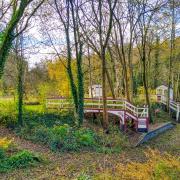
3. Walk past the tennis courts and at a metal footbridge turn right to ascend a series of stone flagged steps into woodland, following a sign for footpath 35. Cross over a road and continue uphill on the footpath which now passes through fields leading to St Nicholas’ Church at High Bradfield with the final section being along a narrow battlemented pathway beside railings in front of the church. Be sure to look around and admire the views across the valley.
The present Church of St Nicholas dates from 1487 and stands proudly 860 feet above sea level. An earlier Norman church occupied the site with surviving features including the north arcade, font and chancel arch. Also within is a Saxon Cross discovered in 1870 down in the valley below. The angular shaped building by the main gates was built in 1745 as a Watch House to prevent body snatchers stealing fresh corpses for medical research. It is said to be the only surviving Watch House in Yorkshire.

4. Head up Jane Street and then cross a wall stile on the left at the top side of the Watch House to follow a path behind the church for Bailey Hill. Notice waterspouts, gargoyle faces and stone features on the exterior of this beautifully ornate building.
Walk through the graveyard and see along the way a sign to the ‘flood grave’ of George Trickett aged 6. From this elevated path there are yet more stunning views. Look for the distant Boots Folly on a rise to the south west. This is a hilltop tower built in 1927 by Charles Boot of nearby Sugworth Hall. On a clear day you can make out the Wheel Stones, also known as the Coach and Horses, atop Derwent Edge.

5. At the far end of the graveyard pass through a stile and follow the arrow for a footpath ahead which is initially level. Soon it will begin to descend but beware of a sheer drop on your left into woodland which centuries ago formed a natural western defence of the 12th century motte and bailey castle constructed here by the de Furnival family. In strategic terms the castle commanded the upper reaches of the River Loxley. These earthworks and remains are now known as Bailey Hill.
6. Cross over Roche End Brook and follow a walled path to its end. Do not enter Rocher End Plantation on your left but turn right and pass through the smaller of two gateways on a footpath to Rocher Head. After going up a bank for approximately 25 yards turn left where there is a gateway on your right and follow a mainly level path beneath ash trees. Up to your right above Rocher Wood is a cliff edge just visible at times above the trees.
7. At Rocher Head are the derelict remains of an old isolated farmstead, once home to the Saddington family but then partly demolished in the 1960s. Follow the former driveway to meet up with Smallfield Lane.
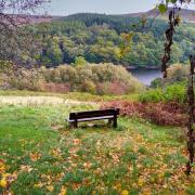
8. Turn left to walk along the road and then right at the junction shortly afterwards onto Agden Side Road. Pass through a gate on the left to follow a wonderful footpath (No. 140) along the ridge of the hill where a couple of benches have been conveniently placed to allow people to sit and admire the views whilst enjoying a rucksack snack. Keeping the wall to your left, follow a stretch of concessionary footpath – which descends gradually and has a much kinder gradient than the extremely steep footpath down Agden Side – emerging onto a wide path close to Smallfield on the edge of Agden Reservoir which was completed in 1869.
9. Turn right to follow this path around the deep, dark, peat enriched waters that are flanked by broad leaf trees and coniferous plantations. On the way see the sign for Agden Bog Nature Reserve managed by Yorkshire Wildlife Trust where birds, mammals and amphibians thrive in a diverse habitat of bracken beds and wet grasslands with sphagnum moss beds and purple moor grasses. In late summer watch for siskin and spotted fly-catcher flying around the reserve as well as dragonfly darting about like miniature helicopters.
10. From Windy Bank your return to Low Bradfield is along a quiet country lane. Arriving at a junction with bus turning circle opposite, turn left and walk back down Fair House Lane into the village.
Route details
Distance: 5.5 miles
Parking: Some roadside parking around the sports field as well as a free car park at The Sands, Low Bradfield, Sheffield S6 6LB Grid Ref: 263919
Terrain: 10+ gates and stiles. Close proximity to water. Steep drop beside woodland path. Steps and trip hazards. Fields with livestock grazing. Roadway without pavement
Refreshments: The Plough and Schoolrooms Café, Low Bradfield The Old Horns Inn, High Bradfield
Toilets: To the rear of Low Bradfield Village Hall and Sports Field
Map: OS Explorer OL1 – Dark Peak
Walk highlight: St Nicholas’ Church, High Bradfield
Description: Beginning at Low Bradfield and ascending to High Bradfield, this walk then explores hidden valleys and remote farmsteads passing through fields, woods and moorland. Packed with interest and illustrated by far-reaching views, the route then descends and ends with a trail around Agden Reservoir.


