

Taking in woodlands, riverside and coastline - this short walk is perfect for blowing away the winter cobwebs, writes Robert Hesketh
Although short, this beautiful woodland, riverside and coastal walk is packed with interest. It might be completed in an hour and a half, but is worth taking more time over.
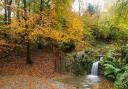
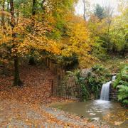
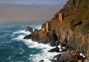
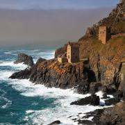
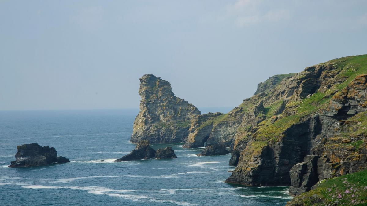
Starting from Bossiney, we cross fields and wind down through Halgabron to Trevillet Mill, an 18th century building on the site of a 15th century mill. We continue into the deeply wooded Rocky Valley. Carved by the River Trevillet, Rocky Valley runs by a series of waterfalls to meet the sea by a seventy foot deep slate canyon. It remains a place apart with its own aura of seclusion and serenity.
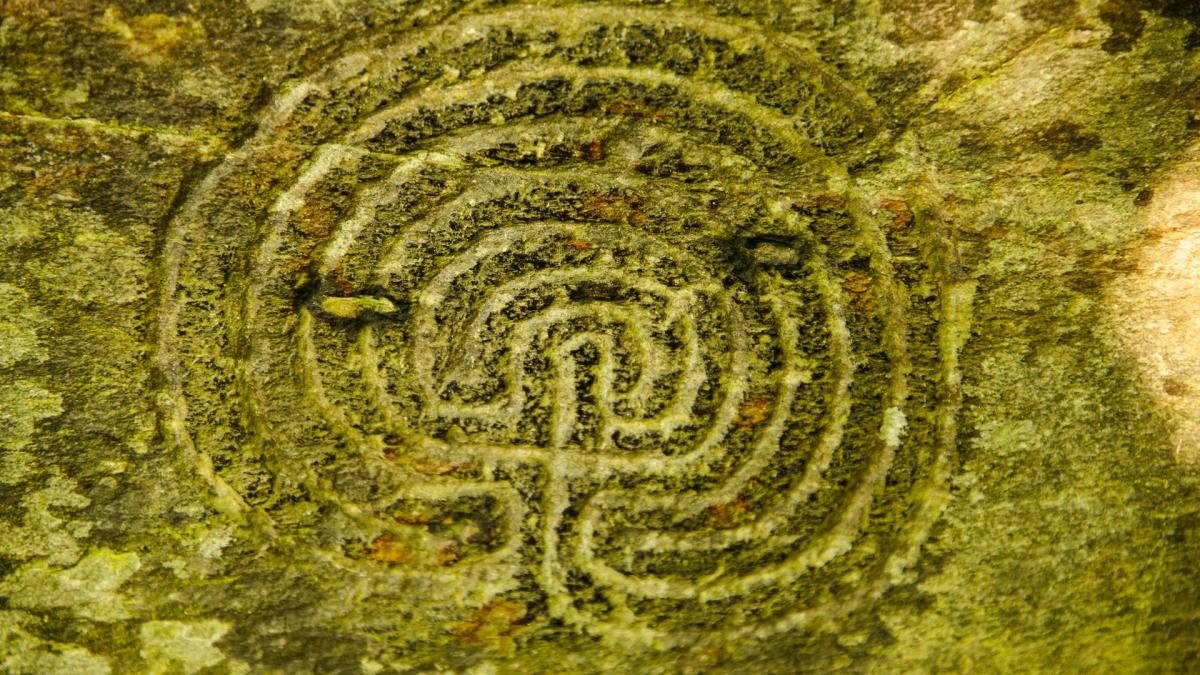
A special point of interest (and much controversy) is its mysterious rock carvings. These intriguing labyrinthine designs are found on a rock face, behind the now ruined Trewethett Mill, which produced yarn and cloth from around 1750 to 1861. Undoubtedly ancient symbols, they may have been cut in the Early Bronze Age, circa 1800-1400 BC, as the nearby plaque states.

Support for a Bronze Age date is lent by similarities between the Rocky Valley carvings and labyrinthine carvings in Galicia, Spain. On the other hand, the Spanish carvings are on high ground, not in a valley and the Cornish carvings are made on relatively soft shale. If they are really 3,400 to 3, 800 years old, they look remarkably sharp.
This sharpness suggests they were cut with metal tools, perhaps in the Iron Age, between 500BC and 200AD, when metal tools were more common.
A third school of thought is the patterns were carved within the last 250 years by the miller or his apprentices. Certainly, there is no doubt about the age of the initials which have been carved into the stonework of the derelict mill buildings: “W.T. 1779”, “D.R. 1794”, “T.B. 1797” and “G.B.1813”.
Labyrinths are an ancient symbol of wholeness. Their lineage stretches back to Bronze Age Knossos on Crete and the legend of the Minotaur and they have continued to stir the imagination ever since.

The many stone lined labyrinths of the Baltic coast have been dated to between the 13th century and modern times, with a peak in the 16th and 17th centuries. In England, eight turf mazes survive, including one on St Agnes, Isles of Scilly, thought to date from 1729 – though this is also debated.
The jury is still out on whether the Rocky Valley labyrinth carvings are ancient, medieval or relatively modern. Nonetheless, they have drawn the attention of some modern neo-Pagans and votive offerings can sometimes be found there.
BOOTS ON? LET’S GO!
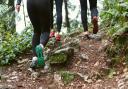
Start: Turn right out of the parking area and start walking towards Tintagel. After only 60 metres, turn left onto a signed Public Footpath. Descend the track with the holiday chalets on your left. Walk straight down and turn right down steps at the sign “Halgabron Waterfall”.
Cross the stream and continue straight up a field to a gateway. Cross another field to a stile, and then cross a third field with a hedge on your right to a gateway.
Turn left along the lane, through the hamlet of Halgabron, and down to the Tintagel-Boscastle road. Cross straight over towards Trevillet Mill. Follow the footpath signs around the mill and walk beside the river.

Cross the river by a footbridge. Where the path recrosses the river, you will pass through the ruins of Trewethett Mill, just behind which are the Rocky Valley carvings. Please beware of slippery rocks, especially if visiting the small waterfalls here.
Cross the bridge and continue, now with the river on your right. Ignore the next footbridge.
A few metres further on, divert right for a fine view of the small gorge and waterfall carved by the river as it rushes to the sea. Return to the path.
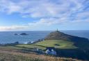
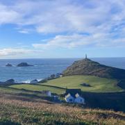
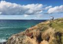
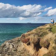
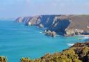
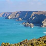
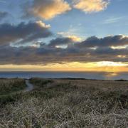
Turn right and climb the steep steps to the summit. From this fine viewpoint, the path winds its way past medieval strip field terraces, then heads inland.
When you reach a short flight of steps down to an old holloway (a deep track), turn left (unless you wish to extend your walk along the dramatic coast path to Tintagel).
Follow the track uphill to the parking area by the transmitter mast.
Information
Distance: 2 miles/3km
Time: 1 ½ hours
Exertion: Moderate
Points of Interest
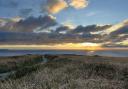
Superb coastal views
Waterfalls and gorge
Rock carvings possibly ancient
Riverbank path
Fact File
Start/parking: Parking area at north-east end of Bossiney village near the transmitter mast, SX067889, PL34 0AX.
Terrain: Woodland path and coast path. One short, steep ascent. Beware slippery, wet rocks.
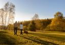
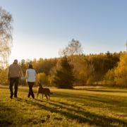
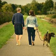
Child/dog friendly: Suitable for dogs on leads and children.
Maps Ordnance Survey Explorer 111; Landranger 200; Harvey’s SWCP 1.
Refreshments: Choice of pubs and cafes in Tintagel, 1 mile.
Public Toilets: At start
Public Transpo: .travelinesw.com
More Walks Writers’ Walks on the Cornish Coast, Robert Hesketh, Bossiney Books, 2019.