This walk from Audlem has plenty of interesting points, including an encounter with a Cheshire river you might not have heard of.
Like many counties, Cheshire’s boundaries frequently follow rivers, and it occurred to me the other day to challenge myself to name them all – before cheating and looking them up on the map.
For simplicity, I adopted the boundary defined by Cheshire West & Chester, and Cheshire East, and ignored anything not named as a river by the Ordnance Survey. And then I thought of the TV gameshow Pointless, the quiz where contestants win by choosing the most obscure answer. So, with the caveats above, and in my best Alexander Armstrong voice:
'Name a pointless river that follows the Cheshire border.'
I reckon the Mersey and Dee would be the big scorers – that is, the obvious answers, which are the worst ones to choose. Better would be the Weaver, Bollin, Dean, Goyt or Dane (the last of which flows past the famed beauty spot of Three Shires Head, where Cheshire meets Derbyshire and Staffordshire). But did you think of that all-important pointless answer? This month’s walk will lead you to what is surely the metaphorical jackpot.

From the attractive south Cheshire town of Audlem we follow the Shropshire Union Canal (I’m sorry, that’s a wrong answer and earns you the maximum of 100 points) to the secretive hamlet of Coxbank, a delightful maze of narrow lanes and footpaths with a wishing well hidden in a dell.
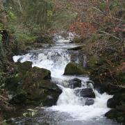
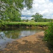
From there, we cross the A529 Market Drayton road and follow a quiet lane down into the valley of our elusive quarry: the tiny River Duckow, which divides Cheshire and Shropshire for a couple of miles upstream of the bridge.
A pleasant footpath leads downstream along the Duckow valley to its confluence with the Weaver, itself quite small at this point, on the outskirts of Audlem, before a towpath return.
There are several stiles to climb, and a slightly unnerving (though avoidable) crossing of a lock gate, and there may be muddy spots to negotiate after wet weather.
Trivia aside, I’m sure those that take the trouble to seek out this peacefully obscure backwater will consider their efforts anything but pointless.
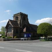
1. From the main public car park in Audlem, head down to the centre of the village. Beside the historic Market House and the adjoining Bear Stone, and below the handsome church of St James, cross the main road and walk down Vicarage Lane.
This curves to the left, with a glimpse of the 17th-century brick of the Old Grammar School on your left.
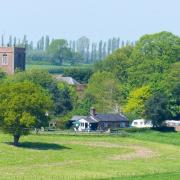
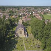
2. Turn right here over a grassy area to cross a small footbridge over the Audlem Brook. An optional there-and-back climb up the hill ahead (Holme Bank, the prime sledging location for Audlem children in times of snow) offers an attractive view back over church and village if time is available, but our main route turns right, directly alongside the stream.
This path wanders pleasantly along the valley until it climbs to the towpath of the Shropshire Union at lock 11.
3. At this point, take stock: the return route as described emerges on the opposite side of the canal here and the only way back is over the lock gates in front of you. If the thought of crossing the narrow walkways worries you, an optional return is described later to avoid it, at the expense of some road walking.
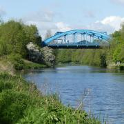
Whatever you decide for later, turn left for now and follow the towpath up past four more of the 15 locks that comprise the Audlem flight – arduous for the boater but an easy stroll for the walker. After lock number 7, pass under Snows Bridge (bridge 77).
4. Continue past three further locks to Bagley Lane Bridge (bridge 76). Here, beside lock number 3, double-back left up to the road and cross to the opposite bank of the canal. A footpath leads off to the left, now with the canal on your left-hand side, along the edge of a field.
5. At the end of the field, cross a stile and turn right, leaving the canal. A short, hedged path leads to the end of the charmingly named Damson Lane, which you follow ahead, between the houses of Coxbank.
Just beyond Hawthorn Cottage on the right, turn left down a path to the left of a brick cottage on the other side of the road. This leads shortly to a road junction; turn left here, along the signposted no-through road. By a couple of car parking spaces on the right, turn sharp right onto a descending path signposted to the Wishing Well.
6. Turn right by the well, and follow the hedged path back up to the road, emerging close to the road junction you passed before.
Turn right and then left, and follow the road to the Primitive Methodist chapel. Here, take the second left, alongside the chapel wall, and follow this lane over the old railway bridge to the A529.

7. Cross the main road carefully, and join Heywood Lane, opposite. Follow it down to the bridge near the confluence of Coxbank Brook and that river that could earn you points – the Duckow. On your left is Shropshire, to your right, Cheshire. Just beyond the river crossing, turn right over a stile by a footpath sign.
This path runs between paddocks (occupied by alpacas when we passed by) on the left, and the top of the steep bank down to the Duckow on the right.
Keeping along the top of the bank, pass a pond on the left then go through a metal hand-gate. In the next field, curve right, down the slope, to a footbridge over the river.
8. Beyond the bridge, bear left and follow the contour along the valley, now with the river on your left. Cross a tractor track to a double stile and footbridge; meanwhile, the Duckow quietly joins the Weaver to your left. Go through a gateway and continue to a stile into a smallholding, beyond which you reach a road. Turn left and follow the lane between mill buildings and onwards to the A525.
9. Cross and turn right along the pavement beside the main road, passing the junctions with Weaver View on the left and Holly Bank on the right. At the entrance to Heywoods Ridge on the right, cross back over, take a few steps along the pavement to the left and then take a footpath up steps on the right.
Cross a driveway to a kissing gate and follow the fenced path beyond, which runs past a house and down the hedged driveway to the A529.
10. If you decided earlier to avoid the lock-gate crossing of the canal, turn left here and follow the main road back to the centre of Audlem, turning right when you meet the A525. Otherwise, take a few steps to the right then cross carefully over a footbridge into Turnpike Community Fields.
Follow the path to the left then bear right uphill, past some isolated trees, to a stile giving onto the canal. Cross the lock-gate with care, and turn left along the towpath. Follow the canal for 400 metres past lock 12 to the road bridge.
11. Continue under the bridge for the Shroppie Fly, or leave the towpath just before it for the Bridge Inn or The Lord Combermere. From the bridge, walk up Whitchurch Street to return to the centre of Audlem and the nearby car park off Cheshire Street.
Compass Points
Area of walk: Audlem
Start point: Free car park in Cheshire Street, CW3 0AH
Distance: 3½ miles
Time to allow: 2 hours
Map: OS Explorer 257: Crewe & Nantwich
Refreshments: The Shroppie Fly, Audlem Wharf CW3 0DX facebook.com/TheShroppie 01270 748898
Bridge Inn bridgepubcrewe.co.uk 01270 812928
The Lord Combermere thelordcombermere.co.uk 01270 812277
In the December issue, David will be guiding readers to family-friendly strolls for the festive season

The Shroppie Fly
Named after a narrowboat type regarded as the pinnacle of the boatbuilder’s art, and the elite express of the local waterways, the Shroppie Fly has an enviable location beside one of the locks on the long Audlem flight of the Shropshire Union Canal.
The pub opened in 1975, occupying a former canal warehouse, and the main bar incorporates the bow of a narrowboat.
The crane outside – beside which are numerous tables for customers – completes the scene, but actually came from a goods yard on the nearby railway, which closed in 1967. The pub is dog-friendly, serves a range of real ales and a range of sandwiches alongside the regular menu, and welcomes walkers and boaters alike.
The current tenants left at the end of October, and although the pub is expected to open under new management in early November, it might be worth a quick call to confirm the situation.
Should you arrive to find the pub closed, the nearby Bridge Inn, or the Lord Combermere in the centre of the village, will doubtless be delighted to serve you.
For those in search of non-alcoholic refreshments, there are also a couple of pleasant tearooms in the centre of the village.


