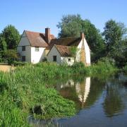
This walk is one of two suggested by Ken McDonald of the Hundred Parishes Society that covers some of the county’s best winter spots. This one takes you from Audley End Station through the countryside and down to Great Chesterford

Click here for the Hundred Parishes' other winter walk from Harlow Town Station
Leave Audley End Station by the main exit. If arriving on a Cambridge-bound train, cross the footbridge before leaving the station. Audley End Station is situated in the village of Wendens Ambo, but was named after Audley End House which is about 2 kilometres north.
Bear left through the car park, passing Nevill House, along the station approach road to the mini roundabout. Turn left past a garage. Cross the road onto the pavement and continue past the terrace of Victorian cottages faced with flintstone and then over the railway line.
Wendens Ambo church is just visible after a while over to the left. Keep on the right, passing several attractive cottages.
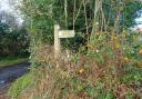
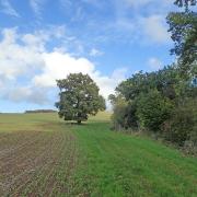
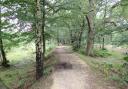
When the pavement runs out, keep on the right for a short distance, until the road turns left. Here, turn right onto the public footpath, climbing steadily for about 700 metres. When the path reaches a wood, turn left, keeping the hedge on the right.
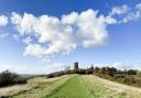
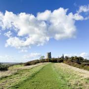
The path continues to climb gently, crossing over the M11 motorway, and eventually passes a telecommunications tower on the right. Turn right onto the lane by the tower and follow the lane round to the right. Stay on the road for nearly a kilometre.

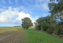
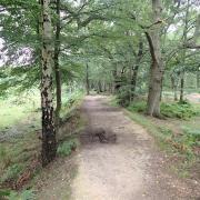
The road turns left and then right, but at the right turn keep straight ahead onto the bridleway. Distance to this point is 2.2 miles (3.5 kms). Soon after a thatched cottage on the left, keep ahead along a field edge with trees on the right until it reaches a wood. Continue ahead with the wood on the left. The path winds for a while just inside the wood.
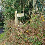
On emerging from the wood, bear left, keeping the wood on the left and a field on the right, gradually bearing right until the bridleway reaches a road, where you turn right. This is the hamlet of Littlebury Green, part of the parish of Littlebury.
Pass the unusual St Peter's Church on the right, built in 1885, and 200 metres after the church, turn left onto the byway, passing Catlin Cottages on the left. At the bottom of the descent, keep straight ahead uphill, ignoring paths to the right and left. The path reaches a road, where you turn left. This is the hamlet of Catmere End, part of Littlebury parish.
Ignore the road on the right, keeping straight ahead along Piper's Lane for 400 metres and also ignoring the path to the right, signposted as Icknield Way. After Lincolns on the right, turn right, past Potash Cottage, onto a short road past a few houses.
This is Strethall, the smallest parish in Essex with a population of 22 in 2001. After the houses, follow the path straight downhill, heading somewhat left of Strethall Church. Before reaching a barn, bear right and through the gate into the churchyard.

Turn to the right to view this simple church of Saxon origin, dating from the 11th century and also to enjoy the anonymous poem on the gravestone of Janet Adams, MBE. Continue round the church to exit the churchyard and descend steeply to a footpath.
Turn left and soon join a metalled road. Follow the road round to the right and continue downhill to the junction. Turn left, signposted as the Icknield Way, and after 300 metres keep straight ahead at a minor crossroads.
After another 300 metres, the Icknield Way leaves the road, turning half right to diagonally cross the field, descending gently. Sometimes the next 700 metres can be muddy and heavy going and you may prefer to take the alternative route (about 200 metres longer) described in the next paragraph.
If you do take the Icknield Way, signposted as a public bridleway, continue in a straight line towards the far corner of the field and a gap in the hedge that comes down the hill from the left. Eventually, at the corner of the field, bear slightly left and follow the well-defined tree-lined bridleway for a considerable distance.
If you choose to avoid the cross-field path, continue along the road for another kilometre, climbing gradually, until you reach a signposted path that leaves the road at right angles.

This clear path descends between two fields until it meets the line of trees. Turn left and follow the well-defined path which is largely tree-lined. The two options in the last two paragraphs have now merged.
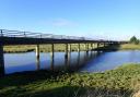
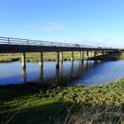
The narrow tree-lined path continues for some distance before climbing gradually and then descending towards the M11 motorway. Turn sharp right and soon turn left onto a footbridge over the motorway.
On the far side, follow the path round to the left and, after a short descent, turns right through trees. The path becomes a lane and then reaches a road (within sight of the Cambridgeshire county boundary sign). Turn right and, with care, cross the level crossing over the railway line. Just to the right is Great Chesterford railway station. The route now covers a short circuit around part of Great Chesterford, passing two potential eating paces before returning to the station.
Keep to the right until it is safe to cross the road, heading towards the modern Plextek building. Keep Plextek on the left and follow the pavement round to the left to join the main Newmarket Road, the B1383. Pass over the River Cam or Granta.
To the left, only 300 metres away, there is now no sign of the Roman fort and town that once stood here. With care, cross Newmarket Road using the traffic island. Continue with a flintstone wall on the right to Church Street.
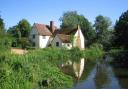
The Crown House Hotel is straight ahead, just after Church Street. Turn into Church Street with the 13th century All Saints church on the right. Pass the village sign on a small green on the left and another small green with seats leading down to the river on the right. Immediately after Manor Cottages, and immediately before the Crown and Thistle Inn, turn right into Manor Lane.
After about 100 metres turn around and retrace back past the 16th century Crown and Thistle Inn on the right. Carefully cross the road to go straight ahead down Carmel Street. Soon, turn left into School Street, passing the village store / tea room and the primary school.
School Street returns to the green with the village sign. Turn right and retrace along Church Street. Cross the street before reaching the main road. Turn left onto Newmarket Road. Follow the main road round to the left, passing the former mill, now converted to apartments.
The second turning on the right is the station approach road. Cross the main road with care, using one of the traffic islands. Go down the station approach to Great Chesterford Station. A ticket machine and the southbound platform (for Newport, London, etc) are on this side of the track.
Cross the footbridge for trains bound for Cambridge. Not all trains stop at all stations so, before boarding one, please check that it is scheduled to stop at your intended destination.
Compass points
Walk 13: Audley End to Great Chesterford
This undulating walk passes through the parishes of Wendens Ambo, Littlebury, Strethall and Great Chesterford.
Distance: 8 miles (13 kilometres)
Start: Audley End Station, Wendens Ambo (Ordnance Survey Grid Reference: TL516363)
Finish: Great Chesterford Station (TL504424)
Parking: At Audley End Station
Map: Ordnance Survey Explorer Maps 195 and 209
Click here for more on the Hundred Parishes Society