
For all these walks pick a clear day and take binoculars to bring the view closer. And don’t forget the map/GPS! These suggestions are précised, and the choice of route can be up to you.
Wavering Down in the Mendip Hills:
Map: OS Explorer 141 Cheddar Gorge & Mendip Hills West 1:25 000
Parking: On-road parking in Cross: nearby postcode: BS26 2EE. Grid ref: ST414547. There is also a small National Trust car park at the top of Kings Wood: grid ref ST421560.
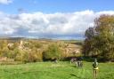
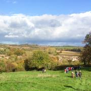
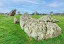
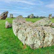
It is a quirk of the English language that ‘downs’ are very often ‘ups’. They are defined as ‘rounded and grass-covered hills in southern England’. Wavering Down is a superb example and the views are jaw-dropping.
From the village of Cross (once the home of Frankie Howerd), a bridleway heads north through King’s Wood. There then follows a glorious stretch of walking, westwards across Cross Plain and Wavering Down.
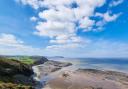
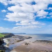
From the trig point Cheddar Reservoir is visible to the south east with the settlement of Winscombe to the north east; to the west is Crook Peak, which lies slightly lower than the trig. Brent Knoll rises to the south west and the coast is visible further away. South Wales can be seen to the north west.
This is all access land so you can choose the distance that best suits you, with a variety of footpaths to bring you back to the start point. Perhaps extend the walk as far as Compton Bishop, or pick a shorter route from the trig, down through wildlife-rich Bourton Coombe and back to Cross. This shorter walk is about four miles in total.
Dunkery Beacon on Exmoor:
Map: OS Outdoor Leisure 9, Exmoor 1:25 000
Parking: Dunkery Gate: grid ref SS895406.
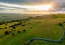
Dunkery Beacon is a windswept place of wide open spaces; the most elevated point in southern England outside Dartmoor. It is particularly lovely when the heather is in bloom; Exmoor ponies graze its slopes.
Dunkery is one of the English Marilyns, a hill with a relative height compared to the surrounding land levels of at least 150m. As part of the Holnicote Estate, it came into the ownership of the National Trust in 1935. It is a place where the past rubs shoulders with the present – bronze-age burial mounds are nearby.
A car parking area is marked on the map to the south of the beacon. There are various paths to choose from to get you to the mighty cairn on the summit with its spectacular 360 degree view.
From here you overlook Exmoor to the south and west, with the Brendon and Quantock Hills to the east. There are glimpses of the Exmoor coastline to the north and on a clear day Wales can be seen across the Bristol Channel.
This is access land with a vast network of paths, so the length of walk is up to you, but if you’re in an exploratory mood you will need to be happy about self-guiding across open moorland.
Beacon Hill area, near West Quantoxhead:
Map: OS Explorer 140 Quantock Hills and Bridgwater 1:25 000
Parking: Near Beacon Hill: grid ref: ST116410.
In 1956 the diverse and beautiful Quantock Hills were the first area of England to be designated an Area of Outstanding Natural Beauty. The hills have been occupied since prehistoric times, archaeological finds indicating successive populations of human settlers.
However, the region hasn’t always been a place of peace and tranquillity: during the 10th century the nearby coastal town of Watchet suffered unwanted attention from the Vikings and the Quantocks also saw activity during the English Civil War when the Royalist stronghold of Dunster Castle was under siege.
Later in the 17th century, when the Monmouth Rebellion came to an end, many of the Duke’s supporters were executed in the Quantocks.
During the late 18th century Samuel Taylor Coleridge lived in the area, a time that is often considered to have been his most poetically productive and during which he encountered the famed ‘person from Porlock’.
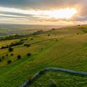
A suggested route of around five miles (which crosses open moorland) starts from the car park marked on the OS map south east of the village of West Quantoxhead, on the edge of Beacon Hill. The start point itself has a fabulous view over Weacombe Combe. Follow The Great Road east to its junction with the Greenway Path, then head north to join the Coleridge Way for a very short distance, before taking the bridlepath through delightful Smith’s Combe.
This eventually climbs out of the combe and various paths lead up to the trig point on Beacon Hill. On a clear day the Bristol Channel and Wales to the north are visible from this lofty spot. The Brendon Hills are to the west with Exmoor beyond. The Mendips lie to the east with the Blackdowns to the south.