It's almost 50 years since Bowland was named an area of outstanding beauty. Author Terry Marsh writes about the granduer of this Lancashire wonder
There was a time when to speak of ‘Lancashire’ aroused images of vast smoky grey blocks of heavy industry. Thankfully, today’s generations see a completely different image, one that the late comedian Les Dawson described as a ‘memory of lakes and woods and rolling hills’.
Those who don’t know the county will, I suspect, be surprised that Lancashire boasts two sizeable areas that have been designated as Areas of Outstanding Natural Beauty (AONB). The larger is the Forest of 37Bowland, with an area of 310 square miles (800 sq km). Imagine that: Lancashire, a place of outstanding natural beauty...and it’s becoming more beautiful by the year.
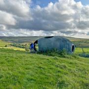
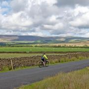
Here in Bowland, you find vastly differing terrain, from lush farmlands in the Ribble Valley to more rugged rough pastures in the Forest of Bowland uplands and the huge boggy uplifts of the main Bowland massif itself. It’s all wonderfully wild walking country.
The Forest of Bowland and the almost iconic Pendle Hill were designated as AONBs in 1964, and though Pendle Hill is quite separate geographically, the two together share the title Forest of Bowland AONB. It is the eleventh largest of the 46 designated AONBs in the UK, and is almost entirely in Lancashire, though a little bit extends into Yorkshire.
The Bowland Fells are designated a Site of Special Scientific Interest (SSSI) on account of the heather moorland blanket bog which supports important upland breeding bird populations.
The forest is, of course, a former hunting forest, not a woodland, while the name ‘Bowland’ probably derives from ‘bu’-land, the land of cattle, and has nothing to do with bows and arrows. In times gone by wild boar, deer and wolves roamed here, making the area a much-prized hunting ground for kings and nobility.
The central core of the area contrasts gritstone fells with steep-sided valleys and peaty moorland expanses, and for many years access to this excellent walking country was a contentious topic. But with the introduction of Access Land under the provisions of the Countryside and Rights of Way Act 2000, much, if not all, of this land became legally walkable. Mind you, while the right to roam is one thing, never lose sight of the fact that footpaths evolved where they did for a reason; get away from the paths and Bowland will often remind you why.
The Bowland Fells form an upland area of heather moorland splintered by deep wooded river valleys. Together with the Bowland Fringe and outlying Pendle Hill they form an area of considerable conservation interest, one dominated by blanket bog and heather moorland with areas of upland pasture. The fells are incised by rapid flowing rivers giving rise to steep cloughs with occasional trees and lush wooded valleys on lower slopes.
The valleys and cloughs, many of them containing examples of ancient or post-medieval enclosure that tell of the area’s landscape history, provide a transition between the exposed moorland fells and the rural lowlands and include a delightful mosaic of woodland, unimproved meadows, rush-dominated pastures, and grassland slopes, with marshes and streams at lower levels. Anyone raised on the manicured orderliness of, say, the Lake District or the Cotswolds, may well find their sensibilities assaulted here, for this is rough country; rough but ruggedly handsome and every bit as appealing in a take-me-as-you-find-me kind of way.
The surrounding Bowland Fringe, which includes popular hills like Nicky Nook above Scorton, and the adjoining Grizedale, has a diverse landscape of undulating meadows and lush pastures, broadleaved woodlands, parkland and water bodies, such as Stocks Reservoir.
The Forest of Bowland supports a considerable area of semi-natural vegetation forming important wildlife habitats. The upland massif with its vast expanses of unenclosed heather moorland and blanket bog is of international importance for breeding bird populations. The in-bye grasslands and herby hay meadows are important features, and semi-natural clough woodlands survive where they are inaccessible to sheep.
For the birdwatcher, the area is superb. The moorland areas hold important populations of hen harrier, peregrine, red grouse, lesser black-backed gull, merlin, golden plover and curlew. The area is also important regionally for short-eared owl and ring ouzel.
Defining walks that don’t have some measure of austerity as an ingredient is not easy. But the circuit of Stocks Reservoir from Gisburn Forest has a great deal to commend it, while Clougha Pike, east of Lancaster has long been popular both as a circular walk from Quernmore or as part of a longer jaunt across to Ward’s Stone, the highest point of the area.
There is a fine walk, too from Cross of Greet Bridge that runs up to Bowland Knotts and across Catlow Fell before tripping down to the headwaters of the Hodder at Cross of Greet, or what remains of it. Tucked among these bosomy fells, small and ancient settlements are found; places like Slaidburn, Dunsop Bridge (which, at the confluence of the Dunsop and the Hodder, claims to be at the exact geographic centre of England, has seen two visits by the Queen and the installation by BT of its 100,000th payphone - unveiled by Sir Ranulph Fiennes), Bolton-by-Bowland and the lost village of Stocks-in-Bowland, all of which have extensive histories.
Walk here and you walk through history; a history of man, a history of landscape, a history of evolution on a grand scale. But then, it’s a grand place, a place of gently rolling hills, sun-brightened lakes and rich woodland valleys.


