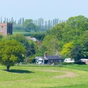
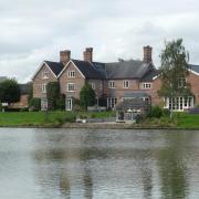
Take a stroll around Bickerton Hill and onto Raw Head and imagine what life was like for local folk here in harsher times

The clue's in the name. Our walk this month begins in Coppermine Lane, a reminder of the industrial history of what now seems a very rural, unspoilt part of the world.
Through the 18th, and much of the 19th, centuries, men went to work in a string of mine shafts - the deepest of them reaching down 156 feet - running just north of what we now know as the A534.
Copper was first mined here, it is thought, in the Bronze Age, and then by the Romans. But the earliest documentary evidence of mining here dates back to 1697, in the form of a report prepared for landowner Sir Philip Egerton.
Anyone familiar with Alderley Edge will be right at home on Bickerton Hill, as the two share not just weather-smoothed sandstone outcrops, woodland and views over the Cheshire Plain, but also that long history of copper mining.

In Bickerton's case, the action petered in the mid-19th century, the shafts were sealed long ago and, apart from the odd chimney, there is little to see today of this mining heritage.
There are walking routes galore in this area, but the route we take this month appeals to my lazier side. Although we are in hilly territory, we are often skirting the contours of the hill. So there are no muscle-burning climbs, just a gentle amble through some very beautiful country.
1. The walk begins from Coppermine Lane, Bickerton. Turn up the lane from the A534, heading for postcode SY14 8BY. At the top of the lane, there is quite plentiful parking by the sometimes muddy roadside. Begin walking up the lane in the direction you arrived, and, reaching a big green metal sign for the Sandstone Trail, bear left along the trail. When the path goes left, at the sign for Rawhead Farm, go straight on, following the Sandstone Trail.

2. After 50 metres or so, go left through a wooden gate, following a path from which you can see across fields to the right. The path takes you up old stone steps, passing outcrops of sandstone. Look out for a flight of wooden steps on the right which take you down to Droppingstone Well. It was originally called Drippingstone Well, and was the water supply for farms and cottages nearby for many a year, with locals walking to the spring along the paths, carrying a yoke with two buckets - a tough way to obtain a vital commodity.
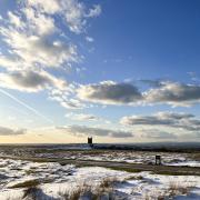
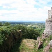
3. Returning to the path, you soon reach the top of the escarpment, encountering the first of several viewpoints - a flat table rock of sandstone, like a mini version of Alderley Edge. Keep ahead on this path with fields to the left and a steep thickly-wooded slope to the right. Before too long, you reach the white trig point at Raw Head. At 227 metres, this is the highest point on Bickerton Hill, indeed the highest point on all the Sandstone Trail, which runs 34 miles from Frodsham to Whitchurch. That doesn't, sadly, mean that Raw Head offers the best views, as a profusion of trees blocks out too much of the landscape below.

4. Follow the path which runs away from the trig point, then bears right. After a little while, you go down steep stone steps and along the edge of a steep drop. After another splendid viewpoint, follow the path as it bears left (ignoring a path which goes downhill on the right) and keep ahead on the Sandstone Trail, passing another viewpoint, then on into woods, dipping and climbing until the views open up on your left.
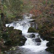
5. The path narrows and runs alongside a field to a metal kissing gate beside Chiflik Farm. Keep ahead downhill, but when the track bears right, go left, leaving the Sandstone Trail, into a footpath. Moments later, you see a sign for Coppermine Lane. Follow this path to the left, taking care of the many potentially slippery exposed tree roots, down to the bottom, crossing a very small stream, and then up to a stile which brings you out at the bottom of Coppermine Lane. Head left up the lane to return to the start point.

COMPASS POINTS
Area of Walk: Bickerton
Distance: 3 miles
Time to allow: 1.5 to 2 hours
Map: OS Explorer 257
Refreshments: The Bickerton Poacher, Wrexham Road, Bulkeley SY14 8BE
Paul will be back next month with a stroll around Rode Heath but if you can't wait that long log onto cheshirelife.co.uk where you'll find more walks to enjoy around the county. And don't forget your camera - you can tag us in your pictures on instagram @cheshirelifemag and Twitter @cheshirelife.


