This month’s walk begins in ‘Happy Valley’ - that’s Bollington, for the unhappily uninitiated, writes Howard Bradbury.
It calls itself Happy Valley now, but I suspect life in Bollington was a good deal grimmer in the 19th century when it was carving a reputation as a cotton town.
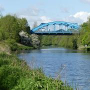
But the legacies of that age of muck and brass are what make Bollington so characterful today, not least the healthy ration of pubs founded to refresh all those thirsty wage slaves. We see a fair smattering of reminders of Bollington’s industrial past on this walk. We start on the Middlewood Way, once the rail line constructed to help Bollington’s cotton industry, and to transport stone from Kerridge’s quarries. We then stroll along the Macclesfield Canal - an artery of the industrial age - and we pass by Clarence Mill, an imposing relic of Bollington’s cotton years. The mill was, of course, built alongside the canal in the 1830s - the first of Bollington’s many mills to be so conveniently placed next to the canal - and replaced with the present structure in 1877.
The 20th century saw a familiar story of decline. After the business failed, Clarence Mill was underused for many years, used for stocking manufacture in the 1930s and a billet for US Marines prior to the D-Day landings, but it ceased all connection with textile manufacture in 1970. Happily, in the 1990s, it was refurbished for mixed residential and business use. The mill is also home to the Cafe Waterside, overlooking the canal, and Bollington Discovery Centre, telling the town’s history.
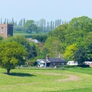
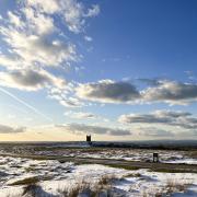
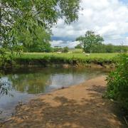
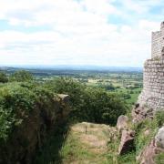
You leave the town well behind on this walk, as you head north along the canal, strike out into farmland and ascend a moor with vast views over the Cheshire Plain before returning to Bollington via the pretty village of Pott Shrigley. It’s quite a long walk, with some moderate hills in the second half.

1. We start from the Middlewood Way car park on Adlington Road, Bollington SK10 5JT. At the far end of the car park, beside the skateboard area, take the path leading up to the viaduct and, at the top, turn left onto Middlewood Way, walking along the old railway bridge and on under a bridge, passing beside some curious stones. When the path reaches a road, turn left, uphill, and take the steep steps visible on your right to get to the canal towpath. Turn left along the towpath, following the sign for Marple.
2. A few minutes later, you pass Clarence Mill on your right. Just after bridge 24, you see some panoramic views towards Manchester and Stockport opening up to your left. Stay on the towpath until bridge 18, where you take the bridge over the canal. Continue along this road for a few yards until just before it turns left into Lyme View Marina, and go straight ahead on what is marked as the private road to Lockgate Farm.

When the road veers to the right near the farm, go straight on over one stile and on to another stile where, on my visit, a herd of curious bullocks was waiting to greet me. Over this stile, go right along the field edge, then over a double stile and head diagonally across the next field. You are aiming for a wooden gate beside a metal gate quite high up this field. Through this gate and up the path and you soon come to a road.
3. Turn right down the road and you pass the Coffee Tavern. A further 50 yards or so later, turn left up the tarmac road to Birchencliffe Farm. At the top of the lane, carry straight on beside some homes to your left and continue on the rough track as it passes between two ponds and then climbs up towards the moor. Eventually, you come to Moorside Lane, an unmade track. Take a breather and look back over expansive views which may, on a clear day, even include the Welsh mountains. Then bear right along Moorside Lane.

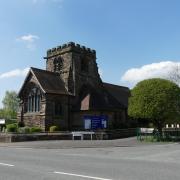
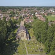
4. The lane dips down until you reach a T junction with Bakestonedale Road. Turn right down this road and walk into the village of Pott Shrigley. St Christopher’s Church here is surely worth a visit - a grade 1 listed building made from local stone in the 15th century. As you enter the village, with the church facing you, bear left, passing the entrance to the church on your right. A few minutes later, take the road forking to the left, signposted Rainow. Keep ahead and you will eventually spot Bollington’s famous White Nancy folly on the hill to the right.
5. When you reach a road junction, bear right down the hill, following the sign for Bollington. You will pass the Poachers Inn and then the Cotton Tree. At the next junction, go left, and straight across at the mini-roundabout and continue along the B5090, passing the recently-refurbished Holly Bush pub. Walk beneath the viaduct, pass the civic centre and turn right into Adlington Road, following the brown Middlewood Way signpost, and you are soon at journey’s end.

Area of Walk: Bollington and Pott Shrigley
Distance: 7½ miles
Time to allow: 3½ hours
Map: OS Explorer 24

Refreshments: The Coffee Tavern, Shrigley Road, Pott Shrigley; The Poachers Inn, 95 Ingersley Road, Bollington; The Holly Bush, 75 Palmerston Street, Bollington.


