Keith Carter leads a heavenly walk from St Mary to Saighton
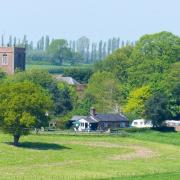
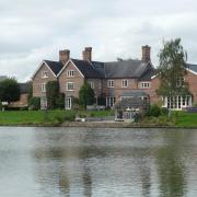
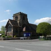
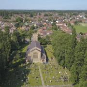
Bruera is an unusual name. I had never heard of it before although its origin is simply from the Latin meaning a heath. The houses with their characteristic red brickwork with geometric designs and twisted chimneys are a familiar sight in the area including Saighton and Aldford where the pattern is repeated. They fall within the estate of the Duke of Westminster. Bruera is only a small village round the church of St Mary the Virgin, an unusual example of Norman architecture with a timber tower and remnants of the original Saxon construction. Inside, bats are in residence and the altar has to be covered with dust sheets to avoid unwanted deposits.
The churchyard has some early graves dating back several centuries and one impressive family tomb to members of a local titled family. We were lucky to find the church open and one of the parishioners tidying up inside. She told us the story of the time the Dean came on a visit, arriving by taxi from Chester from where he had instructed the driver to take him to Satan! (Saighton).
1 The car can be left by the low wall around the church and we start by walking north towards Saighton. In a few hundred yards a bridleway is signposted from a gateway on the left of the road and here an obstacle has to be overcome since the gate itself is firmly chained up regardless of the handle designed to help riders open it without dismounting. Some bridleway! Nothing for it but to climb the gate.

Proceed through two fields then pass a sheepfold with double gates and enter a third field. The idea of coming along here on horseback is laughable. This third field produced an unexpected bounty of mushrooms and my companion Jim set about collecting them, turning out his rucksack for space to pack them into in great excitement. He pressed me to take some but I said her indoors would never let me eat them. You hear so many stories of people eating poison mushrooms. I asked him what he was going to do with them. He replied: ‘On toast! In soup! With bacon! In omelettes!’ At that rate he risks turning into a mushroom.
2 In the field corner we leave by a plank bridge and a metal gate that brings us into a field that in was crowded with cows when we were there. Turn right and follow the right hand boundary along the field edge. The blackberries were in abundance as they have been this year but had just gone over and in any case Jim had nothing to put them in since all the space was taken up with mushrooms. Leaving this field we enter a strip of woodland until the path emerges at a road on the edge of the village of Saighton opposite a square sandstone water tower, castellated in the Scottish Baronial style.
3 Turn right on the road and walk down to the next bend where we find the gates to Abbey Gate College, formerly Saighton Grange and the residence of the Abbot of Chester. Look for a gap in the wall on the left where steps worn hollow with age lead into a broad field which at one time was planted with vines. Today barley is the usual crop, organically grown, but it is not hard to pictures rows and rows of vines with grapes ripening in the sun.
Keep the hedge on your left and walk to the bottom of this sloping field to find a stile at the bottom leading into the next field, a much smaller one. We then meet a prominent track that crosses our line of approach, not a right of way so we cross it to a stile opposite and head slightly left across the next field.
4 Look for a stile in the hedge after negotiating the field margin or headland, left uncultivated as part of the Stewardship Scheme for farms. Jim became entangled in thistles taller than him and emerged puffing and cursing. He had to spend the next half hour extracting prickles from his clothing, to my amusement.
Cross a short field at roughly ten o’clock then after another short field join the road at a stile with an old-style signpost pointing to Saighton, the way we have come. Turn right on the road which does a sharp right then a left to bring us back to the church at Bruera. n
Compass points
Area of walk: Bruera
Distance: 4 miles
Time to allow: 2-3 hours
Map: OS Explorer 266 Wirral and Chester
Refreshments: None on the walk, good pub in Aldford.
Not suitable for wheelchair or pushchair users
1 Xyx yxyxy yxyxy


