Keith Carter leads a walk up and back down one of Cheshire’s most recognisable landmarks
This walk was published in June 2014, so the details of the route may no longer be accurate, we do advise these articles should only be used as a guideline for any potential route you take and you should double check an up to date map before you set off.
Helsby Hill will be familiar to those travelling on the M56 to or from North Wales, the wooded mound that forms the high ground that rises from the flat lands bordering the Mersey estuary. This is the country through which the Sandstone Trail passes. It runs from Frodsham to Whitchurch, following the escarpment for 34 miles through some lovely landscape. I walked this trail over five days with my group known as the Last of the Summer Whiners although the truth is I'm certain they have not seen the last of wine, no matter what the season.

Actually the trail does not go over Helsby Hill which is a pity since it would make sense to divert to the summit if only for the views. Our walk this month touches the Sandstone Trail but only for a kilometre or so through Snidley Moor Wood.
Quarrying was a thriving industry on the south side of the hill during the 1870s and the stone was used in the building of Liverpool Docks and for repairs to Chester Cathedral. If you park at Quarry Car Park there are some interpretation panels with some useful information about the quarrying activities here including an explanation of the 'tunnels' in the Triassic Sandstone laid down 250 million years ago which was new to me.
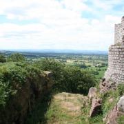
1. From the Quarry Car Park take Hill Road South uphill signposted Helsby Hill soon entering National Trust land at a gateway. Climb through the trees and keep left at a fork where a sign points right to Harmers Lake which will be our return route later. The summit has a green triangulation pillar from where the panoramic view takes in the estuary of the Mersey, Liverpool in the distance and the industrial chaos of Stanlow and Runcorn.
Having marvelled at the view we continue on a clear path that gradually descends through woodland in a north-easterly direction, the clustered roves of Helsby village below us to the left. On reaching an obvious junction at a stile we come out of National Trust land and turn left to follow a path that emerges on Old Chester Road in the outskirts of Helsby. Turn right then take the next right, climbing a brow where, opposite a row of cottages, a footpath sign points the way to Woodhouses and Frodsham.
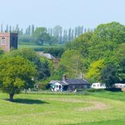
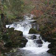
2. A narrow path leads to a kissing gate, crosses a field and reaches an access lane at a bungalow called Tong Dean. Cross the lane to an enclosed path to arrive at a slab bridge over a clear running stream where we join Chestnut Lane. At the top this meets Tarvin Road and here we turn left, walk a few paces then turn right onto a lane leading to the large house built in vernacular style with its own clock tower.
Leave the lane at a gate and enter the wooded slopes of Woodhouse Hill. Here we stood aside to let a walking group through, the cheerful members of Warrington U3A walking the North Cheshire Way. My sidekick Jim asked if there was a U2A. 'I don't know but there's definitely a USA,' replied their leader. They turned left but we began the steep and unremitting climb up the hill, much of it stepped, bringing us at the top to join the route of the Sandstone Trail.
3. Turn right and follow a level path through an area of new planting which in time will develop into a fine wood. This entire area seems to have been tidied up and managed giving it a rather municipal look like the local park. Any sense of natural landscape has been lost and it will take a long time for nature to re-establish itself. The path descends trending right and comes to a gate where there is an interpretation board. Turn right here and follow a sunken lane as far as a road where we turn right then take the next left onto Burrows Lane. At a bend, keep ahead along a field edge.
4. We are now on the Longster Trail, a nine-mile linear walk from Helsby Hill to Pipers Ash. Our path brings us to a road where we turn left and walk along it until we see an opening on the right, the going here as everywhere else this year muddy and slippery underfoot. The way forward continues past a paddock and through the hedge on the right a house that might easily have been worth featuring on Grand Designs.
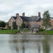
At a lane, turn left and pass a picnic area with a lay-by for parking and a bench and table at the edge of woodland. A board here shows the trails in what is Harmers Wood, laid out and maintained by volunteers. Remain on the lane to the top of a brow and at the entrance to a farm take the gate on the left where a broad track leads beside a large pond or small lake with the usual population of mallard.
At a junction you can either go right to Helsby Hill or keep ahead to the Quarry. This is for us. The path goes through a cutting, once the track of a railway, and we join our outward route in the National Trust woodland and Hill Road South bringing us back to our starting point.
Compass points
Area of walk: Helsby Hill
Distance: Four miles
Time to allow: Two-three hours
Map: OS Explorer 267 Northwich and Delamere Forest.
Refreshments: None on the walk.
Accessibility: Not suitable for wheelchairs or pushchairs.


