Keith Carter leads a walk through the countryside around Kelsall
I have recently found an invaluable book with the title ‘A Dictionary of British Place Names’ which gives the origin of practically every village across our country.
When you come across a place with a name like Noah’s Ark or Pity Me and are curious to know where the name came from, you can find it in this book. This, of course, leads to more puzzles such as Upton Snodbury, Piddletrenthide and Alrewas, keeping you amused for ages.
Many places derive their names from the head man or leader of a small community, so for example Grimsargh in Lancashire was a pasture of a man called Grim and Tattenhall was the land belonging to Tata. Kelsall was ‘a nook in the hill belonging to Kell.’ Fascinating stuff.
Kelsall village is by-passed by the thunderous A54, sparing it the curse of through-traffic. The description ‘nook in the hill’ is quite apt since it nestles below the sandstone ridge that runs north to south from Frodsham (homestead of a man called Frod) to Beeston (place of a man called Beast?). The fine walkers’ route called the Sandstone Trail runs along this ridge but doesn’t touch Kelsall itself, sticking to the higher ground.
There is parking in the centre of the village hard by the pub/restaurant Lord Binning, formerly the Morris Dancer. A plaque on the wall explains that Lord Binning was a noted local bon viveur and raconteur. A staff member was on his break outside and my mate Jim engaged him in conversation.
‘Who exactly was Lord Binning?’‘He was a local man. A lord.’‘Really?’‘Yes, he was well known for eating and drinking a lot.’Jim looked interested.‘Anything else known about him?’‘He told some great stories.’‘Ah, that’s what I thought.’
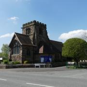
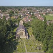
1 Our walk starts from the car park. Turn right and walk uphill away from the village as far as the parish church, St Philip’s, which was built to a design by Sir George Gilbert Scott, he of the Foreign Office Building and the Albert Memorial in London, not to mention St Pancras Station.
Look for a footpath on the other side of the road past the church, an opening by a lamp standard and a sign for the school from where an enclosed path leads first to a quiet housing development where we turn left then first right into Kingswood Walk. A fingerpost points the way that climbs a slope to meet a lane. Cross this into Elizabeth Close and at a house called Oakbank continue uphill by way of a series of steps at the top of which a kissing gate emerges onto a lane at a bend. Turn right and pass in front of Lower Fold Cottages, keeping to the right of a track that leads up to the radio mast.
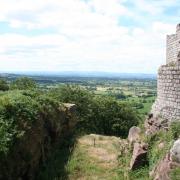
2 Our path is wooded and becomes a broad green lane contouring below the hillside on top of which two prominent radio masts can be seen. We come to a large sandstone boulder with an explanatory board on it describing Kelsborrow Castle, the prehistoric promontory fort here, one of only seven in Cheshire.
A path descends into a deep, wood-fringed valley, the engineered path sloping down to the bottom to meet a track then emerging onto a lane beside Winsor’s Farm Shop. This is a real find, the shop full of the scent of apples which are arranged by type in boxes, more varieties than you will come across in years of searching: Egremont Russet, Red Pippin, Belle de Boskoop and genuine English Golden Delicious – eat your heart out Frenchmen –wonderful apples that remind you how apples used to taste before supermarkets swamped their shelves with produce from South Africa and France. Perversely, Jim bought a bag of figs and we ate them as we walked. Now figs are figs but personally give me a Cox’s Orange Pippin any day.
3 Turn right at the farm shop and follow Chapel Lane to the crossroads at Willington, go straight over and take Willington Road for nearly a mile, a dead straight road that passes the restored buildings of Manor Farm. After Mill Lane on the left, we should see a footpath sign in the right hand hedge with a kissing gate admitting us to a field.
4 Stay along the left-hand hedge, the way marks keeping us going in the same direction through a series of similar kissing gates, each one in good repair, fabricated in galvanised metal to a set design. They are on a trail known as the Eddisbury Way, a 17-mile route between Frodsham and Higher Burwardsley where it joins up with the Sandstone Trail. Some have speculated that Eddisbury derives from a man called Eddy, but scholars have thrown doubt on the theory.
5 After a series of these kissing gates the path crosses the drives to houses then continues to cross a final field by a faint path across the middle to a final gate leading us onto a track. Turn right along it, cross a lane and follow an enclosed footpath soon becoming surfaced with tarmac and leading us across a playing field to arrive at the car park from which we set off.
The good people of Kelsall are lucky to live in such a pleasant and orderly village away from the hurly-burly and set in beautiful countryside. I hope they won’t object to my having fun with the names. The proximity of well-maintained trails like the Sandstone Trail and the Eddisbury Way added to the network of local footpaths, make this an ideal destination for walkers without the danger of getting swamped by crowds. I heartily recommend it.
Compass points
Area of walk: Kelsall, mid-Cheshire
Map: OS Explorer 267 Northwich and Delamere Forest.
Distance of walk: 4 miles
Time to allow: 2 hours
Refreshments: Pubs in Kelsall
Pushchair/wheelchair friendly? No.


