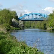
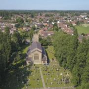
This month’s walk is an easy ramble through fields around Mobberley, though you will get a noisy reminder of the modern world every few minutes

The villagers of Mobberley must by now be fairly blasé about the planes which pass over them with such regularity. Perhaps they even stop hearing them, in the same way that one can filter out constant traffic noise, or the hum of an air conditioner.
But to the visitor, the proximity of so many jets heaving skywards from Manchester Airport is a little exciting, especially so when this walk allows you to look down the runway as those planes take off towards you.
Mobberley loomed large, of course, in opposition to the building of a second runway at Manchester Airport. Twenty years or so ago, eco-warriors took to the trees and, in the case of the most celebrated agitator Swampy, holed up underground in a fruitless bid to stop more greenery disappearing beneath concrete.
As I gazed down the runway in fascination at a succession of planes taking off, a young woman galloped her horse around a field close to the runway landing lights. It seems as if the lovers of this corner of the country have at least reached some kind of accommodation with their noisy neighbour.

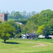
The other point of interest on this walk is rather older. The grade one listed St Wilfrid’s Church dates back to the 13th century, and boasts a rood screen from around 1500 which Pevsner reckons to be the best in Cheshire.
The church also has a window dedicated to Mobberley’s most famous son George Mallory, who may or may not have become the first man to reach the summit of Everest before he and his partner Andrew Irvine died on the mountain in 1924.
1. We start from Mobberley railway station on Station Road, postcode WA16 7QJ. The car park itself is for rail users, but there is some parking available on nearby roads if you do so considerately. Head east away from the station on Station Road, passing through the car park and taking the footpath through the kissing gate immediately to the left into a field. Keep to the left hand edge until you reach a hedge where you go right and then strike out diagonally left across the field aiming for the far distant top right corner. There you will find an overgrown path into woods, over a stream ahead to a stile.

2. The stile brings you to a lane. Go right, passing Owen House Farm, then take the footpath over a stile on the left. Head through a small paddock to an opening in the fence on the right, then go ahead through a gate, across a lane, through another gate. Go straight across the field to a footpath sign which directs you across a bridge, then head across the next field to a kissing gate to the left of the pylon. Head across the next field towards an opening in the hedge, to the left of which is a footpath, over a stile, another stile and cross a tarmac lane beside a cattle grid. After stopping here for a bit of plane-spotting, continue ahead along the line of a hedge to a stile which puts you on a grassy path with shrubbery either side. Follow this until it reaches Lady Lane.
3. Turn right along the lane, then first left into Davenport Lane. After passing Willow House, take the footpath on the right through a kissing gate. Keep on this path through three more kissing gates. St Wilfrid’s Chuch, Mobberley, will come into view to your right. Keep ahead until the path comes to a hedge running at right angles to it, with a metal gate to the left. Bear right along the line of the hedge to a pair of kissing gates. Go left here, heading towards the church and a gate brings you into the car park of the Church Inn.

4. From the pub, bear right up Church Lane, passing the church. As the road veers to the right, take the footpath on the left between two houses. Cross two stiles and keep ahead on the well-defined track. Cross another stile and keep ahead, but just before you reach a field gate, take the footpath over a stile on the left, crossing the field on the right edge to reach a stile on the right. Cross it and head along the left edge of the field. At the farm fence, follow the path around to the right then continue on the left field edge, ignoring the first stile on the left. After a few minutes, look for a very overgrown stile on the left with a path running downhill. Go down here, cross the bridge and head towards the telegraph pole and on to the metal field gate with a stile beside it.
5. Head right up the track, then right into Smith Lane. when the road forks, go right into Slade Lane, which climbs gently. When it reaches Hobcroft Lane, turn left, then first left a few yards later into Station Road, which brings you back to the start point.

Compass points
Area of Walk: Mobberley
Distance: 4 miles
Time to allow: 2 hours

Map: OS Explorer 268
Refreshments: Church Lane, Mobberley, WA16 7RD; Railway Inn, Station Road, Mobberley, WA16 6LA.


