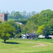
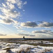
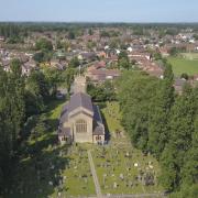
Mow Cop Castle, on the Cheshire-Staffordshire border, is the destination of this month’s walk
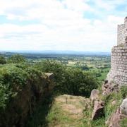
At first glance Mow Cop Castle looks like a battle-scarred, tumbledown relic which has seen a millennium of wars and weathering.
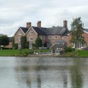
Not so. Pevsner describes it as a ‘sham ruin’. It was built in 1754 by Randle Wilbraham, not as a fortress but as a summerhouse. The hilltop pretend-castle also served to enhance the view from his other, more substantial piece of real estate, Rode Hall.
These days, the castle - National Trust property since 1937 - is more ruined than its creator intended. It is still an impressive sight, but turn your back on the castle and gaze over the Cheshire Plain and there’s a more impressive view.
Before reaching the castle, you will pass the Old Man of Mow - a pillar of gritstone 65 feet high, which remained after the stone around it had been quarried. Quite why it was left in that fashion is not certain. But perhaps the intention was to mark the fact that a cairn once stood on this site. This cairn was probably a boundary marker between two counties and two manors and was there for so long that even in 1530, it was described as a ‘roke of old stones that of old times have been reared’.

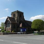
Other points of interest on this walk include a church, reminding us that this village was the birthplace of the Primitive Methodist movement, after a gathering on Mow Cop in 1807. Close to the church, you will pass, in a hole in the wall, the Parson’s Well, dated 1858, which exhorted the drinker to ‘keep thyself pure’.You may need a drink by this point. The first half of this walk takes us uphill, much of it through woodland.
1. Head for New Road, postcode CW12 3GZ, where you will find parking in a lay-by near to a bridge over the canal. You can see Mow Cop ahead. Walk in the direction of the railway and the hill and turn left into Yew Tree Lane, then right into a footpath passing beneath the rail line. As it meets the South Cheshire Way, head right, and when the wide paths fork a few yards later, go right. A few minutes later, the path forks again, with a stile and footpath between the two wider tracks. Ignore this footpath and go left, uphill on a wooded track. Very soon after, take a path which rises to the right, to a metal gate and a sign for the South Cheshire Way.

2. Follow the path into the field as expansive views open up to the right. Passing the cottage on your left, head uphill along the left field edge, looking out for occasional way markers for the South Cheshire Way. At the top, go through a metal kissing gate into woodland. Keep uphill for some time until a flight of stone steps brings you to a kissing gate into a field. Head along the right edge of the field towards the mast, through another kissing gate and over a stile until you are almost level with the mast, then go right along a track signed as the South Cheshire Way. At the National Trust sign for the Old Man of Mow, bear left onto the path which takes you past this jutting stone, continuing on this path which then rejoins the track you have just left. A few yards later you reach Wood Street. Go right for just a few yards and then left into a track bearing a National Trust sign for Mow Cop. Alternatively, if you want to break your journey with a meal, you could instead turn left when you reach Wood Street and follow this road for less than a third of a mile until you reach The Mow Cop Inn.
3. Explore Mow Cop Castle, then head down one of the well-worn paths on the other side of the hill to reach the car park. Exit the car park onto High Street, going left down the road until you reach a house on the right called The Old Post Office. Go right here towards Mow Cop Methodist Church and take the path, marked as the Gritstone Trail, passing beside the church on its left. Eventually, the path meets a track. Go right, then a few yards later left onto a bridleway which will bring you to Station Road. Head left on the road, downhill. Passing the junction with Birch Tree Lane, Station Road becomes Drumber Lane. Keep going downhill, through several bends, looking out for a footpath to the right. Take this track and after a short while, go ahead through a metal kissing gate onto a path through a field.

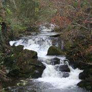
4. Keep to the left edge of the field, passing through another metal kissing gate into woodland. After a while, you will cross a stile at a point where a stream crosses the path. The noise of the railway can be heard, signalling journey’s end. At a farm house, take the stile to the right, and the path which runs behind a black farm building. The path rejoins a track and soon after meets another track. Go left here and you are on the same track on which you started. Retrace your steps back down to the path beneath the railway line.
COMPASS POINTS
Area of Walk: Mow Cop
Distance: Four miles
Time to allow: Two hours
Map: OS Explorer 268
Refreshments: The Brownlow Inn, Brownlow Heath Lane, Congleton CW12 4TH; The Egerton Arms, Astbury, Congleton CW12 4RQ; The Mow Cop Inn, 32 Congleton Rd, Mow Cop, Stoke-on-Trent ST7 3PJ.
Howard will be back next month with a walk around the Mobberley area. But if you can’t wait that long log onto cheshirelife.co.uk where you’ll find more walks to enjoy around the county. And don’t forget your camera - your pictures could win you prizes. See online for full details of our readers’ photos competition and to see the entries we’ve already received.


