This month’s walk is an easy four-mile stroll through some pretty countryside just east of Lymm.
If you are looking for the quintessential Cheshire country walk, then this gentle ramble is a strong contender.
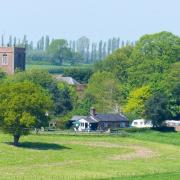
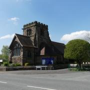
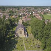
It begins at a lovely church with a sky-scraping steeple, overlooking lush pastures. It proceeds through wide grassy tracks – shaded by old deciduous trees, twittering with birdsong – and along winding country lanes beside meadows of snooker table green. Then it returns to the starting point along a pretty stretch of canal.
There is barely a hint of a hill from to start to finish, some very pleasant real estate to gawp at along the way and a pub at the mid-way point. Perfection.
The church in question is St Peter’s, Oughtrington – built in the 1870s in gothic revival style. A handsome pile, I thought, but Pevsner’s Buildings of England begs to differ, sniffily dismissing the spire as “too thin for so substantial a church” and pointing out other bits of the fabric with no right to be there.

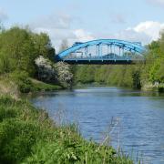
The canal is, of course, the Bridgewater, this stretch being the second phase of what, in the 1760s, had been the world’s first industrial canal. The walk takes us past Lymm Cruising Club, so there is a lot of boat-related enterprise on the opposite bank, and a long line of craft moored up.
Passing all these floating homes-from-home, I mused that there must be a book to be written about the names people give to their boats. Some embrace the unvarnished and hedonistic joy of going where the tiller takes you, toasting every sunset – names such as ‘Tipsy’, ‘Take It Easy’ and ‘Miss ‘B’ Havin’. Others – ‘Turbulence’, ‘Tuksumgetin’ and ‘In-Dispute’ – hint at a darker sense of humour, or perhaps that not everything in life is plain sailing.
1. The starting point is St Peter’s Church on Oughtrington Lane WA13 0RB. There is very little parking in the immediate vicinity of the church, and you may fare better back down the hill near Oughtrington Bridge. You will be coming back this way anyway. With the church on your right, head up Oughtrington Lane, passing Lymm High School on your left and continuing until the lane comes to a T-junction with Higher Lane, the A56. Go left here and, 200m later, cross the road to go right along Whiteleggs Lane. You pass Wildersmoor Hall, with its old sign for the Lymm Shire Stud, and continue until the path meets Kay Lane.

2. Go left along Kay Lane and follow it to High Legh Road. Cross here and go straight ahead into a footpath with a hedge to your right and what looks like a Christmas tree plantation to your left. At the next field, continue ahead following the line of telegraph poles until a stile brings you to Froghall Lane. Bear left, along Agden Park Lane and soon you reach the A56, with the Wheatsheaf Inn across the road.
3. Don’t cross the A56, but bear right along its verge for about a third of a mile. Cross over the main road when you see a narrow lane forking off to the left at an angle, slightly downhill. This is Agden Lane, but on my visit there was no sign to identify it as such. Follow Agden Lane down to Warrington Lane, where you will see a house called the Old Boathouse Inn on the left. Go right, then immediately left crossing the bridge over the canal.

4. On the other side of the canal, go through an entrance on the left, then turn right along the towpath. It’s a gentle stroll of more than a mile now, passing lots of boats. You also pass Spud Wood. I was hoping to find some ancient Saxon explanation for this blunt name. Alas, the more prosaic truth is that the woodland dates back only as far as the 1990s and the name comes from its former use as a potato field.
5. Just after passing Spud Wood, you reach Lloyd Bridge; you can’t miss it, as the name is written on it. We have the great canal builder James Brindley to thank for this bridge, dating back to 1770. The dedication on the plaque, however, is to the Lloyd family who “served the Bridgewater Canal Company for more than 200 years”. Exit the towpath just beyond Lloyd Bridge and turn right up Oughtrington Lane, carefully crossing the bridge over the canal, which is a single carriageway, controlled by traffic lights. Continue up the hill to reach St Peter’s again.
COMPASS POINTS
Area of Walk: Oughtrington and Agden, Lymm
Distance: 4 miles

Time to allow: 1½ hours
Map: OS Explorer 268
Refreshments: The Wheatsheaf Inn, 269 Higher Lane, Broomedge, Lymm, WA13 0TR


