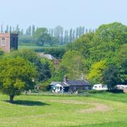
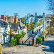
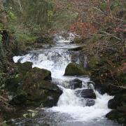
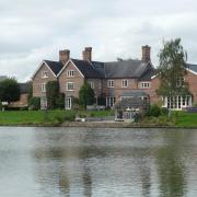
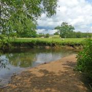
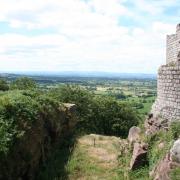
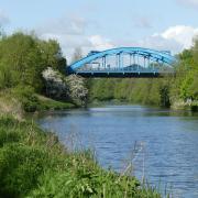
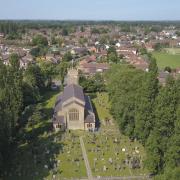
Water looms large in this month’s walk, which takes us along the Peak Forest Canal and beside the River Goyt in Marple, writes Howard Bradbury
Strolling beside the River Goyt on the home stretch, the thought occurs that this walk has taken me through some pretty, unspoilt country.
And yet the truth is that parts of the Marple landscape I have enjoyed have been substantially shaped by the needs of industry. The Roman Lakes I have passed beside were once the mill ponds of the colossal Mellor Mill, built by Samuel Oldknow, who came to Marple in 1787, and even altered the course of the Goyt to feed those ponds.
The Peak Forest Canal, which forms the outward leg of the walk, was also a product of the industrial revolution and Oldknow’s enterprise; he was the largest shareholder in the project, which was completed in 1800. These days, it is a lovely spot for walkers, and it’s a popular section of the Cheshire Ring, though the 16 locks at Marple must seem like old-fashioned hard graft even for today’s leisure boater.
Mellor Mill was six storeys high and 400 feet long, reputedly the biggest cotton factory in England. But today you can pass the site and scarcely be aware that it was ever there. The mill was destroyed in 1892 by a spectacular fire, the land was allowed to return to woodland, and the mill ponds became places for canoeing, fishing and picknicking.

As you walk by the site of the former mill, though, you may see archaeologists and volunteers digging away, trying to unearth what remains of Mellor Mill. Good luck to them. The enterprise of the likes of Samuel Oldknow should not be forgotten.

1. Our walk begins at the car park at Ridge Quarry Viewing Point on The Ridge, Marple, SK6 7ES.
Go back out of the car park entrance, turn left and after 150 yards, turn left into Hollinwood Lane. You see the Peak Forest Canal to your right. Follow the lane downhill until it meets the canal at bridge 21, cross over that bridge and turn left onto the towpath.
2. At bridge 19, cross to the other side of the canal and carry on up the towpath. You soon reach a canal basin with Marple Social and Forces Club to the right. Follow the towpath up to a bridge, crossing over the start of the Macclesfield Canal and then bear downhill beside the flight of locks, starting with lock 16. The path takes you through a tunnel beneath the road at lock 13, then continue walking beside the canal, with Memorial Park to your left, until at lock 9, you reach the busy A626.

3. Turn right here and walk down the pavement of Brabyns Brow, passing Marple Station and the 145-year-old St Martin’s Church on your left. At the bottom of the hill, the road crosses the Goyt, affording a lovely view of the river from the bridge. Turn right into Town Street and enjoy the shops of Marple Bridge village. This is, incidentally, your best chance of refreshments on this walk.
4. From the top of Town Street, bear right into Low Lea Road, passing through a pretty huddle of cottages then up a rough, wide track with the river to your right. The path then bends left, away from river, and you follow it beside farmland, eventually descending to the former site of Mellor Mill. At a junction (where you see the road is signed as Bottoms Mill Road) turn left into Lakes Road and then bear right at a fork not long after, in front of Bottoms Hall (once the place where Oldknow housed his young apprentices) continuing along Lakes Road as the largest of the Roman Lakes opens up to your left.

5. At the end of the lake, continue straight on along the bridleway beside the river, passing under Goytcliffe Viaduct. You reach a wooden sign informing you that you are on the Goyt Way. Turn right here, in the direction of Strines Road, and cross over Roman Bridge, which is by no means ‘Roman’, and was built in the 18th century, rejoicing for many years in the name Windy Bottom Bridge. On the other side of the river, turn left and follow the path up to a house, whereafter you head uphill until you reach Strines Road.
6. Cross over Strines Road and walk up Plucksbridge Road. As the road bends to the right, take the steep path on your left, which brings you back to bridge 21 of the canal. Simply retrace your steps up Hollinwood Lane and turn right onto The Ridge and you are back at the car park.
Area of Walk: Peak Forest Canal, River Goyt, Marple Bridge
Distance: 4½ miles
Time to allow: 2½ hours
Map: OS Explorer 268
Refreshments: The Midland pub, 26 Brabyns Brow, Marple Bridge; Libby’s Patisserie, Dutson’s Cafe and, if chips are your preferred walking fuel, the Town Street Fryer, all in Town Street, Marple Bridge.


