A walk that runs just outside of Chester , takes in sections of the River Gowy
The two and a half inch Ordnance Survey map shows Plemstall just to the east of Mickle Trafford with the railway line dividing them, Plemstall nothing more than the church and the odd farm. We read that paper maps are on the way out, their place taken by a touch of the button image on the iPad.
Techno idiots like myself find this as improbable as printed books being replaced by on-screen texts which we are told is the inevitable fate of the written word, a crowded bookshelf of interesting titles soon to be as irrelevant and unnecessary as horse-drawn carriages.
This won’t stop me buying old-fashioned books and lining them up on my shelves, their spines reminders of time spent in the best way possible, curled up with a good book by a roaring fire. Who will want my maps when my time is up? I see them at some unknown date packed into a cardboard wine box and taken to Oxfam then sent for recycling or priced at fifty pence each or three for a pound.
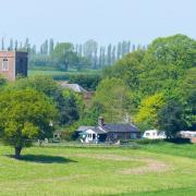
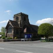
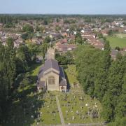
Our walk this month starts at the sandstone church of St Peter at the end of Plemstall Lane where there is enough space for a few cars to park. Legend has it that a shipwrecked fisherman, during the height of a storm, vowed that if he would be delivered from a watery grave he would endow a church and dedicate it to Saint Peter the fisherman. This was at a time when the area was tidal marshland. Having found safety on a rocky outcrop he built his church there.

The present building dates from 1826, so we learn from a plaque high up on the tower and contains some fine carvings and an edition of the early Bible but since the door was barred and locked I was not able to check these out. There are some old gravestones in the churchyard and one massive tomb decorated with skeletons, a rather grisly memento mori. This is the tomb of the Hurleston family whose ancestor is said to have sailed with Drake against the Spanish Armada in 1588. His portrait appeared on a postage stamp issued to mark the 400th anniversary of the defeat of the Armada.
The surrounding area is associated with Saint Plegmund who was chosen by King Alfred as his Archbishop of Canterbury. Saint Plegmund’s Well stands on the lane to the church, recently prettified by the addition of a decorative wrought-iron fence which some might find out of keeping with an ancient well. In recent years the practice of well-dressing has been used here but it’s worth remembering that this pre-dates Christianity, intended as a propitiation to the water spirits.
Directions
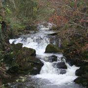
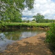
Start the walk from the church by taking a track where a signpost says Barrow and in 50 yards or so fork left to arrive at a gated crossing over the railway. Cross over and on approaching the yard of Holme Farm take a stile on the left from where a fenced path passes paddocks on either side then crosses a stream by a bridge made from railway sleepers. Turn right and follow the stream, actually the River Gowy, not much of a river, which rises in the Peckforton Hills and flows into the Mersey near Stanlow.

Leave the river’s edge and head towards higher ground using a solitary house as the marker. Cross a further similar bridge with a gate then go through a kissing gate then a second, both in galvanised metal like most of the kissing gates on this walk. On reaching a band of trees keep right and in a few yards find a further kissing gate in the bushes to the left and go through it and turn right. The path emerges into the open crossing two fields diagonally at 45 degrees, climbing to a brow where the chimneys and roof of a house can be seen.
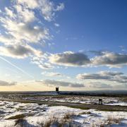
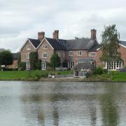
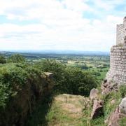
On reaching the brow of Barrow Hill we turn right and walk along the ridge line on a grassy path with fine views over the Cheshire Plain to the west. On reaching a tarmac lane built to serve several newly built properties in the grounds of a huge half-timbered building, Greysfield, converted into apartments. It’s in a lovely position, for sure.
On meeting a T-junction, turn right to find ourselves on the Longster Trail, a nine-mile way-marked route between Helsby Hill and Pipers Ash.
The lane becomes unsurfaced then turns sharp right while we keep forward through a damaged kissing gate to proceed along a left hand field boundary through two fields. At the bottom of the second, go through another kissing gate and cross a stream by a footbridge into a field heavily infested with docks, the grass badly overgrown beyond a point where anything useful can be done with it.

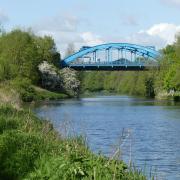
Cross the Gowy again by a concrete bridge and turn left onto an earth track and follow this, passing farm buildings to reach a road at a crossroads. Directly across is a bench commemorating the royal wedding in 1981. Least said, soonest mended on that score. Go forward on Cinder Lane and leave it after a hundred yards by a path on the right which dips down under overhanging trees then emerges into daylight behind the Bird in Hand pub in Guilden Sutton. This you would call ‘a tidy little pub’ if you were my companion Jim who forced me to join him for a pint of a bitter from a local micro-brewery. Unusually for Jim, he found no fault in this and finished his pint without a word of complaint.
Leave the pub and turn right along Church Lane and go left at the junction to proceed along Station Lane. A short distance beyond the village there’s a tea shop on the right, meadow Lea, open seven days a week 10am-4pm. Just beyond that on the opposite side of the road is the start of the extension to the Chester Millennium Greenway, a cycle route which goes right into Chester and further to Connah’s Quay. We continue on Station Lane and go under the railway then around a curve into the village of Mickle Trafford. There are two ways to return to Plemstall Church, one to keep ahead to the junction with the A56, turn right and walk as far as Plemstall Lane and walk the length of it past St Plegmund’s Well, the other to take a footpath on the right that leads into a quiet estate that cuts through to meet Plemstall Lane just before the railway bridge. It’s no quicker but you avoid the main road.
Compass points
Area of walk: Plemstall, Guilden Sutton and Mickle Trafford
Distance: 5 miles
Time to allow: 3½ to 4 hours
Map: OS explorer 266 Wirral and Chester
Refreshments: Bird in Hand Guilden Sutton, Meadow Lea Coffee Shop Mickle Trafford.
Accessibility: Not suitable for wheelchair or pushchair users.


