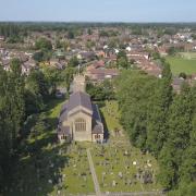
Our walk this month begins and ends in Tarporley, the village once described as ‘one long street’ writes Howard Bradbury

When William I ordered a great totting-up of the spoils of his conquest, the Domesday Book of 1086 put a precise value on all of Tarporley...the equivalent of a mere 50p.
It’s an amusing fact to bear in mind as you walk down High Street today, past wine bars, restaurants, grand pubs and lots of thriving independent shops dedicated to the finer things in life. Tarporley’s stock has risen somewhat.
That high street has existed for many centuries. It was built up on both sides by 1675, not least because Tarporley benefited from so much passing trade, standing, as it did, on the London to Chester road, one of the significant arteries of Britain in the era of the stage coach. Hence, Tarporley also has one of the grandest coaching inns you will ever see, in the shape of the Swan, a place of rest and refreshment for over 400 years.
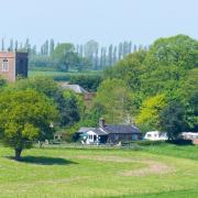
High Street was buzzing with life as I began this walk, but from the minute I stepped off the road and onto the first footpath, I was pretty much alone. I encountered few humans and hardly any livestock, which makes this a good walk for those who are nervous of cattle; the fields we cross here are almost entirely devoted to arable crops.

The walk takes us south, out of Tarporley, picking up the Sandstone Trail to head north and looping back to the centre of the village.
1. There is a car park in the middle of Tarporley, behind the Rising Sun, postcode CW6 0DX. Head back up to High Street and turn right, heading south past the Swan and past the Foresters Arms, cross over Birch Heath Road and, a few yards later, look out for a very narrow footpath between houses on your right. Go down here to reach a stile, cross the field to another stile which takes you down steps to the A49. Cross over the busy road and go up steps on the other side to a stile. Over this, head towards the big tree in the middle of the field, pass to the right of it and then carry straight on down towards another stile which offers several different footpath options.

2. Follow the path to the left, over a second stile right next to the first and through a field, walking parallel with the hedge to your right. Head for a break in the hedge which crosses your path and you will find a stile. Over this and straight across the next field. A metal kissing gate leads to an enclosed, very overgrown path. Ignore any paths off to the right or left and continue on this path until it emerges at the edge of Tiverton. Bear right along the road, passing Tiverton Hall, after which you turn right into Pudding Lane. (I’d be intrigued to know how it got this name. The Pudding Lane in London - where the Great Fire may or may not have begun - was so named because it was the route by which puddings, parcels of offal, were taken for disposal after butchery. It’s difficult to believe this country lane in Cheshire ever saw much traffic in offal.)
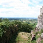
3. Continue along Pudding Lane, where you will be able to spot Beeston Castle in the distance to the left. Along the way, you’ll notice also that you are now on the Sandstone Trail. After quite a few minutes, your reach a T junction. Cross over and a few yards to your right is another Sandstone Trail sign directing you through a kissing gate. Go round the big tree, over a stile to the left and walk along the right hand edge of the next field, over another stile and continue following the Sandstone Trail signs across fields which, on my visit, were still tall with corn.

4. After crossing several fields, you arrive at a sign beside woodland, directing you to Clotton to the left and Tarporley to the right. Go left and you soon reach a kissing gate and a wooden bridge leading up an overgrown and possibly muddy path. You will come to a sign for the Sandstone Trail, going left towards the A54, Rode Street and Fishers Green, but don’t take this. Instead, keep going ahead on the same path until it emerges at a track. Bear left up the track and you soon reach the A49. My plan had been to cross over here and take the restricted byway to complete the journey into Tarporley. Unfortunately, it was not so much restricted as impassable, with the gate tied firmly shut and in too dilapidated condition to climb. Instead, I headed left up the A49 to the roundabout and right along Rode Street back into the centre of Tarporley. This diversion at least showed me one unexpected point of interest: a little well in an alcove on Rode Street which, a sign informed, was used until the 18th century by salters needing to water their horses as they carried their wares from Northwich, Middlewich and Nantwich.
Compass points
Area of Walk: Tarporley
Distance: 4 miles
Time to allow: 2 hours
Map: OS Explorer 267
Refreshments: The Swan, 50 High Street, Tarporley CW6 0AG; Piste wine bar and restaurant, 55 High Street, Tarporley CW6 0DP; Rising Sun, High Street, Tarporley CW6 0DX.


