What is the finest viewpoint in Cheshire? Tegg’s Nose, Macclesfield, must be a strong contender, writes Howard Bradbury
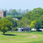
The best way to truly appreciate the Cheshire Plain is to get up high and gaze down across it.
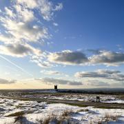
That’s the aim of this month’s walk. So pick a good clear day, and strap on your sturdiest boots because there is a bit of hill-climb involved. Well, at least it’s hill-climbing by Cheshire standards. Folk in Yorkshire and Cumbria may scoff at the 380m summit of Tegg’s Nose as a mere pimple, but they couldn’t gainsay the beauty of the views you get from this pimple’s pinnacle.
We cannot be sure how this chunk of sandstone got its name. Early maps give it as ‘Tegge’s Naze’. Was ‘Tegge’ an early Norse settler, or does the name come from ‘teg’ for sheep, because the hill was once thought to resemble a sheep?
One thing of which we can be sure: Tegg’s Nose now looks very different from when it was first named. Five hundred years or so of quarrying have seen to that. The sheer stone faces now used for climbing and abseiling were where men once spent long, miserable and dangerous days extracting millstone grit; the hillocks now decked with heather and bilberry were once the quarry’s spoil heaps.

At first, that high-quality stone was prised away using pick axes and bars. Imagine doing that on a cold, drizzly November day just to earn a daily crust. But as demand for this traditional raw material declined, the quarry’s output shifted towards pulverised rubble for road construction. The rock-crushing machine, installed in 1938, which smashed 100 tonnes of sandstone a day, is still to be seen on the path around Tegg’s Nose.
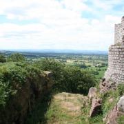
Quarrying ceased in 1955. Sixty years on, the activity on this hill is all to do with leisure. From Tegg’s Nose, you can survey not just the Cheshire Plain, with Jodrell Bank standing proudly in the middle distance and the Welsh mountains on the horizon, but also the hills undulating towards the Macclesfield Forest - a little bit of Austria on our doorstep.
1. Start from the Leather’s Smithy pub in Clarke Lane, Langley, Macclesfield, SK11 0NE. There are designated free parking bays on the road here, but you may need to get there early on a good day as they fill up. Facing the pub, head right up the tarmac lane signposted as ‘unsuitable for motor vehicles’. There is forest to your right, and to your left, views soon open up back across the Cheshire Plain. As the road begins to descend, do not follow it as it bends to the right, but carry straight on along the forest bridleway and into the forest.

2. Stay on this path for quite some time as it climbs. Look out for a large log lying to the left of the track and a small pond on the right, because soon after this, you need to take a left turn towards Tegg’s Nose. The wooden signpost for Tegg’s Nose was obscured by vegetation when I did this walk, so look out for a junction in the paths at which there is a disused stone building to the left. Head towards that building and take the path beside it which then descends. Keep following signs for Tegg’s Nose.
3. Pass through a metal gate and go left along a tarmac lane which becomes a bridleway after you pass Hardingland Farm. Continue on this bridleway between fields, folowing it round to the right, downhill and over a stream. It’s rough going, with large stones underfoot, so take care. Soon after, the track passes a house and becomes a tarmac lane again. Follow it down into a dip then up to a crossroads where you head right, uphill, following a sign for Tegg’s Nose Country Park and car park.

4. After a couple of minutes, bear left up Saddlers Way, a former packhorse track; you can’t miss the wooden sign. Some striking views open up to the right now. It’s steep and the stones may be slippery after rain, so you will be grateful to reach the top where you will find the car park and the visitor centre - a good place for a refreshment stop (see below). From the visitor centre, go to the car park exit and take the path to the left, rising away from the road to give expansive views over the plain. At a wooden gate with a stone plaque announcing Tegg’s Nose Country Park, head up the steps and follow the path uphill.
5. Follow the yellow arrows indicating the Gritstone Trail (and also the Tegg’s Nose Trail) past the old quarry workings, the stone-crushing machine and around Tegg’s Nose, where you can gaze down at Tegg’s Nose and Bottoms reservoirs. Look out for a wooden gate on the left with a downhill path which is clearly marked with another metal Tegg’s Nose Trail plaque. Take this well-worn path to the bottom of the hill, where you turn right along the dam of the reservoir, then slightly left and right through a gate down to the track along the dam of the next reservoir. This is all still part of the Gritstone Trail. The track brings you to Clarke Lane. Turn left up the lane and a few minutes later you are back at the Leather’s Smithy.

Area of Walk: Tegg’s Nose Country Park, Macclesfield.
Distance: 4½ miles
Time to allow: 2½ hours
Map: OS Explorer 268
Refreshments: Leather’s Smithy, Clarke Lane, Langley, Macclesfield SK11 0NE; Tegg’s Nose Tea Room, (open seven days, 9am to 5pm October to April, 8am to 6pm May to September) visitor centre, Buxton Old Road, Macclesfield SK11 0AP.


