Keith Carter explores a canalside route which has a bit of everything
The Anderton Boat Lift is one of Cheshire’s favourite places to visit, one that I have seen described as among the Seven Wonders of the Waterways. It was designed to transfer narrow boats from the River Weaver, or what is known as the Weaver Navigation since it was navigable all the way to the Mersey Estuary, and the Trent and Mersey Canal, and vice versa, the difference in height between the two waterways being 50ft.
Dating from 1875, the lift was designed by Edwin Clark who went on to design further boat lifts even higher than this one. It consists of a steel superstructure holding twin tanks of water, each capable of taking two narrow boats side by side. It was enlarged in 1908 but corrosion to the metalwork made further operation unsafe and it was closed in 1983.
Enthusiasts began campaigning for its restoration and with the aid of Lottery money it was reopened in the year 2000. The cost was �7million. Today there’s a well run visitor centre and from Easter to October you can take a ride to experience the raising and lowering of the lift, an interesting if slightly underwhelming trip. For followers of the Fred Dibnah school of industrial archaeology it is a must. The casual onlooker might be excused for coming away rather bemused.
There is ample parking at the Boat Lift which is well sign-posted from the A-roads in the vicinity. If you intend having a look at the lift go left along the canal to the gate to the visitor centre. If like us you only want a walk, turn right along the canal towpath and (the canal to your left) and walk past the extensive marina where the narrow boats cluster like sardines in a tin.
Pass under bridges 199 and 198 and over another bridge then continue on the towpath between two recent plantations, Hopwoods on the left and Uplands on the right, both part of the Mersey Forest dating from as recently as 1994. We then find ourselves skirting Marbury Country Park before reaching bridge number 193 at Marston.
Here lieth the remains of the old Lion Salt Works, reputedly the last in Britain to produce salt by the traditional evaporation method using brine pans. It closed in 1986 and plans to open it as a museum seem to have stalled. At one time the works ran a fleet of narrow boats transporting salt to Anderton where it was transferred into larger vessels for taking down to the Mersey. The air of dereliction at Marston speaks volumes.
Leave the canal and cross it by the bridge, following Ollershaw Lane between two meres you will see some industrial units to the left one selling furniture under the alarming name of Loony Lins. Just past this furniture discount store take a path on the left at first on a farm drive then being directed into a field via a galvanised metal kissing gate. This is the first of many more we will encounter installed by Cheshire County Council hereabouts.
We pass through a further seven such gates and at the eighth meet a busy road where we turn left. Stay on the verge and, when possible, cross the road to the footway on the other side. Ignore the turning on the left but look for a footpath in the right hand hedge from which a field path climbs a rise then keeps left along a hedge.
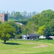
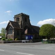
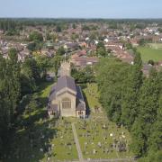
At a break in this hedge, turn left to arrive at the main street of the pretty village of Great Budworth and turn right along High Street towards the church to find the pub, the George and Dragon with J W Lees beers on draught. Beer drinkers will know that the Lees Brewery is in Middleton, Manchester which is more than the staff behind the bar knew. On being asked where the brewery was they thought it might be in Birmingham.
On leaving the pub retrace your steps through the village where the black and white house seemed to sparkle in the sunshine and at the bottom we meet the Warrington Road at a crossroads. Go straight over and ascend Budworth Lane, remaining on it until a turning to the right signposted Budworth Heath. Don’t take it; rather take the footpath into trees on the left.
Once through the wood a kissing gate admits us to a field which we cross, maintaining the same direction and on meeting a fence turn right along it on quite a clear field path beside the fence. Go through three more of those kissing gates to emerge on the road. The views over Budworth Mere are good throughout this last stretch of the walk.
At the road we turn left and walk past the entrance to Marbury Nurseries, the signs now indicating Marbury Country Park close by. Where the road forks, keep left to join a private road. You can get into the park by going through a gate on the left with a signpost pointing to the picnic area where there are tables ideal for having your lunch. Remain on the private road, keeping ahead where it bears left for the car park and by remaining on it you will come to the canal.
You can either cross the bridge and turn right to follow the towpath back to Anderton or take a footpath on the right where a path wanders through the trees then veers away from the canal to skirt a deep depression then crosses a cute little bridge across a stream and climbs up on a zigzag path.
At the top look for a signpost and follow the left pointer marked Hopyards Woodlands. The area is a bit municipal but surfaced paths lead to a road, emerging beside the Moorings Restaurant. Turn left and follow the lane that leads back to the Boat Lift Car Park.
This walk has a bit of everything - canal, a mere, wildlife, a country park, a good pub, a pretty village and lots and lots of kissing gates. Perfect, especially in spring.
Compass points
Area of walk: Great Budworth
Map: OS Explorer 267 Northwich and Delamere Forest.
Distance: 6� miles
Time to allow: 3� hours
Refreshments: Pub in Great Budworth, caf� at the Boat Lift Visitor Centre
Further reading: Pearson's Canal Companion, The Cheshire Ring.


