Friendly Frodsham is the start and finish of this pleasant walk taking in a section of a famous Trail which offers uplifting views and points of historic interest WORDS AND PHOTOGRAPHY BY KEITH CARTER
This walk was published in January 2010, so the details of the route may no longer be accurate, we do advise these articles should only be used as a guideline for any potential route you take and you should double check an up to date map before you set off.
The name Frodsham has a particular interest for me since I have an entire branch of my family tree whose name is Frodsham. They are all in America and how they came by the name is a part of the family mystery still to be un-ravelled.
Anyone who has tried tracing their family tree knows that within a very few generations things become impossibly entangled although my father made a pretty good stab at making sense out of it. Unfortunately his notes fill two large storage boxes and my resolve to get to the bottom of them has never held up. Still, I can never see the name Frodsham without reminding myself that I must get in touch with my American cousins.
The name is actually Old English, the Frod being the name of an individual and 'ham' meaning a settlement which became established on the River Weaver with fishing as its original occupation. Barges and small ships came up the Weaver from the Mersey and carried away cargoes of salt and cheese for wider distribution and there was shipbuilding and repairing on banks of the river.
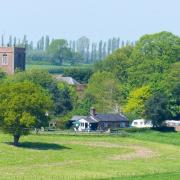
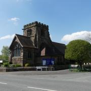
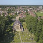
Our walk this month follows part of the Sandstone Trail which starts in Frodsham, officially. Outside the famous old coaching inn The Bear's Paw stands a pyramid-shaped monument marking the start of the trail and good signposting shows the way out of town but since I prefer to avoid the pavements wherever possible I took the car up the hill in the direction of St Laurence's Church, taking time to look inside before lacing up the boots.
The vicar in Victorian times was one William Cotton, a man whose passion was honey bees. He is credited with introducing them to New Zealand although it puzzles me how it was that they had none of their own.
It's intriguing that my spoonful of Manuka honey taken every morning perhaps owes its origins to a reverend from Frodsham. His memorial plaque inside the lovely sandstone church has a bee symbol on it. You'll find it just beside the pulpit.
Leaving the church, head up Bellemonte Road past two pubs, the Ring O' Bells and the Bulls Head and at the next right turn follow the Sandstone Trail signs along Middle Walk to where steps go up into the trees on the left. The Sandstone Trail is a 34-mile route that runs south along the escarpment to Whitchurch.
Cheshire Countryside Management Services have produced a leaflet describing the route. I'm not suggesting you walk the whole distance in one go although the idea certainly appeals to me. Perhaps it would be best left to a longish summer weekend to undertake what includes some of the finest walking in Cheshire.
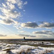
The steps climb up, zigzagging through the trees to emerge at the huge needle-like column of the war memorial on a splendid viewpoint called Mersey View. The outlook from here is stupendous with Liverpool's two cathedrals clearly visible on clear days and the entire sweep of the estuary laid out as a panorama. This has been a popular site for centuries and at one time was a pleasure ground with a helter skelter. Firework displays are held here and in early January the evidence of the recent New Year's Eve display was all too obvious.
After drinking in the view, continue on a path that skirts the edge of the escarpment, soon coming to a series of hand-railed steps leading down by stages. This is known as Bakers Dozen although there are a lot more than thirteen steps as the name would suggest.
At the bottom a signpost indicates that our way is to the left and the path makes its way below the sandstone cliffs to a sandstone outcrop which we climb by way of steps carved in it, an easy enough scramble involving no degree of difficulty.
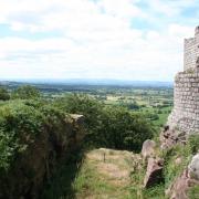
The path keeps along the escarpment, soon coming to a viewpoint from where another wonderful panorama opens out to the Mersey Estuary with the M56 motorway in the middle distance and the industrial landscape of Ellesmere Port over to the left.
Interesting to observe how major transport routes cross this low-lying land including as well as the motorway, the Manchester Ship Canal, the railway line and the River Weaver. This is a fascinating place to observe the varied landscape and for those like me who have only ever seen it from behind the wheel of a car on the M56 it offered a remarkable new perspective.
From the viewpoint, take the path that goes up at a diagonal to the left, a yellow way mark indicating the route of the Sandstone Trail which rises through the trees. At the next post keep right as we enter Snidley Moor Wood and join a sunken path that begins to go gradually downhill.
Look out for a lovely old silver birch tree which is reputedly at least 100 years old. It has a plastic case tucked into a crevice in the trunk. The idea is that passers-by add their thoughts on a scrap of paper and leave them in the case for the Tree Officer to collect and include some of them in a Tree Book. Those I read were by turn moving and amusing. I had to agree with a couple who stopped to have a look like me, commenting that it was an example of the amazing diversity in the world we live in.
The path begins to level out and we need to look out for a footpath departing on the left from the Sandstone Trail through a galvanised metal kissing-gate just before a large pond overgrown with willow.
Take this path which crosses a field then does a zigzag round the end of a bracken-clad hillock or ridge. The path is level and grassy through what seems to have been a glacier valley with young trees, mostly oak, and at a green field gate keep right to another galvanised kissing-gate then climb a bank, cross a field and meet the road opposite a farmstead called Riley Bank.
Here a signpost points left towards Frodsham but we cross straight over and take the gently ascending road opposite, bearing left at the top. Stay on the road until on the bend you will see a signpost on the left indicating the route as a Restricted Byway. Take this old track and at a meeting of ways keep left until we come down to meet the road.
Turn right at a small settlement known as Shepherds Houses and in 200 yards look for a footpath sign in the hedge on the left with yet another of those galvanised kissing- gates. From here the path strikes half right through a field of crops, crosses a farm lane then keeps along beside a chainlink fence before the golf course becomes apparent to the left over the hedge. After crossing a practice green we come to the road and turn left, passing the drive to the golf club on the left.
Just past the turning to the golf club, take a right into the drive to overhill Cottage and passing to the right of the cottage stay on a quiet path which joins the grounds of a hotel. Past the hotel a narrow path appears on the right, leading downhill to meet the road.
Turn right and at the Belle Monte Hotel turn left and follow what must be a very old footpath with well-worn stones underfoot that leads downhill to meet the road again. Turn left and we are back where we started at the two pubs and St Laurence's Church.
A visit to the town is worthwhile before going home. There are plenty of pubs and several places for a coffee. Frodsham is a pleasant town with a strong sense of its past and a nice feel about it. One gets an impression of considerable civic pride from the frequent information boards about local history.
A sunny, cold day in early January meant frozen paths and slippery roads but everyone seemed to be cheered by the sunshine. How lucky the good people of Frodsham are to have such great walking on their doorstep!
FACT FILE
Area of walk: Frodsham Hill and part of the Sandstone Trail
Distance: 6 miles
Time to allow: 3 hours
Map: OS Explorer 267 Northwich and Delamere Forest
Refreshments: Pubs and cafes in Frodsham, pubs at Overton
Parking: St Laurence's Parish Church, Overton
Useful web site: www,cheshire.gov.uk/countryside


