Banish the January blues on a family-friendly walk with a treat included.

The gloomy weather and short days of midwinter don’t exactly help with those optimistic New Year resolutions to get outdoors and take more exercise. But here are five ideas for straightforward, gentle walks to get you into the open air, each with a child-friendly activity or destination nearby to encourage your kids to join you. Banish the January blues with a family day out and a spot of uncomplicated exercise.

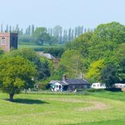
Walton Hall and the Children’s Zoo
There’s plenty to keep your children entertained at Walton Hall. As well as the Children’s Zoo, there is a large playground and room to run around (plus adventure golf and a rope walk, though these are currently closed for the winter).
Grown-ups will appreciate the attractive gardens and the interpretation boards placed around the grounds explaining the heritage of this former stately home and its estate.
The main house was built in the 1830s for Sir Gilbert Greenall, an MP and a partner in the brewing company Greenall Whitley. The estate was purchased by Warrington Corporation in 1941, and its successor organisation, Warrington Borough Council, still owns and administers the house and gardens, assisted by a voluntary Friends association.
The Children’s Zoo has a variety of familiar domestic animals, including goats, sheep, alpacas, donkeys, pot-bellied pigs, chickens, turkeys, rabbits and guinea pigs. The zoo also participates in a captive breeding scheme for red squirrels – I watched one of these charming animals careering madly around its enclosure while one of its wild grey cousins pottered about outside.
The paths within the park are surfaced and pushchair-accessible, but the circular route as described below involves steps and soft ground so is not wheel-friendly. Take care beside the canal.
Compass Points
Area of walk: Higher Walton, near Warrington
Start point: Limited free parking by Hough’s Lane canal bridge WA4 6SL (or £3/£4 pay-and-display at Walton Hall WA4 6SN)
Distance: 1½ miles
Time to allow: 1 hour
Map: OS Explorer 276 Bolton Central, Wigan & Warrington
Refreshments: Heritage Café, Walton Hall heritagecafewalton.com 01925 446266
Child-friendly: The grounds of Walton Hall (including the Children’s Zoo and playground) are free to enter. Last entry to the zoo is at 4pm. There are toilets near the garden entrance, by the zoo, and behind the hall.
The Walk
1. Cross the Hough’s Lane canal bridge and immediately turn left down steps onto a path alongside the canal. Follow the narrow path as it turns right, away from the canal, and crosses a field between fences.
2. Join a driveway and turn right through a gate. Walk between the converted farm buildings of Hillfoot Farm and continue along the driveway beyond. Just after the drive bends right, follow a parallel path on the left until it rejoins. Ignoring a footpath leading onto the golf course on the left, follow the drive until you meet a road (Hough’s Lane).
3. Turn left for a short distance then, by a sign reading 'Golfers crossing 75 yards ahead', step over the wall on the right. Bear right through a gap in the fence, then follow the left-hand edge of the pitch-and-putt course to the shed near the bowling greens. Continue ahead between the greens and the crazy golf course, and past the bandstand, to Walton Hall.
4 . Skirt to the right of the hall and follow the park road round to the left and then downhill to the right, past an ornamental pond on the left. Turn right past the glasshouse to the playground and zoo.
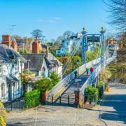
5. Once you’ve looked around the zoo, walk back past the playground, but this time turn right before the glasshouse. Follow the path past Bridge House and cross the pedestrian bridge over the canal.
6. Turn right down the steps onto the towpath and turn left. Follow the towpath back to your car beyond the next overbridge.

Sunbank Wood and the Runway Visitor Park
Ringway used to be in Cheshire but is now a geographical anomaly, as the only civil parish in the otherwise unparished domain of Greater Manchester. Just minutes from the ‘Global Logistics Hubs’ and asphalt expanses of Manchester Airport is a different world: a peaceful woodland clothing the valley sides above the River Bollin. Similarly incongruous is the Romper, a traditional British pub a stone’s throw from the airport security fences.
A quarter of a mile from the Romper is the Runway Visitor Park. A raised viewing area allows spectacular views of the comings and goings on the busy runways, with live commentary at weekends, and there is an outdoor play area.
There are several heritage aircraft, including an RAF Nimrod and a Hawker Siddeley Trident in BEA livery, but the big draw is Concorde G-BOAC, in its purpose-built hangar. Various tours are available at weekends (booking advisable).
Our 20-minute visit was conducted by an ex-pilot whose gossipy, irreverent tales of his VIP customers included the revelation that Madonna habitually avoided sitting next to anyone by booking the adjoining seat as well as her own, despite the £7,500 ticket price.
You can walk from Sunbank Wood to the Romper and the Runway Visitor Park, but it’s a rather dispiriting trudge through an industrial estate (which is likely to expand, so enjoy Sunbank Wood’s relative seclusion while you can). Better to drive the short distance: there’s free parking by the Romper, and a pay-and-display at the Visitor Park.
The woodland walk is not suitable for pushchairs as it includes steps and one stile, and may also be muddy in places. Note that dogs are not permitted at the Runway Visitor Park.
Compass Points
Area of walk: Manchester Airport
Start point: Limited informal parking at the entrance to Sunbank Wood WA15 0PZ.
Distance: 1 mile
Time to allow: 45 minutes
Map: OS Explorer 268 Wilmslow, Macclesfield & Congleton
Refreshments: The Romper WA15 8XJ chefandbrewer.com/pubs/cheshire/romper 0161 903 9473
There is also a café at the Runway Visitor Park.
Child-friendly: Runway Visitor Park WA15 8XQ runwayvisitorpark.co.uk 0161 489 3932. Free entry on foot, £5 for 2 hours’ parking. Concorde tours from £6.

The Walk
1. From the entrance to the wood on a bend by Yew Tree Cottage on Sunbank Lane, go through the gate and down the track. By a large glacial erratic boulder, turn right and follow the path downhill, with a stream valley on your left.
2. At the bottom of the hill, turn left across the stream and climb steps on the left up through the trees. Bear right at the top of the slope and on meeting another path turn left. This path curves right at the top of the wood and winds above a series of ponds, the remains of old stone quarries.
3. When you meet another path at a T-junction, with another small stream valley in front of you, turn right and head downhill. Just before the path curves to the right, turn left down a steep path into the valley, with intermittent steps. At the bottom, cross a footbridge and climb a stile into a meadow beside the River Bollin.
4. Turn right, with the wood on your right and the river on your left. At the far end of the meadow, cross a footbridge over a side-stream and continue through an open area beyond.
5. By a footbridge over the Bollin, turn right, away from the river. This path climbs a small valley (on my visit requiring me to duck under a fallen tree) before emerging in a field. Walk up the left-hand edge of the field back to the road.

Poynton Lake and Brookside Railway
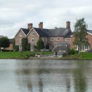
Appropriately for well-heeled Poynton, this walk is shaped like a stiletto. The upper and instep are formed by an appealing circuit of Poynton Lake, constructed as an ornamental pool for Sir George Warren’s adjoining 18th-century mansion (since demolished). The listed lodge house (passed en route) survives from the original estate.

Brookside Miniature Railway is a labour of love for the team of enthusiastic volunteers who have run it for the past three years.
Set within the grounds of a garden centre, the circuit includes a tunnel, two crossings of the Norbury Brook, and lots of fun features for your little ones to look out for, including the Fairy Wood and a sign marking the ‘summit’ of the line, a dizzying nine feet above station level.
The paths around the lake and through Poynton Park are sufficiently well surfaced to render this walk a practical proposition with a pushchair.
Compass Points
Area of walk: Poynton
Start point: Free car park in Anglesey Drive SK12 1LJ
Distance: 1¾ miles
Time to allow: 1 hour
Map: OS Explorer 268 Wilmslow, Macclesfield & Congleton
Refreshments: The Bulls Head Poynton facebook.com/Thebullsheadpoynton 01625 873029
Child-friendly: Brookside Miniature Railway off A555, Poynton SK12 1BZ brooksideminiaturerailway.com 07818 070723 – £2.50 for the five-minute ride (under-twos free). Trains run 10.30 to 4.00, Thursdays to Sundays.
The Walk
Walk or drive along the A523 towards Poynton from Brookside Garden Centre for 500m and take the second left (Anglesey Drive). The car park is immediately on the right.
1. From the end of the car park, walk down alongside the lake with the road on your right.
2. At the far end, opposite the former lodge house, turn left along South Park Drive.
3. After 250 metres, turn left into Poynton Park. Turn immediately left and follow the path around the lake then, beyond the boathouse, continue behind the adjoining properties back to South Park Drive.
4. Turn left and immediately left. Follow Anglesey Drive for 700 metres back to the start point.

Little Budworth Country Park and Cotebrook Shire Horse Centre
Mornings are best at the Shire Horse Centre. Scheduled events before lunch include Shetland pony grooming, feeding time for the resident otters, foxes and wildcats, and the chance of a close-up encounter with the gentle giants – the 30 or so horses that form the UK’s only shire stud that is open to the public.
After lunch in the centre’s onsite café or at the adjacent Alvanley Arms, it’s a short hop via Oulton Mill Lane to Little Budworth Common for a pleasant stroll along the waymarked Heathland Trail, exploring the mixed woodland and rare lowland heath of this SSSI and country park.
As at Walton Hall, a Friends group carries out vital volunteer work, including scrub-clearing and other conservation maintenance. How about resolving to join one of these public-spirited bodies in 2022?
The uneven woodland paths aren’t really suitable for pushchairs. Although the sandy soil is relatively well-drained, expect muddy spots after wet weather. There are toilets at the car park.

Compass Points
Area of walk: Little Budworth near Tarporley
Start point: Little Budworth Country Park car park CW6 9BN (free; closes 5pm)
Distance: 1¾ miles
Time to allow: 1½ hours
Map: OS Explorer 267 Northwich & Delamere Forest
Refreshments: Alvanley Arms, Cotebrook, Tarporley CW6 9DS www.alvanleyarmscotebrook.co.uk 01829 760200
Child-friendly: Cotebrook Shire Horse Centre CW6 9DS cotebrookshirehorses.co.uk 01829 760506
The Walk
1. From the Little Budworth Country Park car park, go through the gate beyond the noticeboard and Heathland Trail map. Follow the path just inside the woodland edge, past a carved tree trunk. Beyond a gate, pass one of the smaller areas of open heath (on your left) then cross a driveway, following the path straight ahead.
2. Cross another track, following the woodpecker waymark. Look out for the next waymark post, which indicates where our route departs along a slightly indistinct path to the right. At a meeting of paths, take the slightly hollow way ahead, shortly passing another waymark then descending to a pond on the left.
3. Turn immediately left after the pond, and climb a few steps. After another waymark post, you continue above the boggy valley on your left and then cross an area of open heath to a road. Turn left. When you reach the main Carriage Drive, cross straight over and join the byway opposite.
4. At the far end of the wood, turn left at the sign for Smithy Lane. Follow the path beyond the ‘no horse riding’ sign, with fields on your right.
5. Pass through a gap in a fence and at a path junction take the left fork, with a woodpecker waymark and a ‘Permissive Path’ roundel.
6. Cross an area of open heath then, beyond a crossing path, re-enter the trees. Emerge into a grassy area with a carved dragon, and follow the path ahead back to the Carriage Drive, passing more open heathland on your left. Bear right to cross the road back to the car park.

Queen’s Park and Tipkinder Park, Crewe
This route is, quite literally, a walk in the park – it’s gentle, accessible and uncomplicated. There’s plenty to look at, whether your interest is in wildlife, horticulture, heritage or just people-watching. A modern, airy café with a terrace overlooking the lake is on hand if you fancy a snack or a coffee.
There’s loads for the kids too: ducks to feed (no bread please) and a freshly refurbished playground for younger children in Queen’s Park, and a skate park and BMX circuit in Tipkinder Park for the older ones.
All the paths are surfaced and fine for pushchairs, apart from the optional extension in Tipkinder Park. Parking is easy, ample and free and there are toilet and baby-changing facilities onsite.
Queen’s Park was donated to the people of Crewe by the London & North-Western Railway Company – the tale that this was a manoeuvre to prevent a rival company building a station on the land is a persistent myth. The lodges at the northern entrance, the adjacent clocktower and the Boer War memorial are all Grade II listed buildings, and the park itself is Grade II* listed on the official parks and gardens register, as a good example of a late Victorian municipal park with a design that is little changed from its original layout of the 1880s.
In the immortal words of Blur, hopefully this walk will leave you with a sense of enormous wellbeing and you’ll be happy for the rest of the day…

Compass Points
Area of walk: Crewe
Start point: Queen’s Park car park CW2 7SJ (free)
Distance: 1½ miles (1 mile without the loop in Tipkinder Park)
Time to allow: 1 hour
Map: OS Explorer 257 Crewe & Nantwich
Refreshments: Park Life Café facebook.com/parklifecafecrewe 01270 583162
Child-friendly: Playground and mini-golf in Queen’s Park; free BMX and skateboarding in Tipkinder Park (equipment not provided)
The Walk
1. From the car park, cross Queen’s Park Drive at the traffic island to the entrance to the park. Turn left and walk down to the end of the boating lake. Cross the bridge and bear right, with the lake on your right.
2. At the far end of the lake, follow the short cut up the bank (or keep right and then turn sharp left if pushing a buggy). Pass the bandstand and keep right at a subsidiary park entrance until you reach the clock tower by the main entrance.
3. Turn right and walk down the broad walk to the Boer War monument and café.
4. Turn left at the monument and follow the path back to the playground and the car park beyond.
5. For the optional extension round Tipkinder Park, exit the car park in the rear right-hand corner and take the path to the right of a gate leading into the trees. This path drops down to Valley Brook and follows it to a footbridge.
6. Turn left, away from the bridge, and bear right before you reach the fence around the BMX track. This path curves around the track to merge close to a road, where you turn left and follow a surfaced path between the track and the skate park back to the car park.


