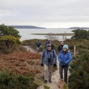
This scenic walk meanders through ancient woodland around the villages of Milton Abbas and Winterborne Houghton, ideal for a shady summer ramble with a pub to drop in on at the end. Let's join Edward Griffiths on this delightful summer walk through the Dorset countryside
Joseph Damer (created Lord Milton in 1753 and Earl of Dorchester in 1792) bought Milton Abbey as his own private house in 1752. Close by the Abbey was Middleton (Milton), a thriving village with an annual market every St Sampson’s Day, July 28th, granted by King Athelstan (894-939). The ancient village spoiled the view from the Abbey and stood in the way of Damer’s plans for a fashionable park around his country house. Between 1756 and 1769, his campaign of closing roads, refusing lease renewals and neglecting cottages eventually swept Middleton away. Milton Abbas model village was built between 1773 and 1779, and the new park, lake and grounds were landscaped by Lancelot ‘Capability’ Brown. St James’ Church was consecrated in 1786 and enlarged in 1886. Every other July (in odd-dated years) a Street Fair is held, having started in 1973, to celebrate 200 years since Milton Abbas model village was begun.

Winterborne Houghton (pronounced ‘Howton’), sits at the head of the River Winterborne, which flows east to Winterborne Stickland then south through six more Winterborne villages and hamlets before joining the River Stour at Sturminster Marshall. Most of the thatched village cottages, built from cob or brick-and-flint, date from the 18th century. St Andrew’s Church was built in 1861, replacing the 15th-century church but keeping the original ornate font.
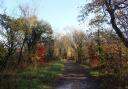
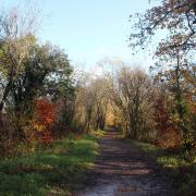
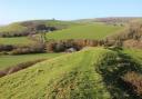
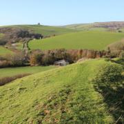
This scenic walk meanders through vast mixed woodland which includes Milton Park Wood, Charity Wood, Whatcombe Wood and Oatclose Wood with ancient deciduous trees and enormous tall pines. Views across valleys and farmland overlook an extensive Roman-British settlement on hill slopes around Winterborne Houghton.

The Walk
1 From St James’, walk up The Street, past Hambro Arms, past left Old School and right ‘Hoggen Down’ footpath-steps. At the left kerb-side railings, take the sign-posted ‘Bridleway’ up to the cul-de-sac. Continue into Catherine’s Well. Turn right to the road with left-corner bus-stop. Cross into the bridleway-signed drive. Continue past right Milton Manor and Coach House, becoming a track, descending, bending left and right.

Before Milton Park Wood (un-signed) forest gateway, take the left bridleway-arrowed rising path, becoming narrower with a left-hedged field and right ferns, over and down to a forest track. Go left. Past a right bridleway-posted path, continue around a hairpin-right bend and up past a right bridleway.

2 After passing a left track at a right bridleway-post, keep straight on past other side turnings. Then, descending, pass another right track. Down to a tracks’ crossing with a bridleway-post on the left corner, cross over and continue up to a bridleway-fork. (The post may still be broken and prostrate). Take the left fork, between ancient beech trees. In about 100 yards, take the left narrow bridleway, widening to a track then narrowing again before another fork with a short bridleway-post right. Follow the right path up to the fence-gap out of the woods into the field corner. Follow the right hedge to Dunbury Road bridleway-signed gate. Cross into the enclosed fenced/hedged path. Through the end bridleway-gate into the high field with extensive views, follow the left hedge down past a bridleway-arrowed electricity-post to an iron-gate. Through, continue down along the hedge and wood to the bridleway half-gate.

3 Through, continue down the steep slope to the bridleway half-gate into the farmyard. Turn right down the concrete bridleway-track past left farm buildings to the fork, take the left arrowed bridleway-track. Past left ‘Old Rectory’ drive, continue down to Water Lane, Winterborne Houghton. Visit left St Andrew’s Church, then walk left up Water Lane.


Pass the right ‘Bulbarrow’ turning with telephone box and brick-and-flint shed. Notice the colourful rose-bedecked cottages, especially Cider by Rosie’s Michaelmas Cottage. Continue up the lane, passing more pretty cottages and into a sunken stretch under trees. At the crossing, with Higher Houghton Stables right and a bridleway into the left farm, continue into ‘Milton Abbas 2½’ track.

4 Follow the rising sunken path with trees and harts tongue ferns in the banks. Out of the trees, continue up to the facing bridleway-gate. Through, bear half-right off the track. There may be a faint flattened track across the grassy hillside. Cross to a wide green gap between left tree clumps and a right wood.


On the way, see banks of the Romano-British settlement on the far-right hill above the valley. Through the gap into a sloping clearing, bear half-left (south-west), slightly upwards. Leaving the green track, go through another narrower stretch between trees into another clearing. Seeing a gate forward slightly-right, veer off left along the faint path to 1½ bridleway-gates onto the Milton Abbas to Bulbarrow road. Through, turn left along the wooded road.

5 In 200 yards, ignore the bridleway-path and take the right ‘Milton Abbas Forest’ cantilever-gate onto the track. Continue to the wide turning point and log-pile area. The track now becomes a narrow path in a wide ‘ride’. Through the end barrier, pass Old Gatehouse left on the closed Winterborne Stickland road.

Leaving the track after the gatehouse, go around the cantilever-gate and stone-blocks. Walk through the coppiced hazel ‘tunnel’ and down around a sweeping left bend. Pass a right black-arrow post at a right offshoot and continue down the track. Pass a left black-arrow post at a right-fork path and keep to the main track down through the wood with old coppiced hazels and ferns. At the next black-arrowed narrower right turning, take it and continue down to St Catherine’s Chapel overlooking Milton Abbey.

Keep following the black-arrowed path and track down to the cantilever-gate and T-junction with Steeptonbill Farm Shop opposite, signed back ‘Catherine’s Chapel ¼’ and left ‘Milton Abbas ¼’. Turn left up the track, past left Catherine’s Well House and on into Catherine’s Well residential area. Continue to the cul-de-sac and bridleway back down to The Street where you started.

Compass Points
Distance: 5¼ miles/8.25 km
Time: 4 hours
Terrain: Fairly strenuous. Several slow ascents
Map: OS Landranger Sheet 194
Start: St James’ Church, The Street, Milton Abbas (Grid Ref: ST806018)
Public Transport: Morebus X12 Blandford to Weymouth
Dogs: On leads in fields with livestock and lanes, abide by The Countryside Code
Refreshments: Hambro Arms in Milton Abbas for real ales and good locally sourced meals

Click here for a circular walk at Bradford Peverell & Stratton in Dorset
Click here for dog friendly places to stay with great walkies