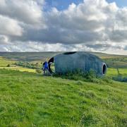
It should be easy to maintain social distancing on this tough walk through spectacular Bowland countryside
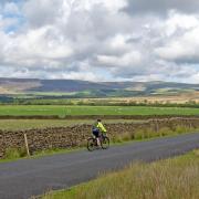
The remote road from Slaidburn to Bentham through the Bowland Fells has got to be one of the most beautiful scenic routes between Lancashire and Yorkshire. It is a cyclist and motorcyclist’s dream ride and is much used by both. It is also a beautiful if not much used area to walk but then again up to a few years ago most of the Bowland Fells were not open to the public. This has changed and large tracts of the land are now open access. Please note that some restrictions remain in the shooting season.
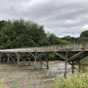
1. Leave the car park and walk over the bridge toward Slaidburn. Cross the stile immediately on the right once over the bridge then head diagonally left uphill to join a track and turn right. Follow the track for about 120 metres then head diagonally right downhill to join the route of an old railway line then turn left and follow the line route to reach a quarry that is quite obvious in the distance. The line is indistinct in places but in others the lines are visible as are some sleepers. Cross a stream and enter the quarry.

2. There is an old steam crane sitting in the quarry, reach this then turn right and clamber over some rough stones to reach a small path on the edge of the quarry. Follow this downhill bearing diagonally left down to a stream and cross this then head diagonally right uphill contouring the valley side to reach the road. Turn left and follow the road uphill to reach the Cross of Greet.
Note: The quarry was used to supply stone to build the dam on Stocks Reservoir and the railway went all the way to the dam four and a half miles away. The crane was built by Thomas Smith and Sons in Rodley near Leeds. It was, and still is, rail mounted and was designed to be able to be moved around the quarry floor. The round tank at the back is the boiler and in the lower part is a firebox which would heat water in the upper part to produce steam. The steam would then be fed through a pipe and control valve to pistons that would turn the gears. The series of levers that can still be seen allowed the operator to select which gear to actuate movements of the crane jib.
Originally there would have been a chimney on top of the boiler. Some of the stones in the quarry still show the drill holes explosives were put in to blast them out of the quarry wall.
3. At the Cross of Greet turn immediate right and with the wire fence on the right follow this. It is a bit rough going and the path is indistinct but eventually a more identifiable path appears. It looks like the wheel tracks of a vehicle.
Follow this, rising gradually uphill, and the wire fence becomes a wall but keep this on the right.
Note:
The Cross of Greet is the large rock by the right side of the road at the roads highest point. There is a square hole in the top of the boulder that presumably held a cross.
4. The path reaches a wire fence crossing in front. There is a stile, cross this and turn right and keeping the wall on the right. This eventually becomes a wire fence and with this on the right, keep straight on. Reach and go through a gate and carry on with the wire fence on the right and this eventually becomes a wall and simply keep following this with it on the right. The wall reaches a corner and just before this is a ladder stile on the right. Cross this and walk up to the Triangulation Pillar.
Note: The views into Yorkshire and the Three Peaks along this section are truly stunning. It is worth taking time to look at this panorama.
5. The pillar is on the summit of the highest point of the group of crags that make up Bowland Knotts and the views into Lancashire are as stunning as the ones into Yorkshire – it is really worth taking time here to take them in.
Leave the trig point and return to and re-cross the stile then carry straight on and down to another faint twin vehicle track that roughly parallels the wall on the right from the wall corner. I did try to follow the wall at first but the route gets a bit too rocky to be comfortable.
Keep on the. track and follow this until it reaches the tarmac road that is the Slaidburn to Clapham road. Join the road and turn right and follow the road as it cuts through a gap in the Knotts and heads downhill towards Slaidburn.
6. There is a footpath sign on a traffic signpost on the right pointing right to a track. Go through the metal gate and then follow the obvious track. The track reaches a short section of wall and an old gateway with a wooden gatepost on the right. At this point leave the track and bear right and go downhill, down at the bottom of the fellside there is a solitary barn and close to that a series of plastic circular tanks. The path is virtually non-existent so aim directly for the barn.
7. Approach the barn, the gable end is facing and head towards the left hand corner and just in front is a small footbridge. Cross this and go around the back of the barn and head towards the plastic tanks, again the path is hardly visible. To the right of the tanks is a wooden gate, go through this and bear slightly diagonally left down to a track then right and through a wooden gate then keep following the track to a ford across a stream. Cross this and follow the track to a wooden gate with a stile on the right, once through the stile leave the track and head diagonally left on an obscure path towards the river and a wire fence on your left. Follow the wire fence and river to an old gateway and go through this, the path then goes slightly uphill and heads towards the Bridge of Greet car park.
COMPASS POINTS
Start/finish: Small car park next to Cross of Greet Bridge near Slaidburn.
Distance: 7.5miles/ 12.km
Time: 4.5 hours
Terrain: This is one for the hardy walker as there are not many good paths and in places it can be very remote and boggy. This is more than outweighed by the stunning views and some very interesting hidden historic artefacts. It is not a walk to be attempted in bad weather or mist as it could be easy to get lost. Navigation skills could be needed in bad weather and a map and compass should be carried. This is a walk for good boots and clothing. On the day I did it with my sister Marie the weather was fantastic and if you can pick a clear sunny day you will not be disappointed. I would easily put this walk in the top 10 I have ever done.
Facilities: There are no public toilets on route
Map: OS Explorer OL41 Forest of Bowland and Ribblesdale


