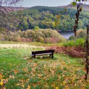
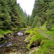
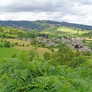
This classic countryside walk, packed with outstanding views, is guaranteed to put a spring in your step and mud on your boots!

Route
1. Having seven masts adorned by satellite dishes and receivers, Alport Heights at 1,034 feet above sea level is a distinctive landmark from miles around. The nine-acre site was acquired by the National Trust in 1930, their first scenic acquisition in Derbyshire. It is believed that a Roman settlement was sited at Alport Heights, while during World War II a small building here provided a look-out for enemy planes.
Exit the car park and turn right. Continue ahead at the crossroads on the road signposted Breamfield and Wirksworth.

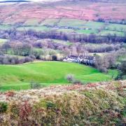
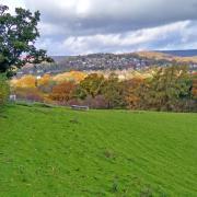
2. At the junction with Knob Lane go through a stile opposite, following the footpath sign. Cross the field and then continue past the front of Chequer Meadow, a characterful country cottage, emerging onto a narrow lane. Continue ahead across fields to the left of Colebrook Farm then uphill through a small area of woodland, emerging onto Wirksworth Road with a reward of far-reaching views ahead. Sweeping left to right you can see Bonsall Moor, Masson Hill, Matlock Moor, Holloway and then the distinctive Crich Stand. See also the tiny spire of Crich Church peeping up over the horizon like an arrow pointing to the heavens.
3. Turn right and follow the road taking care around blind bends, until you arrive at The Bear Inn which reputedly dates back to 1528. The property was purchased by the Hurt family in 1690 when it became an alehouse known as The Olde Brown Bear Inn. By 1764 this had been shortened to The Bear Inn when the premises became popular with coaches, and travellers on the nearby turnpike road in need of rest and replenishment. The names and dates of all innkeepers and owners from 1735-2008 are listed in the entrance hall of The Bear.

4. Go through the car park, following the fingerpost sign to a combination of stile and gate. Cross the following field into the right-hand corner below tin sheds to a wall stile. Bear left then head downhill with a wall to your left followed by a hedgerow, emerging beside cottages and the buildings of Willetts Farm. Notice to your right a walled well by the side of the road.
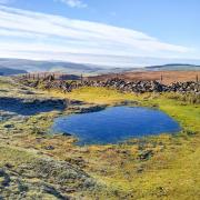
If you look on the OS map you will see lots of little blue symbols dotted around this upland area indicating springs, wells and little watercourses. Tricklets of water bubble to the surface hither and thither which then unite to create streams and brooks, sometimes captured by troughs, ponds and meres on their downhill journey to join forces with a river.
5. Turn left to walk downhill and then left again along the narrow Back Lane when you see a 'Ford' sign. Use the footway to avoid walking through the slippery ford.

6. Turn left and walk up Shaws Hill. Listen for songbirds that haunt this area thanks to the abundance of hedgerows, bushes, trees and cottage gardens with bird feeders.
7. Almost opposite Knott House and Wigwell Cottage Farm go through a stile on the left by a fingerpost sign and head straight over the field to the left corner where a wall stile is located. A short detour walk to your right will take you to an old milestone on the verge. Although now sadly weatherworn and eroded, this superb waymarker dates back to the mid-18th century and depicts hands wearing ornate gauntlets pointing the way to Derby and Wirksworth, as well as the distance to London as being 139 miles.

8. Go through a gap in the hedge and over a wall stile then cross the field to Moor Farm. Go through a gate onto the drive and then just before the farmyard turn left to a small field gate. The footpath then proceeds through fields on the top side of the farm.
Now ascending to high ground you should be able to see further afield, this time extending far to the north.
9. Turn left along Breamfield Lane where you will come to two seats strategically placed to look down over Wirksworth whilst enjoying a rucksack snack. Listen for nostalgic hoots, toots and the clickety-clack of trains operating along the Ecclesbourne Valley Railway far below. Spot the chimney like a brick-built finger pointing skywards at Middleton Top above an extensive disused quarry face. Look for the tiny St Mary's Church in the heart of the town surrounded by old houses and buildings, its upturned ice-cream cone spire atop a short tower.
10. Turn right at the junction and walk down St Helen's Lane to a footpath sign on the left. Go through a wall stile to the side of which is a stone seat with memorial plaque: 'Sit thee down and rest a while, then on you go another mile.'
Descend two fields to emerge onto an old track. English folklore often refers to boggarts as being mythical spirits or bogeymen that inhabited fields, marshes and other topographical features as well as properties. There are several references around Wirksworth to Boggarts with Boggarts Farm being a little further down the hillside.
11. Turn left and head to Gorsey Bank where once mills were powered by water permeating down. As well as millworkers' cottages and houses, down to your right is the former Providence Mill of 1886 which, until its closure, was one of several tape mills in the town, manufacturing narrow fabrics such as the red tape that was used to bind legal and government documents.
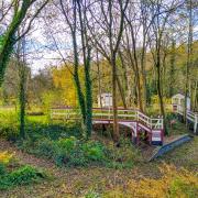
12. Do not descend to pass these properties, but instead turn left to continue along the restricted byway, heading uphill through a fabulous old holloway eroded into the hillside, the sides draped with ivy and ferns and lined with trees high above.
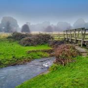
13. At the gateway to Doveswood Farm turn right along the road, initially with a small watercourse to your left before heading uphill.
14. By a green Severn Trent Water booster station for Ashleyhay, go through a little gate then narrow stile to follow a footpath steeply uphill. Turn left on reaching a road and then left again at the sign for Alport.
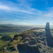
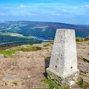
15. After a sharp left-hand bend head up a permissive footpath on the right to return to the entrance of the car park. For an interesting short detour turn right here and walk about 75 yards to another permissive path for a wander past gorse bushes decorated with bright yellow flowers appearing like candle flames, leading you to Alport Stone. This twenty feet high tower of quarried gritstone has been a popular canvas used by graffiti artists for centuries. Along the way look for an early 18th century guide stoop believed to have been moved here from nearby Spout. Originally this stoop guided early travellers over the wild and inhospitable Wirksworth moors to DARBY, WIRKSWORTH and ASHBORN. It is dated 1710 and has deep holes carved into one side from a time when it was used as one half of a pair of old-fashioned gate posts. Easy-to-move poles would have been inserted into these sockets to create a barrier.
Near to the highest point at Alport Heights and close to the top level of parking is a circular topograph indicating that on a clear day it is possible to see the Wrekin at 52 miles distance and the Long Mynd ridge in Shropshire some 63 miles away. A small patch of Carsington Water can also be seen, appearing like a little puddle in the hills with the masts of boats moored in the marina just visible to the side of the visitor centre.
COMPASS POINTS
Distance: 5.25 miles
Parking: Alport Heights car park DE56 2DQ (nearest post code) Grid Ref: 304516
Terrain: 25+ gates and stiles. Some quiet roadway walking without pavement. Blind bends. Old trackways with uneven terrain. Fields with livestock grazing. Areas prone to mud in wet weather as well as surface water and puddles. Ford with footway.
Refreshments: Bear Inn, Alderwasley
Toilets: No public toilets
Map: O.S. Explorer OL24 - White Peak
Walk highlight: Far-reaching views from Alport Heights
Description: See for miles in every direction along this fabulous walk over elevated fields and pasture. Wander quiet lanes edged with ancient hedgerows and discover two perfectly placed benches to enjoy aerial views over Wirksworth.


