Blow away any January blues with Sally Mosley on this stunning walk around Derbyshire’s finest estate
1. From the car park turn right to walk past the kiosk shop and over Barbrook Bridge on what was part of the 1759 turnpike road from Chesterfield until the road was re-routed a century later to what we now know as the A629.
2. Turn right at the fingerpost for Chatsworth passing to the front of Thatch End Cottage which dates in part to the 17th century. Follow the path to an unusual kissing gate inspired by Mrs Jill Cannon in 1999 which allows access for wheelchair users.

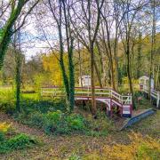
3. Continue straight ahead on the easy-to-follow, level path to the little pagoda-style White Lodge which stands beside entrance gates and a private drive to where Barbrook House once stood. For a time this was the home of Sir Joseph Paxton which is commemorated by a blue plaque. This incredibly talented man was a gardener, architect and writer, his legacy to Chatsworth being the arboretum, rock gardens and Emperor Fountain as well as his work in rebuilding the village of Edensor. Paxton designed the Crystal Palace for the 1851 Great Exhibition and was also responsible for cultivating the Cavendish banana, the most consumed banana in the western world.
4. Continue along the level path towards Chatsworth passing the cricket ground with thatched pavilion on your immediate right, after which you will see the River Derwent for the first time. As well as traditional oak, sycamore and broad leaf deciduous trees, notice more unusual specimen trees dotted around. The majority of landscaping by Lancelot ‘Capability’ Brown took place from 1760-1764 during the incumbency of the 4th Duke of Devonshire. Not only were trees planted but earth was moved, drainage put in place and part of the estate was levelled which Brown carried out with the aid of a workforce of groundsmen and Michael Millican, his competent and capable foreman.
The path will lead you to the landmark feature of Queen Mary’s Bower. Not used as a prison or stronghold but as a place for Mary to take the air and exercise during the various times she was at Chatsworth on house arrest during the 1570s. At that time this structure was a feature in an area laid out as formal gardens, orchards and fish breeding ponds.

5. Go through gates to cross over towards James Paine’s magnificent Italianate bridge decorated by statues, which spans the Derwent. Constructed in 1760, it was built at an angle so as to be seen from the house whilst providing a fabulous last glimpse of Chatsworth through an ornate balustrade for anyone departing. Turn left and walk up the approach path to Chatsworth. Head up through the car park to the left of the former stable block which now contains restaurants, a shop and function rooms and go towards the farmyard and adventure playground. A pedestrian gate provides access to Stand Wood walks where for a time you will follow the woodland road leading up to the Hunting Tower. At a blue sign turn left on a shortcut footpath up through The Dell, emerging back onto the road.
6. Turn left and walk up the road in front of the Hunting Tower, completed in 1582 for Bess of Hardwick to a design by the famous architect Robert Smythson, who also created Hardwick Hall for her.
7. At a junction of paths to the rear of the tower turn left and follow the fingerpost sign for Robin Hood along a woodland track. Continue on this concessionary footpath ignoring a path descending through trees on your left and then pass the drive for Park Farm on your right until you come to where the track enters a field.
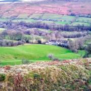
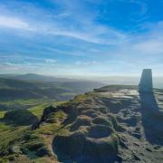
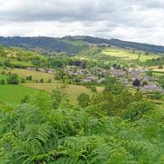
8. Notice, in the far distance on the skyline directly above the gate, the three standing stones on Birchen Edge. These three natural gritstone boulders are carved with the names of Nelson’s ships – Victory, Defiant and Royal Soverin (sic). Nearby is a ball-topped pillar known as Nelson’s Monument. Do not go through the gate but follow a short path on the left through trees to a very high wall stile providing access to Dobb Edge. Having emerged from woodland you will soon have the advantage of stunning views across the valley and towards the string of Edges that flank the eastern boundary of the Peak District National Park. Follow the well-walked concessionary path through bracken with a wall on your right.
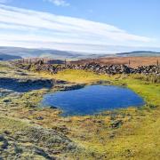
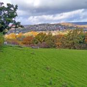
9. After dropping down to a corner do not cross over a further high wall stile but continue to descend on a hollowed path which twists and bends downhill to open pasture where sheep and deer graze.
Aiming towards Baslow in the distance descend to the bottom of the valley. At one point you may wish to make a small detour to your left where a large stone sits beside a lone oak tree. Now known as Jubilee Rock it was previously called the Elephant Stone as from a certain angle it looks somewhat like a recumbent elephant.
Surgeon Lt Col Edward Mason Wrench FRCS MVO was the son of a London vicar. He qualified as a surgeon at the age of 20 and served in the Crimea before taking over a medical practice in Baslow in 1862 where he remained for the next 50 years. Dr Wrench erected the Wellington Cross on Baslow Edge, incised a loyal inscription on the Elephant Stone with lines from the national anthem and also provided the Jubilee clock face on Baslow Church to commemorate Queen Victoria’s Diamond Jubilee in 1897.
10. On reaching level ground cross a wooden stile in the fence following the arrow indicating ‘Footpath to Baslow’. Away to your right you will catch sight of the famous Golden Gates designed by Jean Tijou who was famed for his work at Hampton Court. The ornate ironwork urns on top of the gates date from 1696 and have recently been restored by a specialist firm in Shropshire. On reaching a fenced-off band of woodland be guided by the sign to head left which will bring you back to the Cannon kissing gate from where you retrace your steps to the car park.
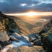
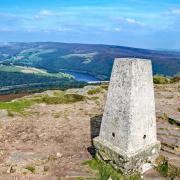
DESCRIPTION: Not just a walk in the park, this winter amble affords the opportunity for far-reaching views over a Peak District panorama fashioned long ago by glacial melt, but embellished more recently by the forward planning of landscape architect Capability Brown and gardener/architect Sir Joseph Paxton.
DISTANCE: 4.25 miles
PARKING: Nether End Car Park, Baslow DE45 1SS (pay & display), Grid Ref: 258721
TERRAIN: Four stiles, four field gates and a kissing gate. Moderately strenuous walk. Woodland paths with trip hazards. Livestock grazing. Concessionary paths on the Chatsworth estate.
REFRESHMENTS: Tearooms, pubs and kiosk shop in Baslow. Stables restaurant, Chatsworth
TOILETS: Baslow car park and Chatsworth
MAP O.S.: Explorer OL24 (White Peak) https://www.ordnancesurvey.co.uk/shop/explorer-map-the-peak-district-white-peak-area.html
WALK HIGHLIGHT: First glimpse of the ‘Golden Palace’


