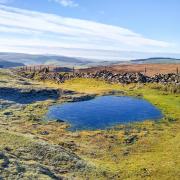
Pools, ponds, puddles and a canal give this ramble around Chesterfield with Sally Mosley a watery theme
DISTANCE: 8 miles
PARKING: Roadside parking (limited spaces) beside Tapton Lock Visitor Centre, S41 7JB. Grid Ref: 388729
TERRAIN: Two gates, six stiles. Numerous sets of steps. Close proximity to deep water. Woodland paths with trip hazards and areas prone to mud. Two busy road crossings
REFRESHMENTS: Tapton Lock Visitor Centre (drinks & snacks), Nona’s Coffee Shop, Hollingwood Hub

TOILETS: Tapton Lock Visitor Centre and Hollingwood Hub
MAP: OS Explorer 269 – Chesterfield and Alfreton
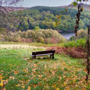
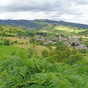
WALK HIGHLIGHT: View over Chesterfield from Tapton House
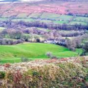
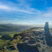
DESCRIPTION: This is a relatively long but easy-going walk with few steep ascents or descents. Although never far from urban areas of Chesterfield and its suburbs, the route is surprisingly rural and scenic, passing nature reserves, lakes, parkland and through a long stretch of old established woodland

1 From Tapton Lock head north along the canal path following the instructions for Hollingwood Hub 2.5 miles or Istanbul 2,500 miles!
Chesterfield canal dates back to the early 1770s. It was one of the first canals to be built at the start of the Industrial Revolution, created as a way of transporting coal, stone, lead, pottery and bricks from north-east Derbyshire with return loads of goods such as grain and timber. The original surveyor was James Brindley, who was born in Tunstead near Buxton in 1716, but the on-site engineer for most of the construction work was John Varley – his name is immortalised as it has been given to the tripboat which on certain days provides boat rides for visitors. For the hundred years or so after the canal was constructed it became an important trade route for Derbyshire, Nottinghamshire and Yorkshire. Then the arrival of the railways resulted in a gradual deterioration of the waterway and its ultimate demise. In 1907 part of the Norwood Tunnel beyond Killamarsh collapsed, cutting off the Derbyshire section and making it navigable only to local traffic. In time this too became unused.
Of the original derelict 20 miles, so far 12 miles, 36 locks, 11 major bridges and two marinas have been restored by the Chesterfield Canal Trust (www.chesterfield-canal-trust.org.uk)with more work to follow on the remaining eight miles. The towpath walk from Chesterfield to West Stockwith is called the Cuckoo Way, named after the style of boat that generally used this waterway which were known as cuckoos.
The canal is a haven for wild flowers and wildlife including rabbits, stoats, weasels and grass snakes that live in embankments and fields alongside, whilst in the canal water voles, toads, frogs and smooth newts have been found as well as freshwater mussels and valve snails. Dragonflies, blue damselflies and an airborne flotilla of butterflies can be observed during the summer months whilst birds such as moorhens, coots, ducks and dabchicks dabble in the water or nest on the banks. Waterside platforms indicate that fishing is available for those with a valid day or season ticket.
2 Along the way you pass Wheeldon Mill Lock where there is an information plaque. Beyond Bluebank Pools is a bend in the canal, created on purpose to avoid plague graves discovered during construction work. During October 1603 and January 1604 it is believed a fifth of Brimington’s residents perished as a result of the Black Death, their bodies buried vertically here in pits.
3 Leave the canal path at Hollingwood Hub and turn right to walk up Troughbrook Road to the busy junction with the A619. Use the pedestrian island slightly uphill to the right to cross, with extreme care, and then walk back to the crossroads and enter the parking area for Ringwood Park.
4 Follow the footpath through the car park and then straight ahead with a lake to your left. Out of sight on the hill to your right is Ringwood Hall. This Georgian Grade II listed manor house, now a country house hotel and wedding venue, was built by industrialist brothers George and Richard Barrow, owners of the Staveley collieries and iron works.
5 Follow the footpath around the top end of the lake and go through the gateway in the metal fence. Head right on a path up the bank and then bear right at the top of the trees onto a well-walked path along the bottom side of a field, passing a waymarker post with yellow arrow.
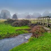
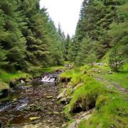
6 Go over a wooden footbridge to enter woodland. Keeping Trough Brook down to your right, follow the path ahead for almost a mile. At one point it will descend and ascend steeply by means of steps and you will pass over another plank footbridge crossing a stream entering the brook from the left. Ignore cycle paths which from time to time dart off among the trees, continuing straight ahead on the main path which is occasionally waymarked by wooden posts. This will lead you through West Wood which is many hundreds of years old and contains a variety of mature trees and woodland plants.
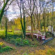
7 Arriving at a post where your path meets up with the Trans Pennine Trail bridleway, bear right and drop down to cross the brook by means of a wide bridge with metal sides. Now follow the bridlepath up to Lodge Farm at Brimington Common which until its enclosure in 1853 was a wild and thinly populated area.
8 Continue straight ahead up Westwood Lane to the main road then turn right and follow the roadside pavement until just before a chapel on your right. Turn left down Grove Road and continue ahead where it becomes a rough track.
9 At a little cluster of properties on the approach to Tapton Grove go through a gate on your left, following the blue sign for the Trans Pennine Trail indicating the route to Chesterfield.
10 Arriving at the drive to Tapton Grange and Swiss Cottage turn right and walk past the large deep pond on your right to the far end then turn left at the junction to walk up Balmoak Lane which is lined with trees.
11 After passing between a pair of impressive stone gate piers, which at one time formed the entrance to Tapton Grove, cross a stile on the left before Tapton Hall Farm. Walk to the left side of the farm and go over another stile. Head up the side of a field and then turn right on a footpath before a band of trees.
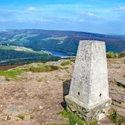
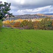
12 Cross over a lane and continue ahead following the footpath through an area of grassland. Go up a bank to pass tennis courts on your left. The path will then pass the modern Tapton Park Innovation Centre which was built to a futuristic design in order to provide modern high specification workspace and in-house support services in an inspirational environment for enterprising businesses. Head around to the drive leading to Tapton House which dates from the late 18th century. It was home for a time to engineer George Stephenson who built the first public railway line in the world to use steam locomotives. This railway pioneer moved here to oversee work on the North Midland Railway and remained until his death in 1848. The house stands majestically on the site of a Norman motte and bailey castle dating from between 1000 and 1200. There are stunning views from this elevated vantage point across Chesterfield to the Peak District hills.
13 Follow the drive downhill and then turn left on a woodland track leading behind a playground. This lovely path leads down to the railway line which you cross by means of an old metal footbridge.
14 Cross over the road with care and turn right to walk on the roadside pavement. After approximately 200 yards and just before a new complex of apartment buildings turn left down steps and a narrow footpath to return to the canal path.
15 Turn right and follow the canal path along a section that is earmarked for restoration. Cross the brick-built Tapton Mill Bridge No 1 and turn right to continue on the towpath which will return you to Tapton Lock.


