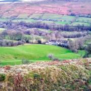
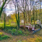
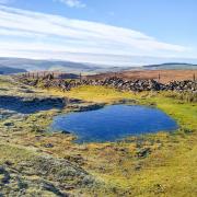
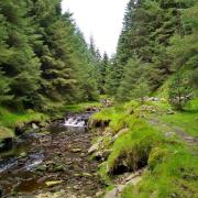
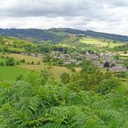
Sally Mosley takes us on a winter wander around Matlock, which is drenched in a varied assortment of architectural features and decorated with numerous blue plaques to commemorate historical importance. After an amble through the park and a riverside stroll the walk ascends to Pic Tor and then Matlock Bank for aerial views following many old paths
Distance: 3.25 miles
Parking: Station Car Park, Matlock DE45 3NA (pay & display)
Terrain: There are three stiles. The walk mainly follows paths and pavement, some become slippery when wet or icy. Uneven terrain, trip hazards and tree roots near the river. Numerous steps.
Refreshments: Various pubs, tearooms and cafes around the town.

Toilets: Hall Leys park
MAP OS: Explorer OL24 – White Peak
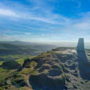
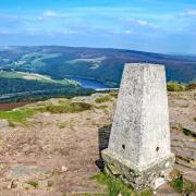
Walk highlight: View from Pic Tor War Memorial
DESCRIPTION: This is a winter wander around Matlock – Derbyshire’s County Town – which is drenched in a varied assortment of architectural features and decorated with numerous blue plaques to commemorate historical importance. After an amble through the park and a riverside stroll the walk ascends to Pic Tor and then Matlock Bank for aerial views following many old paths.
Matlock Bank evolved during the 19th century hydropathic era when visitors flocked to dip, sip and dunk into the curative waters. Hydros, hotels and guest houses sprang up everywhere, transforming the once small town into ‘The Matlocks’ tourist attraction.
1. From the car park cross Matlock Bridge into the heart of the town. This has been an important crossing of the Derwent since Medieval times when it was known as Pontem de Matelock. Originally a narrow packhorse bridge, the 15th century structure was widened on the upstream side in 1904 to cater for ‘modern’ traffic requirements. A few yards downstream is a cluster of grinding stones thought to be a lost load from a passing cart centuries ago.
2. Walk down between the avenue of trees beside Hall Leys Park. Notice the shelter with clock above which at one time stood in the centre of Crown Square. This was the lower terminus of a cable tramway constructed in 1893 to copy that of San Francisco. It ran up Bank Road at a gradient of 1 in 5½ and cost ‘tuppence up, penny down’. See also the rare surviving trademark black elephant on the gable wall of what was Burgon’s tea merchants. Hall Leys Park with its manicured flower borders, bowling green, boating lake and playground is the venue for the Victorian Market Christmas Weekend from 5th to 7th December. Celebrating its 20th anniversary, there will be fun for all the family including 150 stalls as well as entertainment and Santa’s Grotto.
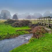
3. Follow the lines of the miniature railway and notice a solitary standing stone by the river erected by voluntary subscription to the memory of P.C. Arthur Wright who lost his life by drowning whilst attempting to save another in 1911. Exit the park into Knowlston Place, a tranquil backwater with classical Victorian terrace and gardens opposite. Walk through the gardens to continue on the riverside path passing limestone crags striped with minerals leaching from the stone. The deep gorge around here and Matlock Bath was extensively mined for lead, dating back to Roman times, and in recent centuries stone was quarried for building material.
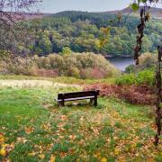
4. Turn left at the fingerpost for the War Memorial and follow the steep and narrow zig-zag path to Pic Tor for a reward of amazing views across the town. Riber Castle stands majestically on the hillside to your right. It was built in the 1860s by John Smedley as a home from where he could admire his empire – Smedley’s Hydro, the biggest of them all! Now known as County Hall it is the headquarters of Derbyshire County Council.
5. Walk down the path through the churchyard to St Giles at Old Matlock. It reputedly sits beside the route of a Roman road known as Hereward Street and later utilised as a turnpike road to Cromford. Wheatsheaf House with blocked up windows is dated 1681 but thought to be even earlier, standing on the site of the original manor house of Metesford. For a time it was the Wheatsheaf Inn. Walk down beside the high stone wall built onto solid bedrock and pass the intricate lychgate of 1908, attributed to the well-known wood carver Advent Hunstone of Tideswell.
6. Descend the steep Stoney Way and return to Knowleston Place then turn right and walk through houses to emerge by the crossroads at Matlock Green. The petrol station is situated on Matlock’s original village green where horse and cattle fairs took place long ago.
7. Head back beside the main road towards the town, passing a row of pretty Alms Houses built as a memorial to her beloved brother William Harrison by his sister Margaret to provide rest for the aged poor. This road is Causeway Lane and home to Matlock Town Football Club, known as The Gladiators.
8. At the mini roundabout turn right by the former Ritz Cinema building, now Maazi Indian Restaurant with authentic tuk-tuk on the balcony. Head up steep turnpike. (The origin of the name will become obvious!) Opposite Matlock Library is the former tollhouse. Just above Lilybank Close turn left on an old footpath once known to locals as Happy Valley. It is still part-paved with large gritstone cobbles and retains its stone bollards at the far end where you emerge onto Henry Avenue.
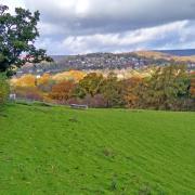
9. Continue uphill to cross Smedley Street East where there is a little park on your right. To your left is a nice view beyond the shops to the corona crown on the top of County Hall beside the tall chimney from the boiler house. Cross the road and continue uphill on a path passing the end of Rutland Avenue and then leading up between 18th century Wellfield House on your right and Wellfield Cottage to your left. With the date 1667 above the door, this is one of the earliest properties on Matlock Bank.
10. Turn left and walk along Wellfield to the junction with Rutland Street and Wellington Road. Up to your right is the impressive former Rockside Hydro, now luxurious apartments. Opposite is the tram shed with blue plaque to the Matlock Cable Tramway Depot mentioned earlier. Carefully cross towards Rockside and head past Rockside Steps to descend part of the way down Wellington Street. Turn right onto Jackson Road and walk past The Thorn Tree Inn, a small friendly real ale pub with fabulous views across to Masson Hill, High Tor and a glimpse of the cable cars at Matlock Bath. Continue along Jackson Road and then follow it down to the junction at Far Green.
11. Turn left to walk along Smedley Street passing All Saints’ Church. Opposite is an unassuming town house with another blue plaque. This one is to commemorate Ground Station Zero (1940-44), an auxiliary wartime wireless station operating from Toplis’s tailoring workshop. Continue along Smedley Street to the rear of County Hall and then turn down Bank Road.
12. Carefully cross and turn into New Street just below the side-by-side Methodist chapels. Notice two houses set back from the road with steps to the front. These were used in 1969 as a film set for Women in Love starring Alan Bates, Oliver Reed and Glenda Jackson. Descend New Street passing the former Ernest Bailey School, now home to the newly revamped Derbyshire Record Office. Turn right onto Lime Grove Walk taking you to the base of Bank Road. Part of the impressive Town Hall was built in 1863 as the Bridge Hall Hydro. Head back to Crown Square to complete your walk and notice the ornate centrepiece stainless steel crown sitting on a wonderfully sculpted stone cushion.


