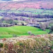
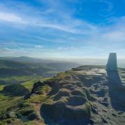
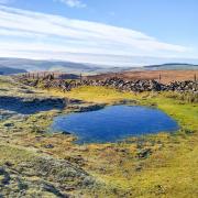
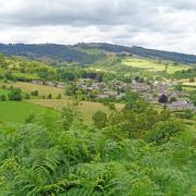
A circular walk incorporating the charming estate village of Osmaston which has magical camera moments around every corner
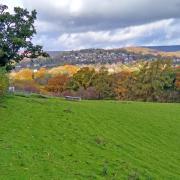
Description: This is an easy-going ramble around Osmaston Park and village located on the edge of the picturesque Derbyshire Dales. In autumn the pretty red brick and thatched cottages blend into a landscape of amber hues amid a golden glow of arable farmland, whilst deep hedgerows wilt with the weight of ripe seasonal berries. www.sallymosley.co.uk
DISTANCE: 5.5 miles
PARKING: Roadside parking in Osmaston – please be considerate of areas designated for residents
TERRAIN: Ten+ gates and three stiles. Numerous steps. Rough tracks and woodland paths with trip hazards. Slippery boardwalks. Some roadway without pavement. Livestock grazing.

REFRESHMENTS: The Saracen’s Head at Shirley, the Shoulder of Mutton at Osmaston, the Shire Horse at Wyaston
TOILETS: No public toilets on route
MAP: OS Explorer 259 – Derby
WALK HIGHLIGHT: Osmaston Sawmill

1 Walk past the church dedicated to St Martin and continue to the small village green and pond just beyond the Shoulder of Mutton pub where a small outbuilding now serves as the village post office and stores. Notice the grandiose duck house overlooked by an ornate seat made from horseshoes.
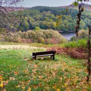
To the left of the impressive gated driveway head along a track following a sign with an arrow for ‘Bridleway Shirley’. This passes arable fields where crops have matured over summer months into a golden harvest. Ignore paths leading off on either side and continue straight, descending through a belt of woodland towards a lake and Osmaston Sawmill. Built around 1850 in an alpine style this mill processed locally-sourced timber providing work for as many as 20 employees until its closure in the 1980s when imported timber became more economical. In 2011 a grant was secured through English Heritage to re-roof the property. Future plans include conversion of the Sawmill into an event venue.
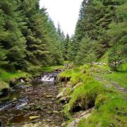
2 Walk up the deep hollowed-away track between towering trees and then continue along the bridlepath which follows a section of the Bonnie Prince Charlie Walk, a route which traces his march from Ashbourne to Derby in 1745.
3 Follow Park Lane to Shirley, walking into the village past St Michael’s Church, parts of which date back to the 14th century. Shirley is Saxon in origin, its name derives from ‘Scyrie’ being a clear place or pasture. The Saracen’s Head public house dates from 1791 when it was run as a farm and hostelry.
4 Follow the footpath sign to the right of the pub (not into the car park but down the adjacent drive) and proceed around the bend between properties as indicated by arrows guiding you to a stile into a field. Turn immediately right through a small gate and walk across to a gap in the hedge. Turn left and head down the field.
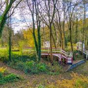
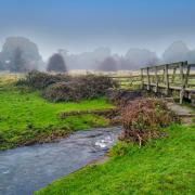
5 After another gap in a hedge turn left and follow a footpath downhill toward woodland. After a little gate and footbridge beyond go along a boardwalk which can be slippery when wet. Either side of the path is marshland rich with wild flowers and plants forming a perfect habitat for all manner of insects and small mammals. Together with woodland and deep hedgerows, this area is home to a wide variety of song birds.
6 At a ‘Y’ junction in the boardwalk bear left and proceed to a gate then go right to another gate and head up a field with a fence and hedgerow to your left. Go through another gate just beyond a trough and then bear right across a large field, meeting up with a track and then make towards a farm in the distance.
7 Go through a gate to the left of the farm and continue ahead on a wide track/drive between high hedgerows of hawthorn, elderberry and blackberry. This rough road leads beyond Shirley Old Park Farm and to the rear of Wyaston Common Farm before emerging onto Rodsley Lane.
8 Turn right and walk beside the quiet road until some houses and the sign for Wyaston. Turn right and walk down Orchard Lane past Charity Farm then uphill to a junction at Wyaston Grove, a Grade II listed house built in 1802. The late Mrs Alderson of Wyaston Grove who died in 1881 left in her will the sum of £12 yearly to be distributed to the poor in coals at Christmas.
9 Turn right and follow the bridlepath as indicated. After the first gate, go straight ahead, following the contour of the field and not on the track which leads down to the left. This will bring you to another gate onto a path through a band of trees. The bridlepath then heads uphill with Copse Hill over to your left.
10 Pass an ornate estate house on the left which was probably occupied by the gamekeeper, then be guided by signs indicating the exit of Osmaston Park by walking on a tarmac road through trees and shrubs before heading down the impressive main driveway, passing between the cricket pitch on your left and a lodge on your right. Walk through the towering main gates to return to the village pond.
The 70-roomed Victorian house which stood at Osmaston, majestically surrounded by a spectacular estate, was demolished in 1965. However, the landscaped grounds – inspired by Sir Joseph Paxton – with terraces, ponds, stone steps and balustrades remain. Osmaston Manor was built for Francis Wright, a member of the family that owned Butterley Iron Works, who were responsible for many of the country’s most famous constructions, including St Pancras Station in London. The estate at Osmaston is now the property of Sir Andrew Walker-Okeover Bt, who resides at Okeover Hall. In the gardens of Osmaston Hall there is a marquee overlooking the lake that can be hired for weddings or other functions.


