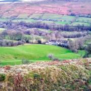
Only a stone’s throw from the metropolis of Sheffield lies Moss Valley, overlooked by the sleepy hamlet of Troway. Sally Mosley ventures to the north of the county

This walk was published in March 2016, so the details of the route may no longer be accurate, we do advise these articles should only be used as a guideline for any potential route you take and you should double check an up to date map before you set off.
DISTANCE: 5.75 miles

PARKING: Ford picnic site at the side of the Bridge Inn S12 3YD (grid ref: 403804)
TERRAIN: Five gates, three stiles and four footbridges as well as stepping stones. Close proximity to deep water. Woodland paths with trip hazards. Livestock grazing. Paths liable to mud and surface water.
REFRESHMENTS: The Gate Inn, Troway (drinks and snacks); The Bridge Inn, Ford
TOILETS: There are no public toilets on the route
MAP O.S.: Explorer 278 (Sheffield and Barnsley); O.S. Explorer 269 (Chesterfield and Alfreton)
WALK HIGHLIGHT: Discovering the Seldom Seen Engine House
DESCRIPTION: Troway is located in the north-east corner of Derbyshire on the fringe of South Yorkshire. This walk explores a network of old tracks and footpaths through a diverse landscape of arable farmland, patches of ancient woodland and past redundant mill ponds in the Moss Valley, once a place of rural industry but now popular with outdoor leisure pursuits such as walking, cycling, horse riding and fishing. www.sallymosley.co.uk
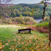
1. From the car park follow either the high or low path around the side of the former Ford Mill pond where fishermen can often be seen in quiet contemplation, their long coarse fishing rods and poles waiting for a bite.
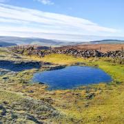
Skip between the counties as you follow a stretch of the Sheffield Country walk beside the River Moss, sometimes referred to as Moss Beck which means stream through marshy ground. The Moss Valley stretches four miles from Jordanthorpe in the west to Eckington in the east. From the early 1500s the river was harnessed to power forging and grinding mills for the production of flour, cutlery, scythes and sickles. At one time there were eight mills operating in this location. All have long since gone leaving behind a legacy of ponds, old mill buildings and former mill workers cottages, many converted into select residential properties. Notable names involved in iron works here were Thomas Cowley, who was a sicklesmith in the early 1600s, the Turner family in the 17th century and the Staniforths until the end of the 18th century. Nails were also made locally and it is reputed that by the end of the 17th century more iron nails were being made in Eckington than anywhere else in the world.
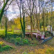
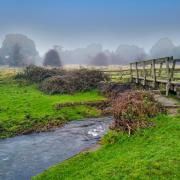
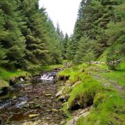
2. After a field you will cross a stream by means of a wide wooden board. The path then passes by the Never Fear dam. Just beyond this, cross over the river by means of a white-painted metal footbridge and then continue on the riverside path with the Moss now down to your left and fields leading up on your right. Then enter Twelve Acre Wood which forms part of Eckington Park. The Moss Valley is noted for its wildlife, flora and fauna. There are areas designated as SSSI, including traditional hay meadows. Eighty-five species of moths and butterflies have been recorded around here including the white-letter hairstreak.
3. Continue ahead passing beneath mature beech and other deciduous trees for almost half a mile until a junction of paths where there is a wooden footbridge over to your left. For a short detour walk approximately 150 yards straight ahead and you will come to the restored Seldom Seen engine house on your right. Built between 1855 and 1875, it once housed a massive winding wheel for Plumbley Colliery. A stretch of railway line was laid to it from the main line at Renishaw, this was called the Penny Engine railway as the public could use it for the charge of one old penny. Plumbley Colliery was owned for a time by the Sitwell family of Renishaw Hall. Lady Ida Sitwell was concerned about the amount of alcohol consumed by hard-working miners and in 1879 opened the Eckington Coffee House. Miners who worked for the Sitwells were given part of their wages in tokens to spend there. A road through the woods which was laid in 1893 is still referred to on maps as Lady Ida's Drive.
4. Retrace your steps to the open area and junction of paths. Turn left by the side of a gate and driveway up a field. Follow the path with rustic fencing on your right to the top corner of the field, ignoring a path leading off to the left which goes behind the engine house. Now walk uphill on a narrow path that leads up to a junction on a track where there is a wooden post marked with a horseshoe sign for a bridlepath.
5. Turn left and follow the level track, ignoring a path leading downhill. In parts you will be walking on a sound surface made up from rough stones and old red bricks. Soon you should be able to see the red-tiled roof of a dormer bungalow on the edge of the woods. Follow the track passing to the rear of the property. At a junction beyond, ignore a drive which exits the woods on your left. Continue on the woodland track taking you along the top of High Bramley Wood, at one point passing beside a row of tall pine trees.
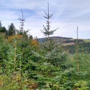
6. You will be able to see a plantation of young trees down to your right. Towards the end of this look for a narrow footpath going left through trees to a metal kissing gate leading into a field. (This is just beyond another narrow path which only leads to a wooden bridge-shaped structure probably used as a look-out.)
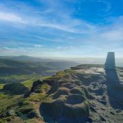
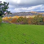
After exiting the woods into a field you will be presented with far-reaching views toward a landscape of Derbyshire hills. Turn right and walk through a gate in the hedge a short distance away and then follow the edge of the next field along two sides until it meets up with a grassy bridlepath. With a hedge on your right and a fence on your left, walk straight ahead, going to the right of a house and then down to a gate. Walk up through the farmyard to emerge onto Ford Lane.
7. Turn right and follow the roadside pavement going beyond the drive to Shady Hall, then when the road bends around to the right and begins to descend, cross carefully and proceed along the bridleway to the right of Score House.
8. Where a footpath crosses over the bridlepath turn right and walk down the field in a straight line and enter woodland at the bottom. Be guided by an indication post to follow a winding path through the trees taking you down to a narrow footbridge between two mill ponds. Take care as you walk along the narrow path beside deep water.
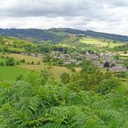
9. The path then ascends to join a bridlepath through Fold Farm which has a datestone of 1687. Emerging onto a road at the end of the drive go straight ahead and walk to Troway. To your right there are extensive views. Notice the Oakes water tower on top of the hill at Norton which was constructed in the 1940s to supply some 10,000 dwellings. It is 109 ft high and could hold 300,000 gallons of water before its closure in 1992. The distinctive stacks of white 1960s' tower blocks on the skyline are at Gleadless. See also the tower of Ridgeway Church which was built in 1840 at a cost of £2,000. The first marriage took place there on 11th May 1840 but as the church had only recently been sanctioned for weddings, to be on the safe side the couple were then married again at Eckington Church.
This road takes you to the little hamlet of Troway where the Gate Inn is a traditional country ale house. Troway Hall is home to Medibee honey where Gloria Havenhand, beekeeper extraordinaire and an expert on the benefits of eating honey, farms bees in ancient wild flower meadows and woodland planted with acres of Christmas trees and spruces.
10. Just before Troway Hall is a footpath sign for Doe Lane leading downhill on the right. For a time this runs parallel with a bridlepath before they unite as one and descend towards the river. The path bends around to the right before arriving at a substantial wooden footbridge.
11. Cross the footbridge and continue ahead to a junction of paths. Turn right and cross a short string of stepping stones then head up the path to Geerlane Farm.
12. Turn left and follow the signpost for Public Bridlepath. Walk around the side of the farmhouse and head up the track beyond between deep hedgerows. Ignore paths leading off to the left and continue on the bridlepath to Litfield Farm then walk down to a ford in the road by a sheltered cluster of old houses and cottages.
13. Turn right and cross a footbridge to follow Sloane Lane, taking you to the main road at Ridgeway Moor where you will find an interesting information plaque erected to remember John Haslam a local scythe maker who worked at Never Fear dam. He reputedly owned a donkey that when loaded with scythe blades would walk alone and unaided to deliver them at Broomhead.
14. Turn right and follow the roadside pavement downhill to return to Ford.


