Words and photos: Simon Taylor of the Public Rights of Way team at Essex County Council
This is a town and country walk, with woodland and open fields contrasting with modern infrastructure, including a spectacular footbridge
Distance: 4.5 miles (7.3km)
Starting point: Mountnessing Village Hall car park, next to Mountnessing Windmill, off Roman Road, postcode CM15 0UG, grid reference TQ631979
Getting There: The car park is accessed directly off the B1002 (Roman Road), which itself is accessed from the A12 at junction 12 (Chelmsford-bound) or junction 13 (London-bound). There is a bus stop near the car park entrance (opposite The Plough) on the hourly 351 Chelmsford – Warley route.
Map: OS Explorer 175 Southend-on-Sea & Basildon
Food and drink: The Prince of Wales and The Plough public houses are at the start/end of the walk on Roman Road, Mountnessing. A short deviation halfway on the walk will take you to Shenfield high street where there is an abundance of places to eat and drink.
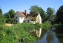
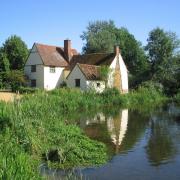
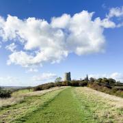
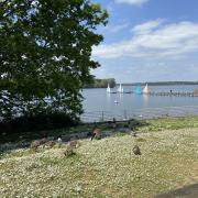
Places of interest: The current Mountnessing Windmill was built in 1807, though a windmill is thought to have existed here since 1477. After World War II it fell into disrepair and was struck by lightning, but it was restored to full working order in 1983. The village itself sits astride the old Roman road between London and Colchester, indeed the B1002 as it passes through the village is called Roman Road. A mile to the south, off Wash Road, Hutton Country Park (postcode CM13 1FA, grid reference TQ633969) is a local nature reserve run by Brentwood Borough Council. For more urban pursuits, further north-east along the old Roman road sits Ingatestone high street, which has an eclectic array of shops and eateries.
Find an interactive map at essexhighways.org/getting-around/public-rights-of-way
The Walk
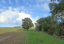
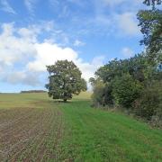
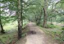
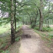
1 There are muddy patches on this route so be sure to wear appropriate footwear. From the windmill, head diagonally across the playing field, past the playground area, towards the main road. Pass a large spreading oak tree and emerge at the road beside the carved wooden village sign that depicts the windmill above the county crest. Cross Roman Road here, turn right and then head left down Church Road. This bridges the A12 and then the London to Norwich railway (careful here as there is no footway). Just 100 metres beyond the railway bridge, take the footpath to the right, leading out across the arable farmland. The view from here is splendidly rural; were it not for the sound from the railway and the A12, one could be miles from anywhere. On reaching the ditch, keep to the right of it. Pass two footbridges to the left before eventually reaching a road. Cross the road, pass to the left of some steel gates and cross the River Wid via a flat concrete bridge before turning left to follow the edge of the field. This swings right; keep to the field edge rather than entering the wooded area when you reach it and soon you come across a stile leading to the entrance to a bridge over a railway.

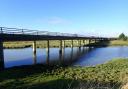
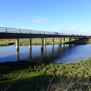
2 This bridge is enormous; probably the longest railway footbridge in Essex. It has to be as it passes over two lines leaving Shenfield station, separated by an area of scrubland. Cross the bridge and, looking east, see where the two lines merge, becoming the up- and down- lines of the branch, which ultimately leads to Southminster and Southend Victoria. From the bridge you emerge into a residential road, Shaw Crescent. Turn right and then continue right along Arnolds Avenue. At the end, turn right again onto Long Ridings Avenue and follow it for 700 metres, past the primary school, to its junction with Alexander Lane.

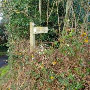
3 To divert to Shenfield for refreshments, turn left here. To continue on the walk, turn right, cross the road and pass under two railway bridges. Pass Oliver Road on the left then, as the road bends left, cross it and take the footpath indicated by a metal fingerpost beside a laurel bush. The path follows the base of the railway embankment for 400 metres before crossing a field diagonally. A short slope leads into a wood; follow the left edge of the wood and this leads to a grassy track, which itself heads left, past some old buildings, to emerge onto the A1023 Chelmsford Road.
4 Turn right on the footway, heading towards the petrol station in the distance. You may recognise this as it sits beside the rather unusual roundabout, atop the junction with the A12, around the edge of which cars and lorries are often parked. With extreme care, cross the accesses to the filling station and then the top of the slip road off of the A12. Pass over the bridge over the dual carriageway and then, again with extreme caution, cross the top of the slip road leading onto the A12. Turn down Roman Road and cross it just before the roundabout at the bottom, to access the wide grass verge on the opposite side. Follow this away from the roundabout and pass over Chain Bridge (there was a greyhound racing track here in the 1930s) before turning left into St. Anne’s Road. Again, be careful here as there is no footway.

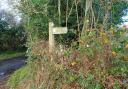
5 After 200 metres, a fingerpost indicates a path off to the right, over a wooden stile. Follow this, cross a small footbridge onto a field edge and continue straight to meet a track. Turn right and you will see a footpath entrance well marked on the left. Follow this narrow (and in places muddy) path for 200 metres before turning right along a tree-lined field edge. At Thoby Manor, take the track (Laundry Lane) and soon you will emerge onto a road (Thoby Road). Turn left then cross and squeeze past some green gates; across the greensward you will see the windmill again.