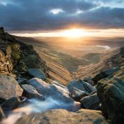
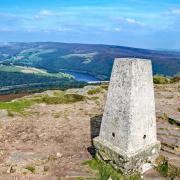
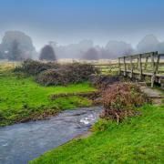
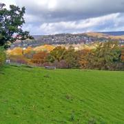
Step out with the River Goyt as it escapes from the trappings of two reservoirs to flow north and marry the Mersey
Route
1. Opposite the closed toilet at the base of Bunsal Cob look for a plaque beneath a tree which states that the road here, which has a gradient of 1 in 7, was built in 1967 on the Bunsal Incline of the former Cromford & High Peak Railway. Walk downhill to a footpath sign on the right and follow the steep drive to the side of the grassed over dam wall which holds back Errwood Reservoir.
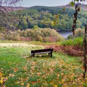
2. Follow a level track with Fernilee Reservoir on your left and walk past memorial seats, the first of several that are sporadically placed throughout this walk, enabling anyone to rest and appreciate scenic views or take the opportunity to enjoy a rucksack snack along the way.
From time to time you will see little springs and streams trickling down from surrounding High Peak hills to flow into this large expanse of reservoir. When the reservoir is full, trees lining the banks appear to dip their roots and branches like fingers and toes into the deep, dark peat-enriched water.

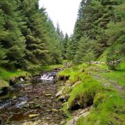
3. Arriving at the dam wall for Fernilee Reservoir, continue straight ahead and then down a drive following a footpath sign (go through a gap by the gate if it is padlocked), which leads to a treatment works, then follow a riverside path with the River Goyt on your left.
For a time the valley opens out, with the path then proceeding through a series of small field gates. Eventually it becomes slightly elevated from the river, passing beneath towering beech and ancient holly trees. At this point you will get a glimpse of the main A5004 road up to your right above a high retaining wall. A long section of this former turnpike road is attributed to the professional road building skills of John Metcalf (1717–1810). This civil engineer extraordinaire was also known as Blind Jack of Knaresborough or Blind Jack Metcalf. He was an incredibly talented Yorkshireman who, although blind from the age of six, was responsible for plotting the route of some 180 miles of roads in Derbyshire and Yorkshire.

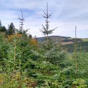
4. Just beyond this point and across the river to your left, notice a small plantation of tall pine and larch trees that taper skywards like giant matchsticks. Your path now is also lined with rhododendron, birch and hawthorn, appearing for a time like an arboreal tunnel, scented in summer by wild honeysuckle. This is known as Shallcross Wood, its name taken from an ancient stone waymarker. Shall Cross, which dates from AD832, stands in a small settlement higher up the hill. The Shallcross incline not far from here formed part of the 1831 Cromford and High Peak Railway Line.
5. Arriving at an old track (now a restricted byway), walk down towards a ford in the river. Cross by means of a wooden footbridge and then ascend the steep path to Taxal, arriving at the side of St James’s Church. This surprisingly large church for such a small community is in fact the parish church for Whaley Bridge. Formerly known as St Leonard’s, the church has a 16th century tower with earlier fabric that is Saxon in origin. The main body of the church was rebuilt in the 19th century. Within, there is said to be a tablet memorial to Michael Heathcote who died in 1768 that reads ‘Gentleman of the Pantry and Yeoman of the Mouth to his later Majesty King George III’. In the churchyard notice the large canopied gravestone which must surely be the final resting place of either a bridge builder or an engineer.

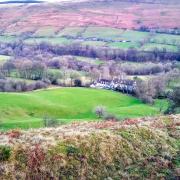
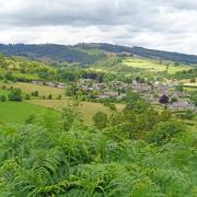
6. Turn left and walk along the road past Glebe Farm. Also known as a church furlong or parsons close, a glebe is an area of land within an ecclesiastical parish used to support a parish priest. The route will now become elevated from the river allowing you far-reaching views of the surrounding hills. You are following a stretch of the Midshires Way, a long distance footpath and bridleway that runs for 230 miles from Stockport in Greater Manchester through the Midlands to the Chiltern Hills in Buckinghamshire.
7. At a junction to the far side of Overton Hall Farm turn left to follow the restricted byway which descends very steeply past Madscar Farm to Mill Clough. Beside the brook here are the ruins of a small building, presumably a former mill. Continue on the track which then passes Normanwood, eventually returning you to the dam wall for Fernilee Reservoir.
A Bill was passed by Parliament in 1930 allowing permission for the construction of this reservoir on the River Goyt, and it was completed in 1937. Fernilee holds 1,087 million gallons of water and reaches a maximum depth of 121 feet. When built it submerged the Chilworth Gun Powder Factory where in 1909 an explosion killed three men. At its height shortly before the First World War, 120 men are said to have worked there, but it is reputed that a gun powder factory had existed on the site since the 16th century when it supplied explosives for the fight against the Spanish Armada.

8. Walk straight ahead and then when the road bends right, follow a footpath sign for Hoo Moor and enter woodland. Vast swathes of forest on the sides of the valley contain a rich assortment of trees from beech and ancient oak with their bulbous, gnarled branches to clusters of tall fir and pine-like thick green spears pointing to the sky.
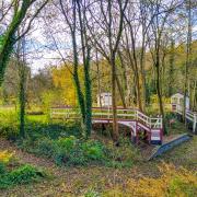
9. Arriving at fingerpost signs choose the Woodland Walk option. Just after the second sign notice a bench with a metal plaque and Latin inscription Progredere aequo animo per concursationem ut cogitas quantam sit inter silentium tranquillitatem which, I think, roughly translates as ‘Do not rush by but enjoy calmness of spirit and think about the value of silence and tranquillity.’ The woodland path ascends to cross a wooden footbridge but soon after drops back down again before arriving at the dam wall to Errwood Reservoir.

10. Head up the steep path to the right side of the dam wall and follow the footpath which then meets up with the road. See a plaque commemorating the inauguration of Errwood Reservoir on 14th June 1968 by HRH the Duchess of Kent. Follow the pathway beside the road to cross the dam wall.
Compass Points

Distance: 6.75 miles
Parking: Free roadside parking beside Bunsal Cob SK17 6GJ (do not park in Sailing Club car park). Grid Ref: 018758
Terrain: 10 gates, 2 stiles. Close proximity to deep water. Woodland paths and trip hazards. Fields with livestock grazing. Steep ascents and descents but mainly on tracks with hard surfaces.
Refreshments: No tearooms, cafés or pubs on the route

Toilets: No toilets on the route
Map: OS Explorer OL24 – White Peak
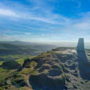
Walk highlight: Far-reaching views of the High Peak
Description: Beginning with an easy walk beside Fernilee Reservoir, the route then ambles alongside the river to Taxal through fields and gates, in part overshadowed by mature trees and ancient outgrown hedgerows. The return on the opposite side of the valley is an ‘upsy-downsy’ delight of old tracks and distant views culminating with a wander through woodland.


