Angus Watson tackles a strenuous walk on the South West Coast Path from East Portlemouth to Dartmouth in Devon in the company of four friends. By Angus Watson
The website said ‘very strenuous’. We wondered just how hard that could be. We were going to find out. Five of us, in our mid-thirties (and a dog, two years old) were walking together for the first time since our Bristol University days, along a 23-mile section of the South West Coast Path National Tail between East Portlemouth and Dartmouth.
Apart from increasing flab, losing hair and finding employment, we haven’t changed much. The team was me (journalist), Al Poulain (travel agent), Henry Knapman and Oliver Denny (both bankers), James Lamont (solicitor) and Elsie, Lamont’s working cocker spaniel (jobless, despite her title).
Knapman was in charge. He had
the maps and had arranged the trip
with the precision of a finicky adjutant. We were to spend Friday night in his parents’ holiday house in Kingswear, then ferry to Dartmouth, taxi to East Portlemouth, then walk back, overnighting in Torcross.
Day 1: East Portlemouth to Torcross
14 miles, height gained (and lost) 2106ft (642m)
After a pleasant ferry ride from Kingswear, we wolfed down wonderful fry-ups in Alf Resco’s Dartmouth caf� and zealously raided Dartmouth’s bakeries for en route victuals. There is nowhere to buy food or drink for most of this section.
We spilled out of the taxi at East Portlemouth and set off (from the west, you take the ferry from Salcombe). Four of us were fully kitted up with mini rucksacks and waterproofs (just in case). Denny, never over-prepared, had a spare jumper and a Somerfield’s carrier bag.
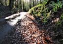
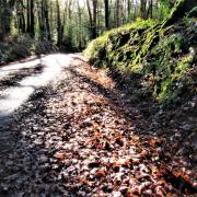
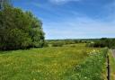
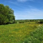
We sauntered along opposite genteel Salcombe, and played with Elsie on Mill Bay’s beach in Salcombe Harbour. Up over the headland, and boom! – Salcombe Harbour’s mild woods gave way to sea-smashed craggy Devon coast and wide Atlantic. The path led through high autumnal bracken along to Gara Rock, where we detoured to the wide, low-tide beach for a second breakfast. There are beaches all along this stretch, tempting for a swim in the summer, or just a nose-around on cooler days.
We pushed on, chatting away, not, as you might expect from old uni pals, about life’s paths and lessons learned, but about things like where you’d land if you swam due south and whether there were any man-eating sharks in the sea below us (France and no).
“Dolphins!” cried Poulain at one point, pointing out to sea. Nobody else could see them. It is possible to see dolphins on this walk, apparently. We’ll never know whether Poulain actually did.
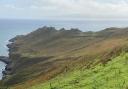
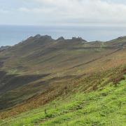
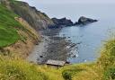
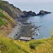
The path dipped through cove after pretty cove. Soon we rounded Prawle Point, Devon‘s most southerly tip. This next stretch is one of the last habitats of a rare cuckoo bee. We didn’t see any cuckoo bees, but we did enjoy the views: bracken and gnarled trees on one side, tortuously folded cliffs leading down to beautiful but cruel sea on the other. Many ships have been wrecked here, including (at least) one in the Bronze Age. We were there on a calm day, but the waves still looked treacherous, so it was easy to imagine the plight of those poor ancients as their wooden boat splintered on the rocks. But we put their problems behind us and, by the time we settled down for a pasty-based lunch, we were enjoying the walk a great deal.
We wanted to see Start Point lighthouse up close, so we took a direct line to it, away from the path. This is not advised for the nervous or those who suffer from vertigo, and in fact the path proper leads there eventually anyway. Clambering over Start Point’s crest, we found a massive new view westwards – Start Bay. That’s the joy of walking. A whole new vista is rarer and therefore more satisfying than when you’re cycling or driving. Plus, of course, you have time to take it in properly.
Onwards along Start Point, we ogled the derelict remains of Hallsands Village. The hapless settlement was destroyed by storms in 1917 (see link). After a pint in the charming Cricket Inn at Beesands, we climbed a final 230ft hill above Dun Sands.
“This hill is why the walk is ‘very strenuous’,” puffed Denny.
After our walk, we deserved our large night in the excellent 14th-century Start Bay Inn. There – we’re not sure why – we were mistaken for a group of holidaying estate agents.
Day 2: Torcross to Dartmouth
10 miles, height gained (and lost) 1470ft (448m)
After an excellent hangover-obliterating fry-up at Waterside House B&B we set off again, just four of us plus dog now. Denny had mismanaged his weekends and had to head elsewhere.
Boys at heart (apart from Elsie the dog), we stopped to admire the Sherman tank at Torcross. The Allies trained for the Second World War’s Normandy landings here. The tank is a monument to American troops killed in a German attack.
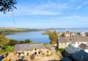
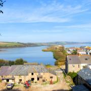
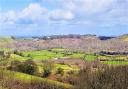
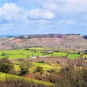
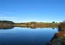
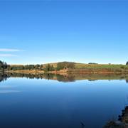
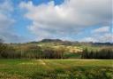
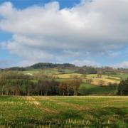
Leaving Torcross, we marched along the Line at Slapton Sands, which separates the sea from Slapton Ley, Devon’s largest natural freshwater lake and a twitcher’s paradise. This section was more homely than the previous day’s. Up into the hills after Slapton Sands, we passed through friendly villages and intimate woods, which gave way only now and then to sublime south coast scenery. It made a nice change from the previous day’s relentlessly brutal landscape.
We found a caf� at Blackpool Sands, but unfortunately dogs were not allowed near it. So, after Knapman, Poulain and I had nipped in for a quick can of cola (organic), we moved on.
After lunch at the Green Dragon in Stoke Fleming, the day’s ten miles passed too quickly. Soon we turned the corner from hilly coastline into Dartmouth’s calm harbour. The final path bisected lovely woods, led through Dartmouth Castle, and into the streets of the old naval town.
We’d done a wonderful walk through some of England’s finest scenery. Appropriately, we congratulated ourselves by touring Dartmoor’s pubs then chowing down on a gigantic curry.
By Angus Watson