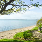
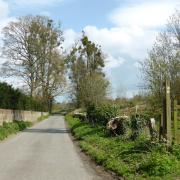
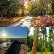
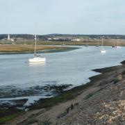
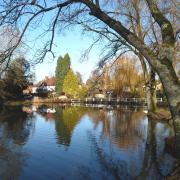
Steve Davison heads to the southern fringes of the New Forest National Park to explore the picturesque coastline around Keyhaven and Pennington Marshes

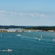
This easy to navigate 5 ¼ mile walk, with a shorter 3 ½ mile option, starts at the small picturesque village of Keyhaven overlooking The Solent with views towards Hurst Castle and the Isle of Wight.

The first part of the walk takes a slightly inland route heading north-east to reach the picturesque surroundings of Moses Dock; a short detour from here leads to the 16th century Chequers Inn.
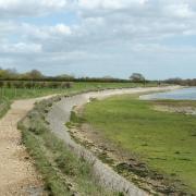
The return route follows part of the 60-mile long Solent Way, a long distance route between Emsworth Harbour and Milford-on-Sea, passing the Keyhaven and Pennington Marshes. The marshes form part of a nature reserve that offers a mosaic of habitats from coastal grazing marshes, shallow brackish lagoons to tidal mudflats and salt marshes. The reserve is an important stop-off for migrating birds in spring and autumn and a major breeding site for common sandwich and little terns – don’t forget to bring your binoculars.
For hundreds of years, and maybe as far back as Roman times, the coastline between Lymington and Keyhaven was a thriving centre for the production of salt. Sea water was allowed to flow into the salterns – areas of land divided into small shallow ponds only about three inches deep – where it was left to partially evaporate, forming a strong brine solution (a mix of salt and water). This was then pumped by windmill into storage tanks before being dried in large metal boiling pans to produce salt crystals. During its heyday, there were numerous salt workings along the five mile stretch of coastline, with each salt pan producing around three tons of salt per week.
Moses Dock, one of several narrow inlets, was constructed to allow barges to dock and off load coal for the boiling houses and to export the salt. The old brick buildings on the eastern side of the inlet are the last two remaining salt boiling houses that used to house some of the boiling pans. Cheaper, mined salt, forced the closure of the last saltern in the 1860s.
While in the area, if you have the time, call in to Hurst Castle perched on the end of Hurst Spit, easily reached by a small passenger ferry from Keyhaven (01590 642500); if you’re feeling energetic, it’s a 1 ½ mile walk along the top of the shingle spit. The castle (English Heritage; 01590 642344), originally built by Henry VIII in 1544 to defend the western approach to The Solent, remained part of Britain’s coastal defences until 1956. The 19th century lighthouse was built to help guide vessels through the hazardous western approaches to The Solent between The Needles and the Shingles Bank.
Keyhaven walk information:
Distance: 5 ¼ miles (8.4km) or 3 ½ miles (5.5km)
Time: 2 ¼ or 1 ½ hours
Terrain: Level walk, tracks and paths, short sections of road, some gates
Start/Finish: Pay and display car park in Keyhaven; grid ref SZ305914
Map: OS Explorer OL22
Refreshments: Keyhaven – The Gun Inn (01590 642391); Woodside – The Chequers Inn (01590 673415) – off route
***
1 (SZ305914) – Head north-east through the car park and leave via a path in the top-right corner. Turn right along the metalled lane with the sea on your right passing a small free parking area (time limited). Pass round the large gate and continue along the enclosed gravel track for just over ¾ mile to pass another gate and reach a small parking area (SZ318927); here you have to choose between the short or long walk.
For the shorter walk: keep ahead for a few metres and turn right through a gate, take the left-hand path to reach the sea wall and turn right, rejoining the longer walk and heading back to Keyhaven (mid Point 3).
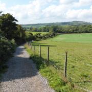
For the longer walk: continue along the lane and shortly after the left bend go right along an enclosed gravel path, later go round another large gate and pass Oxey Farmhouse.
2 (SZ321932) – Follow the lane round to the right and then left, ignoring a path off to the right. Shortly after the next left bend reach a path junction on the right. From here you can take a short 300m detour northwards along the lane to the Chequers Inn; retrace your steps back to the path junction. Turn right (left if coming back from the pub) along an enclosed path, keeping right at the split with the tidal inlet of Moses Dock on your left. Go through the small gate and turn left following the inlet before going up some steps to a path junction. To the left is a footbridge and sluice gate, however, we continue straight on.
3 (SZ323934) – Follow the path as it curves right and then right again before heading generally south-westwards. The route now follows the coastal path with the sea on your left, along the top of the sea wall back to Keyhaven offering some great views across the nature reserve; along the way the shorter walk joins from the right. At the end of the path go through a gate and turn left along the lane retracing the outward route back to the car park. Opposite the car park entrance is The Gun Inn while to the left is the small harbour from where you can catch the ferry to Hurst Castle.


