Steve Davison heads to the historic market town of Bishop’s Waltham, on the edge of the South Downs National Park, for a walk past a once grand palace
The earliest records of Bishop’s Waltham relate to a Saxon church built in 640 and the town’s original name of Waltham is derived from the Saxon ‘walt’ meaning forest and ‘ham’ meaning settlement; the ‘Bishop’s’ part of the name was added a few hundred years later when the town was given to the Bishops of Winchester in 904. However, it wasn’t until the 12th century that mention was made of the bishop’s palace, which was noted for being comparable in size and grandeur to royal palaces of the day.
During the English Civil War, the palace was held for the King before surrendering to Parliamentary forces in 1644. Although the bishops recovered their property following the restoration of the monarchy in 1660, they never again lived in the palace, instead favouring Wolvesey Palace in Winchester. The buildings fell into a ruinous state over the centuries until 1935, when Admiral of the Fleet Sir Andrew Cunningham bought Palace House together with the palace ruins; the latter were granted to the state and are now maintained by English Heritage.
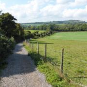
After leaving the town the walk follows a section of the Pilgrims Trail, a long distance route from Winchester Cathedral to Mont St Michel in Normandy, along part of the disused Bishop’s Waltham to Botley branch line which closed in 1962. A short distance further on we follow the Pilgrim’s Trail along the course of the former Roman Road that ran between Winchester and Portchester.
After these historic highlights the walk meanders through fields before arriving back at Bishop’s Waltham, passing St Peter’s Church and the preserved medieval heart of the town to arrive back at the start. Stop off at St Peter’s Church, which dates from the early 12th century, to see numerous memorials and a Saxon font from an earlier church.
Information
• Start/finish: roadside parking in Station Road off B2177 in Bishop’s Waltham, near the palace (SU551174)
• Map: OS Explorer OL3
• Distance: 5 miles (8km)
• Terrain: easy ups and downs, tracks and paths, gates and stiles, sections of road
• Time: 2.5 hours without stops
• Refreshments: lots of choices in Bishop’s Waltham
• More Information: To find out more about Steve, including his books, visit steve-davison.co.uk
The walk
1 (SU551174) – Follow Station Road southwards to a junction and turn right to reach a roundabout. Immediately turn left past the old railway gates and follow the disused railway for half a mile. Keep ahead along the lane for 125m and turn right along the track towards River View Farm; later keep left. Shortly before River View Farm, fork left following the enclosed path. Go through a kissing gate and fork left through another gate to enter a field. Turn right (stream on left), pass under the powerline and continue alongside the fence on the right to a kissing gate. Turn left along the track for 10m and then right through a kissing gate. Follow the path through the long field, crossing a footbridge on the way. At the far side go through two gates 1m apart. Keep ahead through a kissing gate, continue past the nursery, then through another gate. Cross the footbridge and continue through the meadow.
2 (SU535180) – Cross the road and follow the track towards Wintershill Farm. Just before the houses, turn right over a footbridge, through a kissing gate and follow the enclosed path (field on right) to a track. Turn left for 3m and then right, following the hedge-lined course os the Roman Road. Cross straight over the B2177 and follow Stakes Lane. Just before the T-junction, turn right over a stile. Follow the left-hand boundary for 100m to a marker post and turn right (private gardens). Continue through the trees and cross a stile. Follow the left-hand boundary through three fields, then continue along the grass strip between fields, up towards the trees. Cross the stile and follow the enclosed path, cross another stile and follow the hedge on the right. Go over a stile and follow the narrow path, then continue past the large gate to the road.
3 (SU542184) – Turn left up the road to a junction and turn right. Where the road curves left, take the second waymarked route on the right over a stile and follow the right-hand field edge. Continue up through two fields. Go through a hedge gap and bear diagonally left (can be muddy) through a third field. Cross a stile at the lower left corner, then over a footbridge and continue straight on through the field, soon following the boundary on the left slightly uphill. Go through the hedge gap at the corner and turn right along the track for a few metres, then left along the enclosed path; vineyard on right. Head downhill, later following the surfaced track as it curves left to Beeches Hill road. Turn right to a junction
4 (SU557180) – Cross over and follow Free Street uphill for 350m. Turn right past the parking area and follow the path through the churchyard (church on right), exit through the gate and follow St Peter’s Street down past the Bunch of Grapes pub to a junction. Turn right along Bank Street (passing the High Street to left) and at the next junction (car park ahead) turn left along Brook Street to the square and clock tower. Bear right along the path, cross Malt Lane, then turn left to cross the B2177 at the traffic island. Turn right past the entrance to the palace and turn left into Station Road.
More…
• The ultimate Hampshire walking guide - With the New Forest, South Downs and a picturesque coastline, Hampshire is an amazing place for a walk. We round up a few of our favourites


