Steve Davison takes a walk round Dunbridge and Mottisfont in the Test Valley

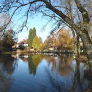
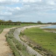
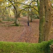
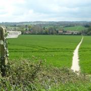
This month’s walk through Spearywell Wood, heads through fields to arrive at Mottisfont, home to picturesque cottages and a stately abbey with attractive gardens, including the fragrant rose garden.
Following Henry VIII’s Dissolution of the Monasteries, the Augustinian priory at Mottisfont – founded by William Briwere in 1201 – was acquired by Sir William Sandys; at the time the family also owned The Vyne near Basinsgtoke. Sir William turned the priory into a country home, using the church to form part of the mansion. Jump forward to the 18th century and the Mill family transformed the estate and redesigned the old Tudor styled house; it was during this time that the more romantic title of ‘abbey’ was given to the house.
In 1934, Maud and Gilbert Russell arrived at Mottisfont and it became the centre of a fashionable artistic and political circle. Maud, a patron of the arts, entertained writers and artists here, including Rex Whistler and Boris Anrep; Whistler created an impressive trompe-l’œil painting and Anrep created several vivid mosaics.
The final chapter in Mottisfont’s history occurred in 1957, when the estate was gifted to the National Trust (www.nationaltrust.org.uk/mottisfont; 01794 340757). During the summer (19 July to 14 September), Mottisfont is hosting an exhibition of work by Quentin Blake and other leading contemporary children’s illustrators.
Before leaving the village step inside St Andrew’s Church to see some ancient stained glass and Norman architecture. The next part of the walk follows a short section of two long distance paths – the Test Way and the Monarch’s Way – before making a quick circuit round Dunbridge Hill to pass the Mill Arms at Dunbridge. The final part of the walk meanders near to the River Dun – a tributary of the River Test – before heading through wooded countryside back to the start.
--------------------------------------------------
Information
Distance: 51/2 miles (9km)
Time: 21/2 hours without stops or time for abbey visit
Terrain: Some gentle ups and downs, tracks and paths which can be muddy with stiles and gates, sections of road
Start/Finish: National Trust car park at Spearywell Wood on the B3084; grid ref SU316276 (alternative start: Point 4 Mottisfont and Dunbridge rail station – SU318261)
Map: OS Explorer 131
Refreshments: Dundridge – The Mill Arms (01794 340401); cafe at Mottisfont Abbey (01794 340757)
--------------------------------------------------
Directions
1 (SU316276) – Turn right along the B3084 for 200m and go left past a gate. Head diagonally right across the field. Go through the trees in the corner into the next field and continue in the same direction, passing a tree mid-field. Leave through a gate in the far corner and bear left along Bengers Lane to a T-junction and turn right (Mottisfont Lane). Follow the road as it swings left at the junction – the road is quite narrow so take care with traffic. After 100m on the right is Church Lane where we turn right. To visit the abbey: Continue straight on along the road for 250m and then turn left along the access drive to the abbey.
2 (SU325267) – Follow the lane past the church and keep ahead along the track. Go through a gate and head across the field passing under the power-lines. Cross the footbridge, go through a gate and continue between fences to a junction. Turn right crossing the railway bridge and continue to a track junction. Turn right, cross a stile beside the gate and continue past houses to a road (B3084).
3 (SU323255) – Cross straight over, go through the kissing gate and follow the path as it skirts anti-clockwise around the small lake. On the far side leave over a stile and continue south-west through the field towards the trees and a crossing track. Keep ahead alongside the trees on your left and, at the corner of the wood, go straight on across the field to a path. Turn right and follow the path as it goes right and then left to follow the grassy strip down between fields to the trees. Continue alongside the trees, turn left at the field corner for 50m, then turn right into the wood and follow the path northwards. Keep ahead down the access road to the main road beside the Mill Arms.
4 (SU318261) – Cross over, turn left then right along the B3084 for 100m passing the rail station and crossing the River Dun to a crossing path. Turn left across the road and follow the hedge-lined track, go through a gate and cross the railway line. Go through another gate and follow the right-hand field boundary, first with an electricity sub-station and then a hedge on the right. Later bear right along a track to a thatched cottage. Take the path through the kissing gate to the left and follow the path past trees and bushes. Pass under the power-lines and turn right at the field corner through a gate. Follow the path as it bears left, cross a stile and head west through the meadow, crossing two footbridges on the way. At the far side go through a kissing gate and turn right.
5 (SU304262) – Follow the shady path for 1/2 mile passing under the power-lines and railway bridge. At the hedge, dogleg right then left through a hedge gap and continue north-eastwards across the field. Cross the footbridge and bear right gently up through the trees to a junction. Turn right between hedges, pass a gate and continue along the track with Cadbury Farm on the left to reach a road (B3084), turn left back to the car park.
--------------------------------------------------
Read on
See more Hampshire walks and placesHampshire eventsShare your photography of the county


