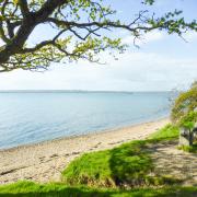
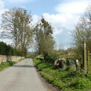
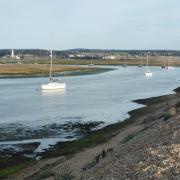
Head to the western edge of the New Forest for a wander through Hatchet Green and Woodgreen
From Hale Purlieu the route heads north to arrive at Hatchet Green with its picturesque thatched cottages overlooking the village green. The stone sculpture by Paul Wilson was commissioned to celebrate the Millennium, as was the planting of one of the trees; the other tree commemorates the 40th anniversary of Queen Elizabeth II’s accession to the throne.
From here the walk follows the Avon Valley Path for a couple of miles, soon passing Hale House and St Mary’s Church; the 34-mile Avon Valley Path follows the River Avon from Salisbury in Wiltshire, heading south through Hampshire to Christchurch Priory in Dorset.
The Palladian style Hale House was built by well-known London architect Thomas Archer, in the 18th century. However, the manor of Hale dates back to at least the 14th century when Adam de la Forde was granted a licence to hold services at the manor. St Mary’s Church, which dates from the 14th century (although it was altered and enlarged by Thomas Archer), contains many memorials to former owners of the manor, the oldest being to Sir John Penruddock (d.1600) and the most striking to Thomas Archer (d.1743) and his two wives.
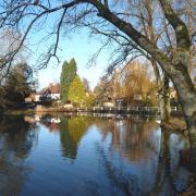
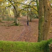
After joining Moot Lane, take a short detour for a lovely view of the River Avon before continuing to Woodgreen, with its cricket pitch, thatched cottages, pub and tea rooms. Once suitably refreshed, the final leg of the walk heads through trees of Godshill Inclosure, which was first enclosed in 1810, before heading back to the car park.
Information
• Start/Finish: Hale Purlieu car park (SU188177), on a minor road to the south-west of North Charford
• Map: OS Explorer OL22
• Distance: 5.25 miles (8.4km)
• Terrain: Ups and downs, tracks and paths which can be muddy, some stiles and gates, sections of country road
• Time: 2.5 hours without stops
• Refreshments: The Horse and Groom (01725 510739) and village shop / tearoom (01725 512467) at Woodgreen
The walk
1 (SU188177) – From the car park turn right (north-east) alongside the road for 350m and after the power-lines turn left through a gate. Head diagonally right down the track through the trees for 200m to a fingerpost and cross-junction. Turn right along the narrow bridleway for half a mile, then go through a gate to a lane. Turn left for 100m and at the right-hand bend, turn left up a track (bridleway) towards Hatchet Green. At the village hall bear right through the car park and then go left along the surfaced track towards a thatched cottage (The Old Dame School); to the right is the large village green and on the left is a stone sculpture and two memorial trees. Turn right to a T-junction.
2 (SU192191) – Turn left along the lane for slightly under three quarters of a mile, passing more thatched cottages; the walk is now following the Avon Valley Path (AVP). At Home Farm follow the lane as it swings left and after 50m turn right through a small gate at the footpath sign. Keep close to the right-hand fence; over to the left is the lime-tree-lined drive to Hale House. Cross a track and keep ahead before curving right near the house, cross another track and head down the surfaced path, passing St Mary’s Church, to reach Moot Lane, where the walk turns left. Before continuing with the walk, cross over the lane and follow the track opposite to the bridge and River Avon; retrace your steps to the lane and turn right.
3 (SU177186) – Head southwards along Moot Lane and bear right at the junction towards Woodgreen and Breamore for 25m, then go left up the drive towards North End for a few metres. Cross the stile just to the right of the entrance gate and follow the right-hand boundary through three fields. Keep ahead along the track, following it as it bears left and keep right at the split to join a road at Woodgreen Common. Turn right down alongside the road and after a lane joins from the left follow a permissive path on the right-hand side of the road. Go through a gate and follow the enclosed path to reach the village shop and tearoom. Turn left along the road passing the village hall and keep ahead at the junction to reach the Horse & Groom pub on the left.
4 (SU170175) – Just after the pub, fork left and follow the lane for 75m. At the skewed T-junction turn left over a stile beside the driveway. Follow the enclosed path, then continue up the gravel drive to cross a stile beside a gate. Turn left along the lane for 25m and then right, following a gravel track with houses on the right. Where the track swings right, continue straight on across the common, passing between the cricket pitch and the clubhouse. Go through a gate in the fence on the right. Follow the path down through Godshill Inclosure, cross the stream to a junction and go straight on uphill; keep left at the split to reach a track. Turn left and then left again along the cycle track. Go through a gate, cross the lane and follow the track opposite. At the gated entrance (private), fork right along the enclosed path. Cross two footbridges, then a stile and keep ahead through the field to leave over another stile. Turn left along the track to a lane and turn left back to the car park.
More…
• The ultimate Hampshire walking guide - With the New Forest, South Downs and a picturesque coastline, Hampshire is an amazing place for a walk. We round up a few of our favourites


